
AUSTIN, Texas — A stalled frontal boundary continues to linger across our KVUE area, and this boundary will likely spark a few scattered showers and thunderstorms through Tuesday evening. This is not a widespread rain chance where everyone gets rain, but we do have a 30 percent rain chance in the forecast, and where storms develop they could produce heavy rain and some gusty winds. Any storms that develop this evening should come to an end prior to midnight.
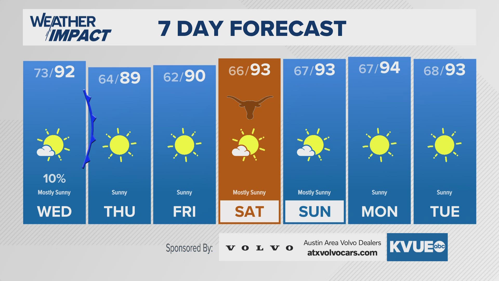
A secondary push of cooler air arrives on Wednesday. There is a small chance that a few isolated showers and storms develop along this secondary front, especially south of Austin, but the overall rain chance Wednesday is only 10 to 20 percent. Behind the front, we're tracking a big drop in humidity that will lead to some very comfortable mornings!
For the late week into this weekend morning lows will be in the low to mid 60s and perhaps even 50s for parts of the Hill Country. The afternoon on Thursday will stay in the upper 80s, but then afternoon temperatures trend warmer back in the low to mid 90s over the weekend into early next week. Fortunately, the humidity will stay low as northerly flow continues on the dry side of landfalling tropical system Helene.