
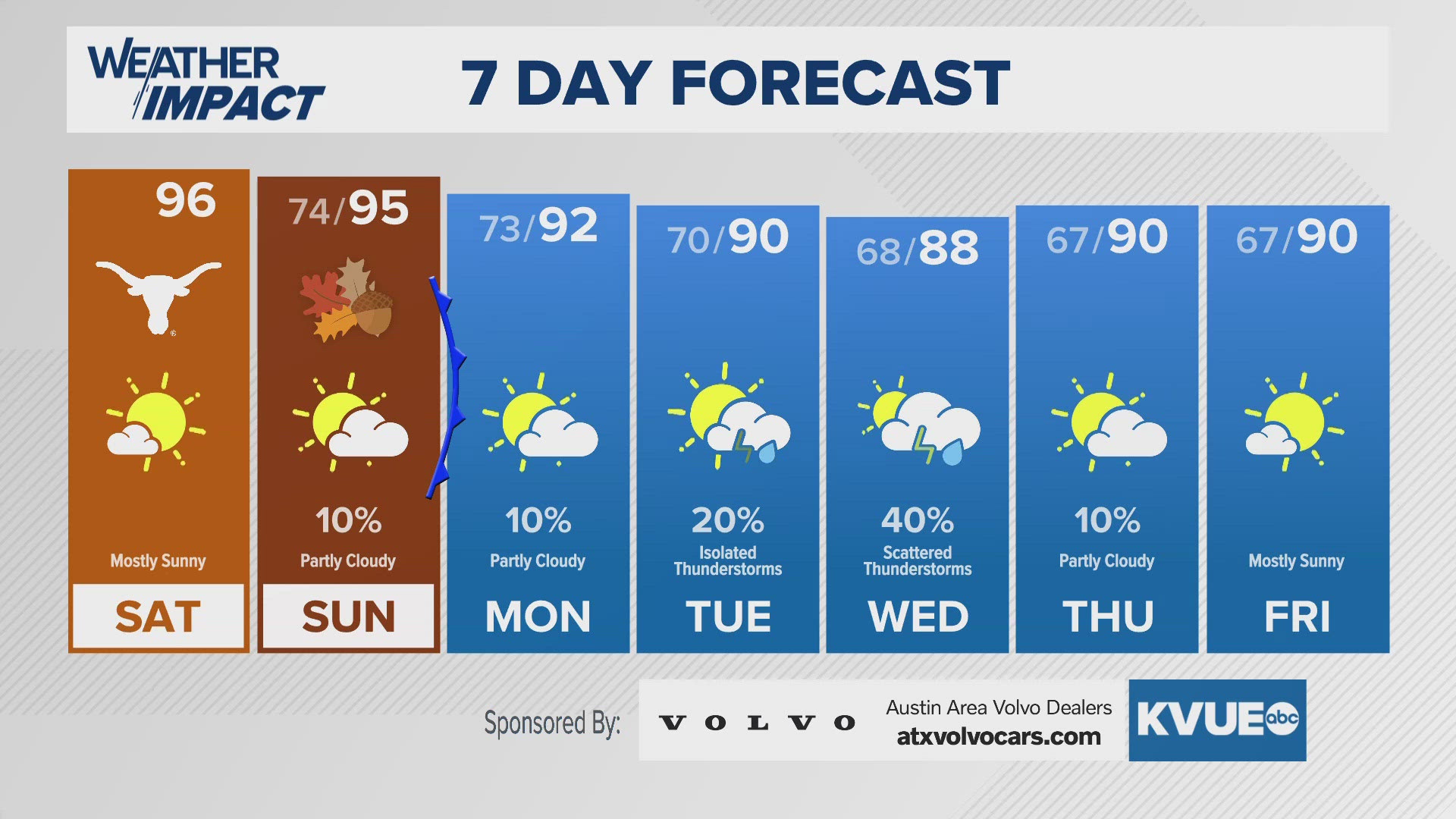
AUSTIN, Texas — We've tracked a very toasty pattern across Central Texas this week, but that will soon change with some areas getting below average to start next week.
This is the result of a weak cool front that'll slide in from the northwest as we head through the day on Monday, and resulting highs get down to the lower 90s as opposed to upper 90s to near triple-digits. Additionally, we're tracking a better storm chance as we get that lifting mechanism as a result of the front essentially stalling out.
We're tracking the tropics as well, and the system over the western Caribbean now has a 60% chance of development over the next seven days, with the next name being Helene.