
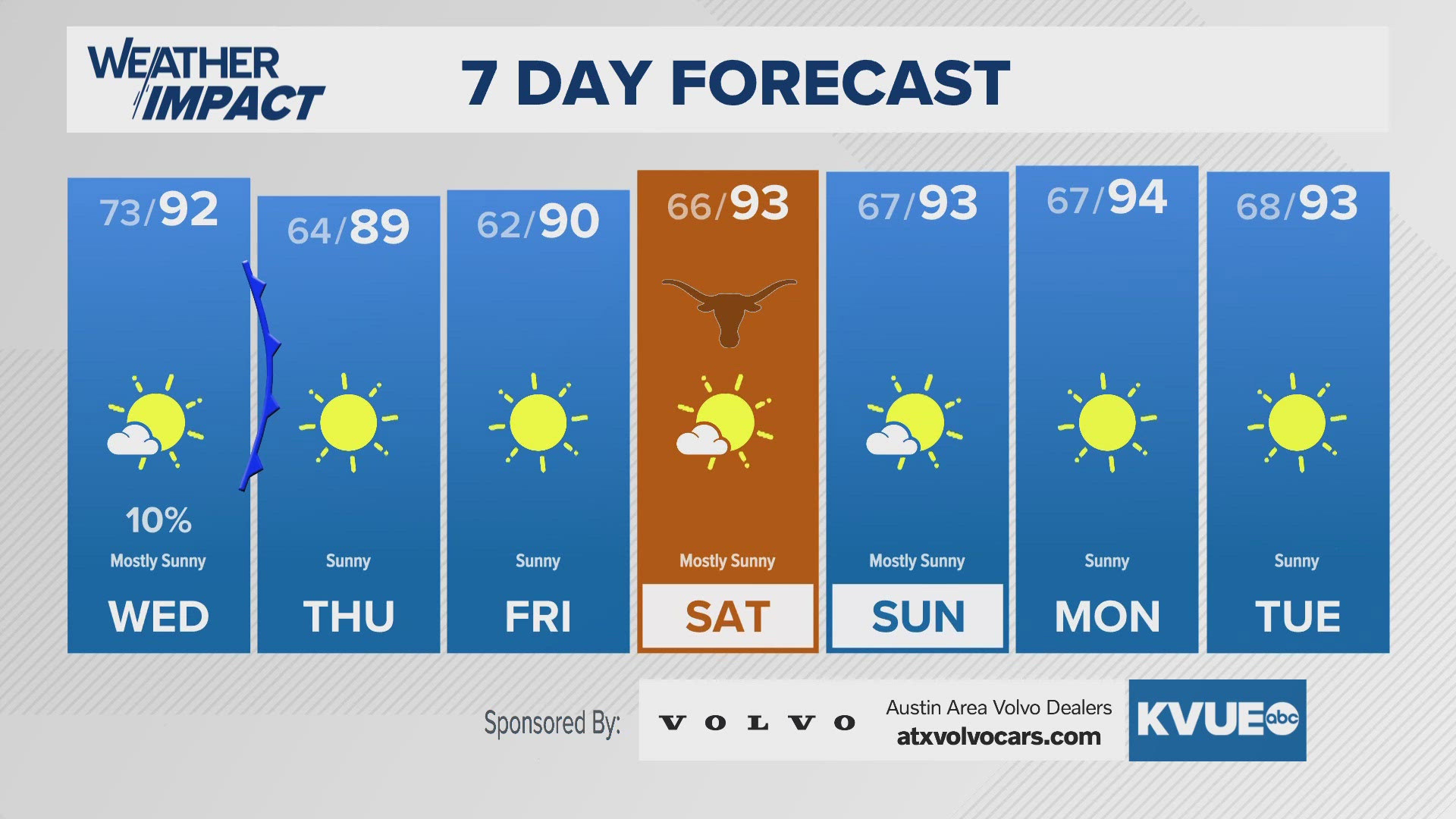
AUSTIN, Texas — Wednesday will hold some changes to the forecast, as our stalled front begins to move southeast, and ushers in breezier cooler conditions in it's wake.
For Wednesday morning, expect a mix of cloudy conditions from last nights rains and temperatures ranging mostly through the 70s. A few more showers might slide through our far eastern counties as we push into the hours between 8-10 a.m., but most of the region will be dry. Meanwhile, winds start to shift out of the north and west, picking up wind gusts to 20-25 mph just in time for the afternoon.
As the frontal boundary moves out, it's possible a few more showers hitch a ride on it, so while most of us experience dry conditions Wednesday afternoon, the chance for rain doesn't reach zero until after dinner time.
Thursday morning will be breezy and brisk, with temperatures in the 60s, a handful of 50s for the Hill Country. Friday morning will feel similar, even a bit cooler, with calmer winds. Afternoon temperatures will be in the upper 80s Thursday, and reach back toward 90 for Friday.
This weekend stays dry and warms back up, with afternoon highs returning to the mid 90s.
*Tropical Storm Helene is expected to reach hurricane strength sometime Wednesday morning. Track and timing as it heads towards the Florida Big Bend have not largely changed. It is still expected to rapidly intensify to a Cat 3, major hurricane before landfall sometime Thursday evening.