AUSTIN, Texas — It's Thursday, or as the cool kids say, it's "Friday's Eve"!
A weak cold front slid Wednesday night, allowing for cooler temperatures as you step out the door Thursday morning. You might need to put on a jacket this morning, with lows getting down to the 40s in some spots. The Hill Country even dropped to the lower 40s in isolated areas.
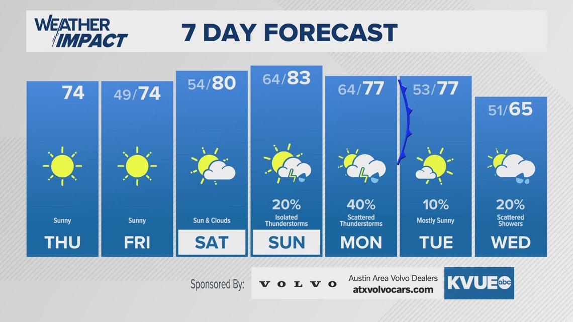
The 40s will be slightly more widespread Friday morning after Thursday's highs only reach the lower 70s. This is a result of that frontal passage through Central Texas. Some areas Friday morning may drop to the 30s in spots, so don't be surprised if you need to put air in your car tires in the coming days.
We'll warm to around the 80s this weekend, but that'll be a result of a southerly flow bringing in Gulf moisture and clouds. With that, we're tracking a storm chance of around 20% Sunday and roughly 40% Monday.
That Monday storm chance is part of a stronger front that'll come into Central Texas Monday night into Tuesday, with Tuesday's highs similar to Monday.
Wednesday's highs may not get out of the 60s in spots.
THURSDAY MORNING:
Clear and chilly. North wind at 5 to 10 mph.
LOW: 51
THURSDAY:
Not nearly as warm but still sunny. North-northeast wind at 5 to 15 mph.
LOW: 74
THURSDAY MORNING:
Clear and chilly. Northeast wind at 5 to 10 mph.
LOW: 49
SEVEN-DAY FORECAST:


Check out the live radar for what you can expect the rest of the day and into the workweek.

