AUSTIN, Texas — A cold front will bring rain and storms to Central Texas this weekend, but it won't be an all-weekend washout. Rain and storms will move through Saturday night and early Sunday morning, but that still leaves most of Saturday and the second half of Sunday with mostly dry weather.
Fortunately, the severe weather risk for Central Texas continues to look quite low, but there is still a low-end threat for a strong storm, especially across the Hill Country.
The Storm Prediction Center (SPC) still includes parts of Mason and Gillespie counties in the "marginal," level 1 of 5, threat for a strong storm. The main threats would be gusty winds and possibly some hail.

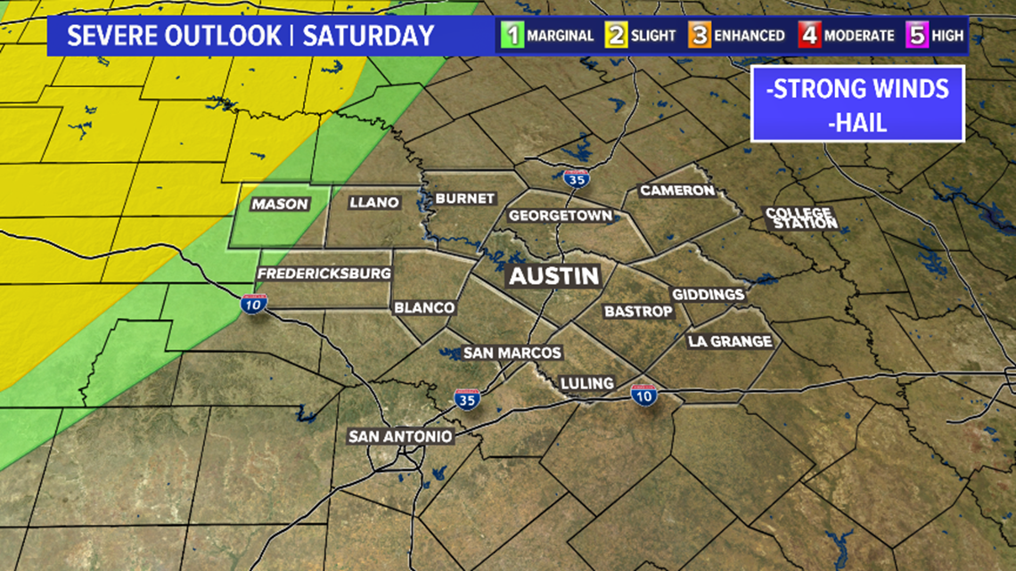
We're expecting a line of thunderstorms to develop to the north and west by Saturday evening along the cold front. The far more robust severe weather parameters will be in place across North Texas and the Panhandle. This is where the SPC has outlined the "enhanced," level 3 of 5, risk for severe storms.
Ahead of the front, we'll have just patchy areas of light drizzle or some light showers Saturday morning. Saturday afternoon should be just about completely dry with more clouds than sun and highs near 80. It's not until the late evening that storms start to move in and, thankfully, they should be losing steam as they do so.

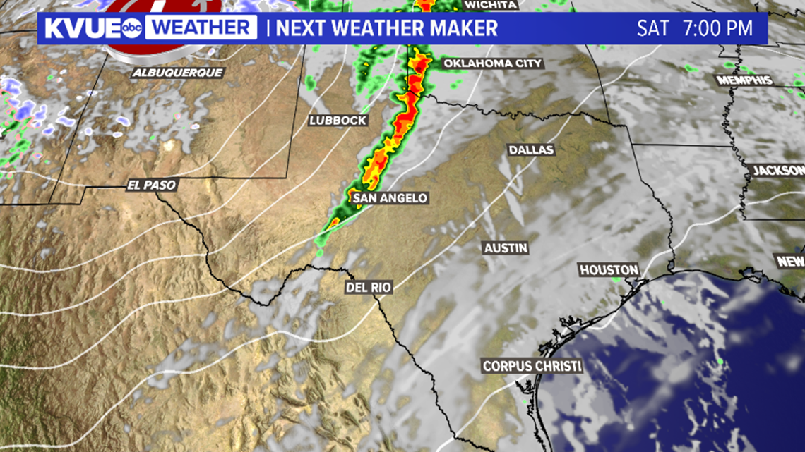
Rain and storms could be knocking on the door across the Hill Country as early as about 10 p.m. or 11 p.m. Saturday evening. We're expecting these storms to gradually weaken as they push eastward, so the main strong storm threat will be across the Hill Country as these storms initially move in.

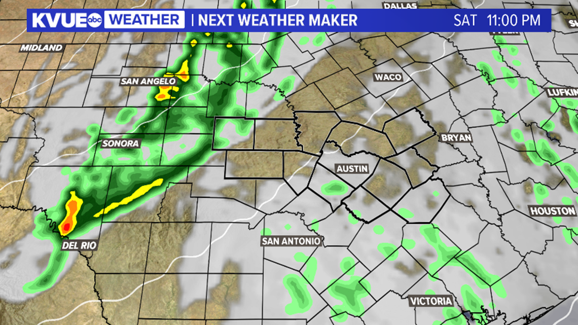
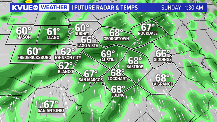
Rain and storms spread eastward through Saturday night and early Sunday morning. Again, the severe threat for the Interstate 35 corridor and points east look very low, but don't be surprised to hear some thunder overnight.

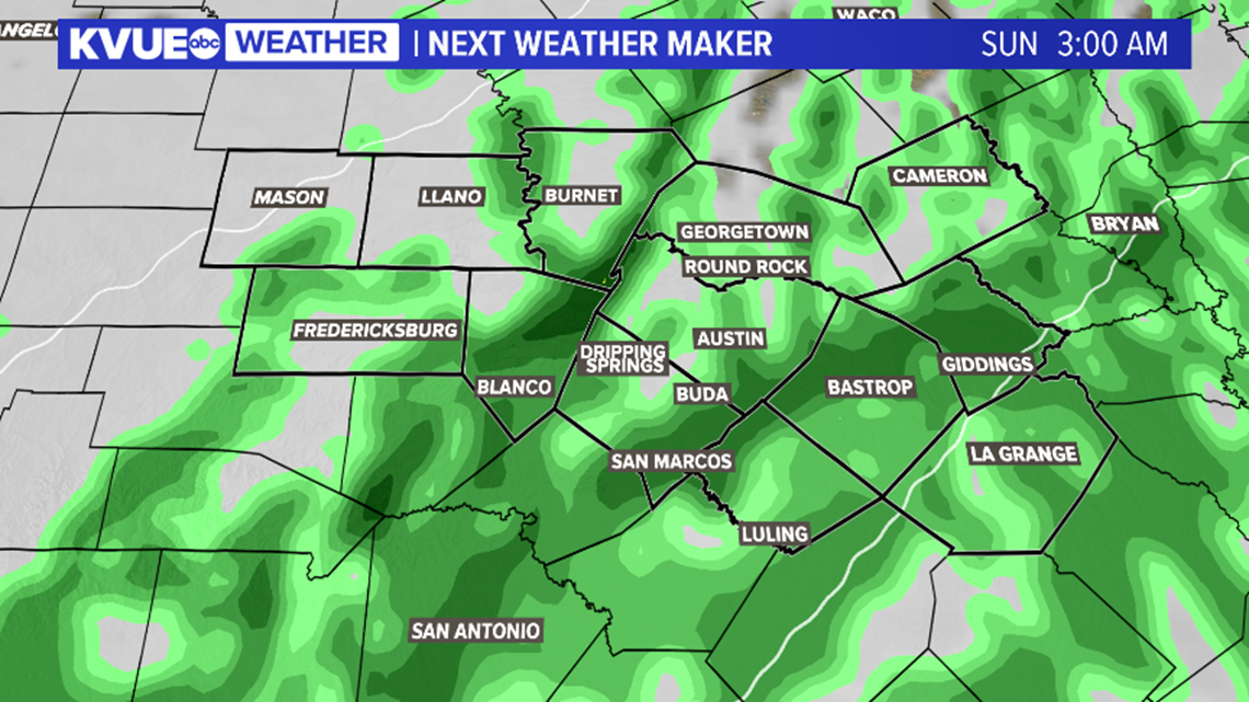
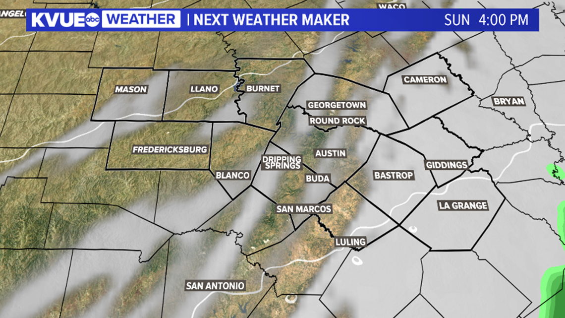
The wet weather will be moving through our eastern areas early Sunday morning but will quickly push away through the late morning and early afternoon. In fact, by about lunchtime, most of Central Texas should be drying out.
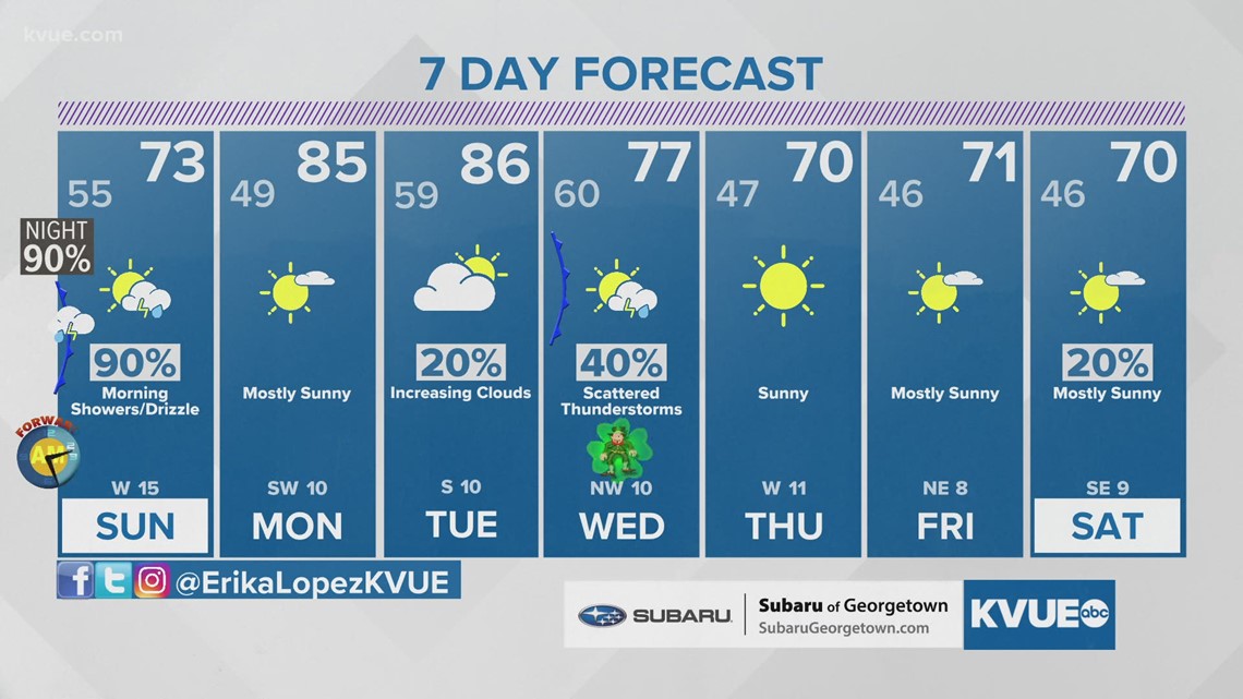
Behind the front, we will gradually clear through the late day. It will be breezy and a bit cooler with highs in the low to mid-70s on Sunday.

We need rain here in Central Texas, and this system will bring some but not a ton. Generally, we're expecting totals from around a 10th of an inch to around a quarter of an inch.

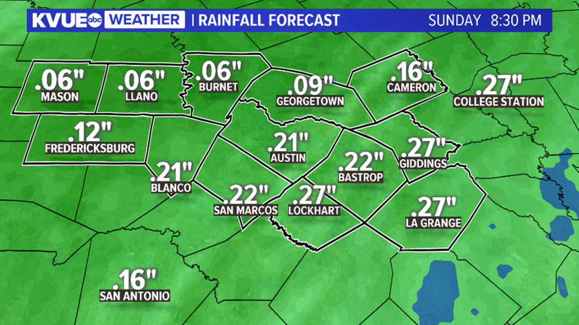
After the weekend front, Monday is looking dry and warm with highs back in the 80s. Another cold front will bring a chance for rain and storms around the middle of next week.
The KVUE Weather Team will continue to closely monitor this developing forecast.
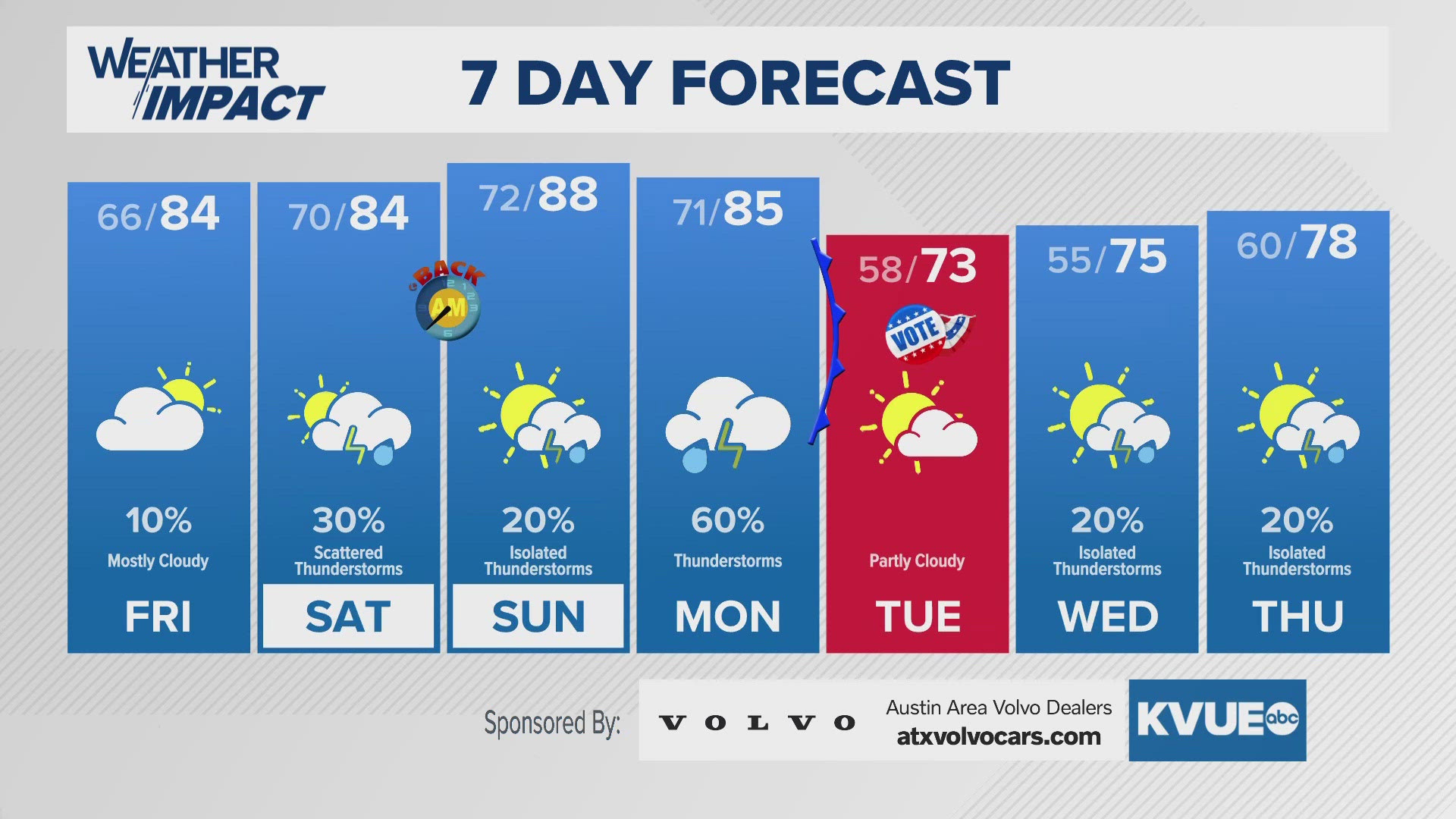
In the meantime, the extended forecast can be found below:

