AUSTIN, Texas — While we were dry for the first weekend of the Austin City Limits Music Festival (ACL), we are tracking some changes as we head into the middle of this week.
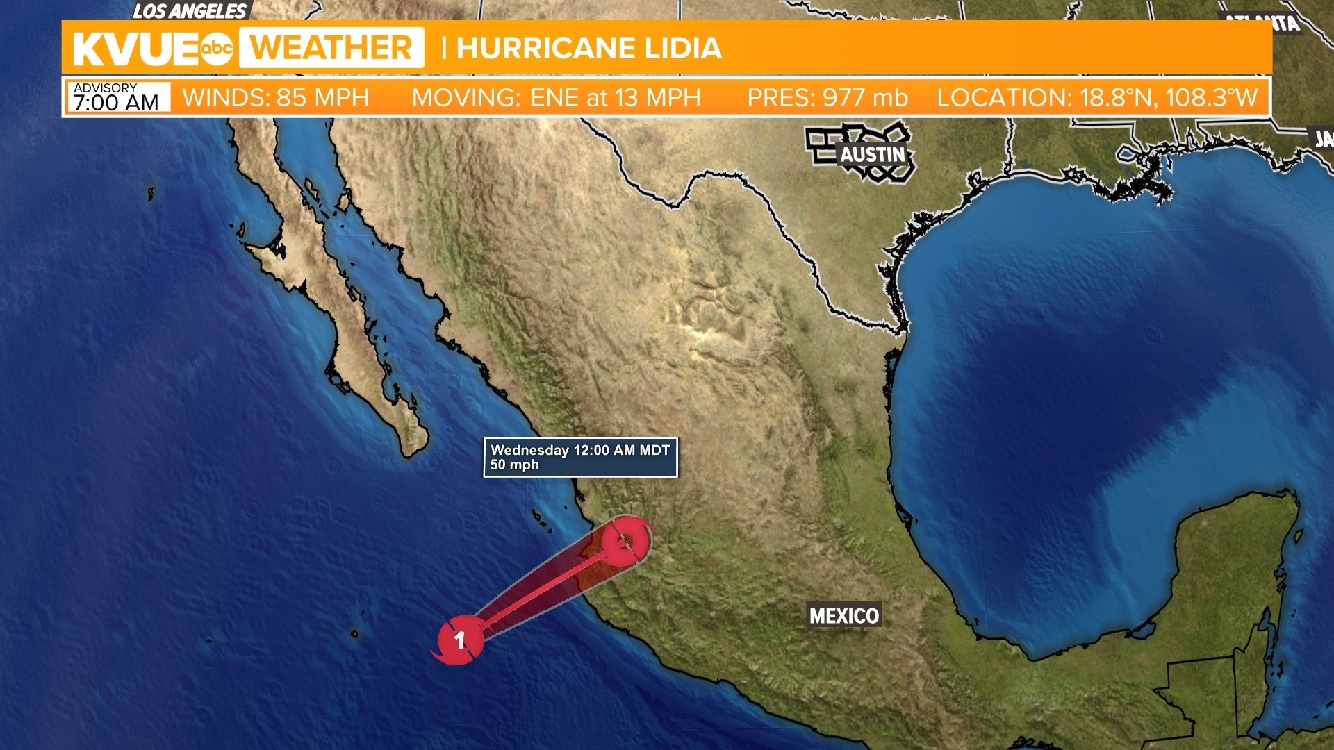
This is a result of Tropical Storm Lidia and disorganized moisture in the Yucatan Peninsula. Tropical Storm Lidia is currently in the eastern Pacific Ocean and has a track that could impact Mexico as a Category 1 hurricane by Tuesday. As the system crosses the Sierra Madre Occidental, we could be seeing some impacts from this system.
Here is the latest on how Lidia could impact Central Texas.
Timing
Lidia is expected to make landfall in western Mexico as a Category 1 or 2 hurricane early on Tuesday. While the system is expected to weaken through the afternoon, eventually downgrading to tropical depression status, it is expected to conjoin with another tropical system that is also forming in the western Gulf of Mexico, near the Bay of Campeche.
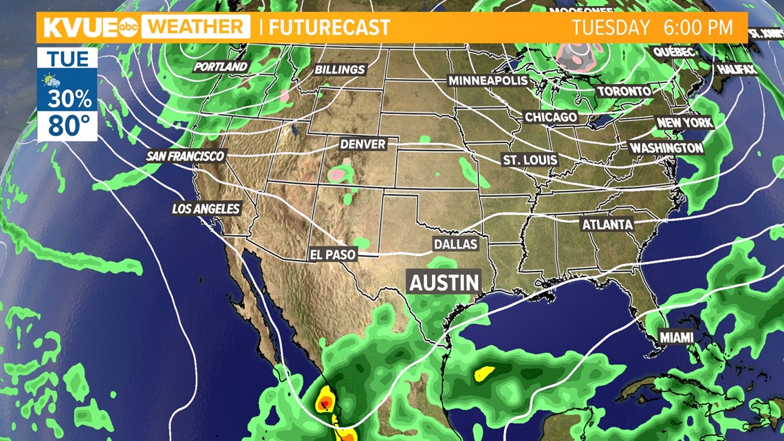
These two systems will combine to widen the moisture field, making it potentially wide enough to impact Central Texas as early as Tuesday late morning or early afternoon.

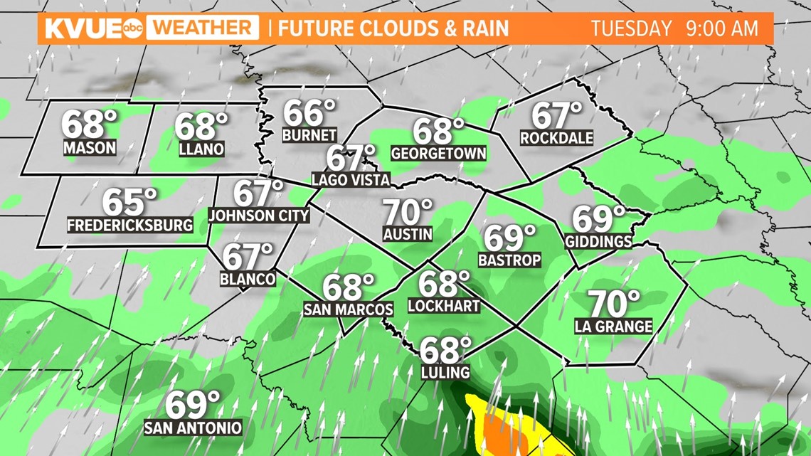
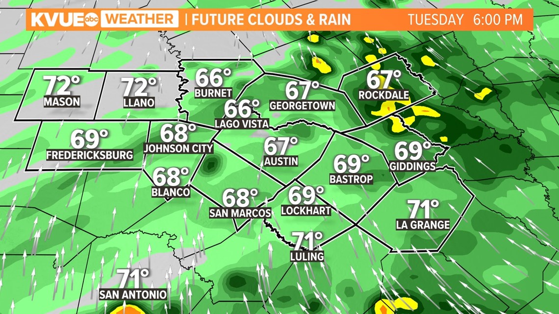
Rain chances will remain mostly along and east of Interstate 35 beginning late morning and running through Tuesday evening.

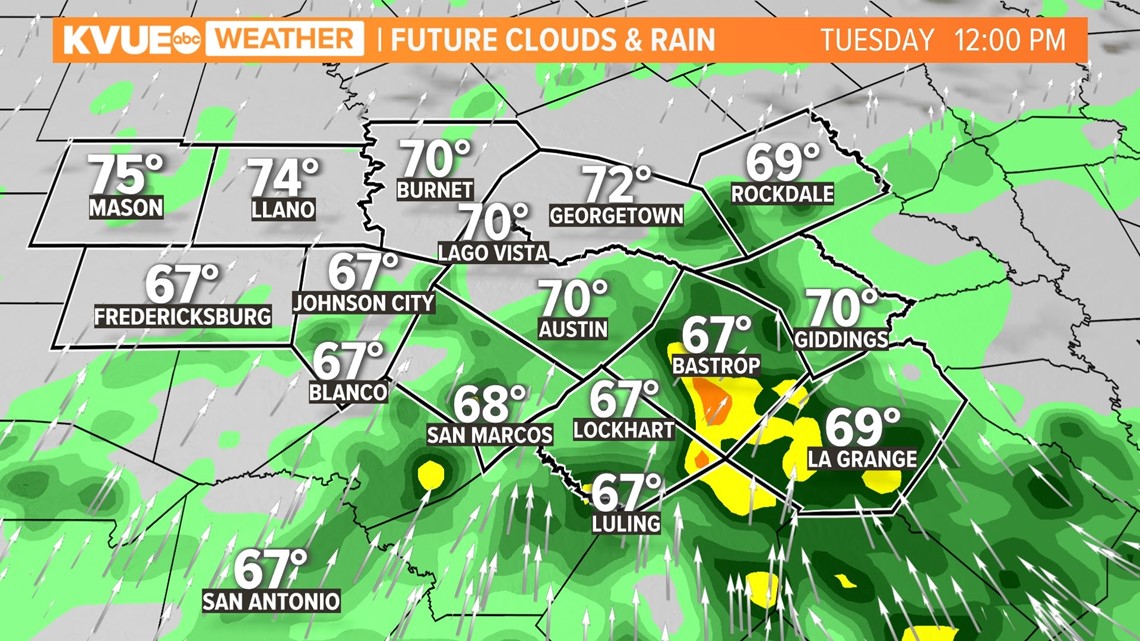
It's possible that throughout the afternoon and evening, a few thunderstorms and heavier rain will enter the mix. However, there is not a significant risk of severe weather on Tuesday or Wednesday.


As we get into Wednesday, remnants of Lidia will be stalled across northern Mexico and moving east toward the Gulf of Mexico. The moisture from the disorganized low in the western Gulf will be headed toward the Florida Panhandle, set to push 3 to 5 inches of rain over portions of the southeast or more.

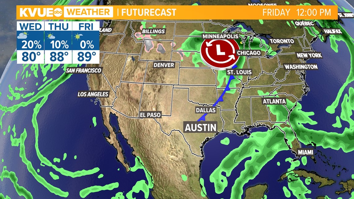
It's possible a few showers and cloudiness will be left around Austin for Wednesday morning, but sunny weather will make a return on Thursday.
Rainfall Amounts
An important component of how much rain we see will depend on the final track of Lidia. However, recent updates generally keep the storm from entering Central Texas, so models have come up drier in regards to rainfall as of Monday afternoon.

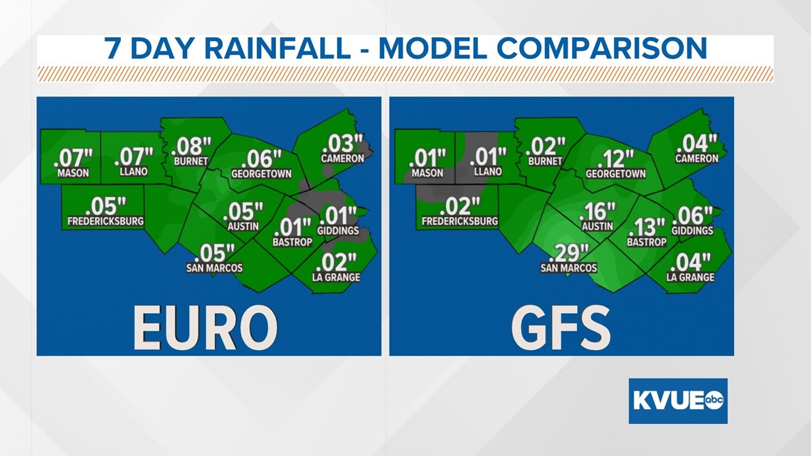
It will generally be the east side of I-35 and the southernmost points of Austin that will experience more rainfall, potentially an inch or more in localized spots.
High pressure incoming from the north will help keep moisture from Lidia's from coming farther north than Corpus Christi.


Stick with KVUE for the latest on this tropical system and its impacts to Central Texas.
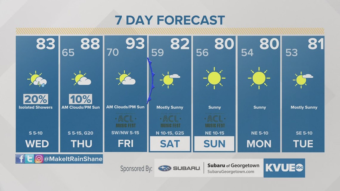
In the meantime, your 7-day outlook is below.