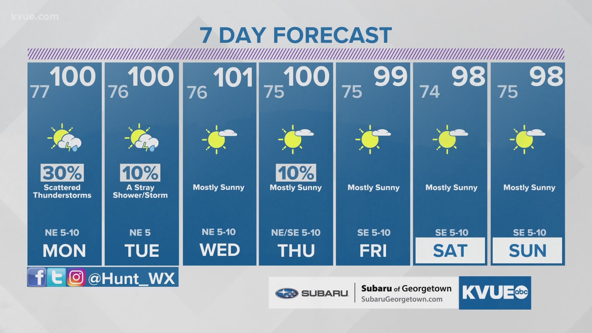
AUSTIN, Texas — Another day of triple-digit heat is in the books for Austin. Saturday's high of 107 marked the 14th straight day of 100-plus degree temperatures – but that streak may come to an end on Monday with a weak cold front on the way.
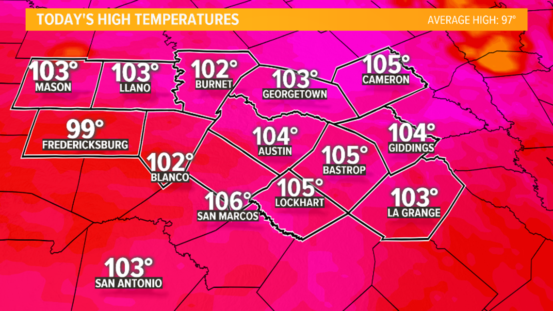
Temperatures will likely trend a degree or two cooler for Sunday afternoon, but overall, the forecast still looks scorching hot. A Heat Advisory remains in effect for all of Central Texas through 7 p.m. Sunday.
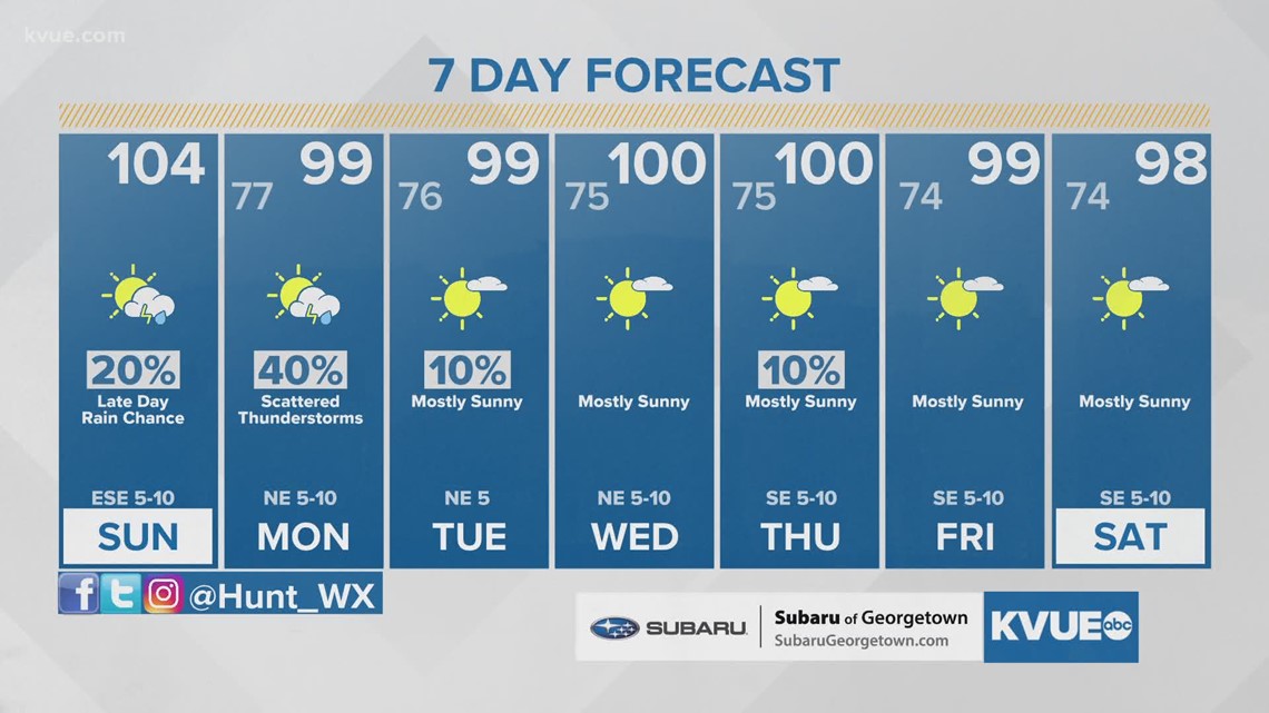
The current forecast calls for a high of 104 in Austin, a few degrees shy of the daily record.

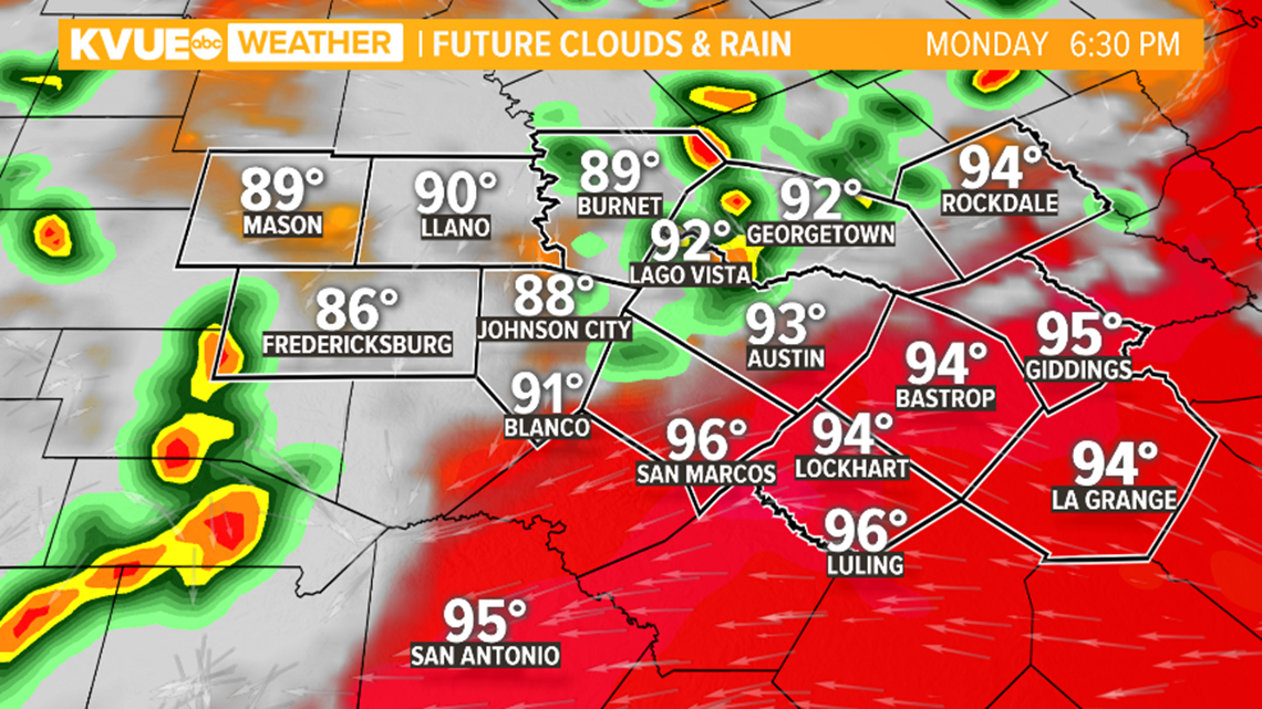
The day on Sunday will be primarily dry, but rain and storm chances trend higher for Sunday evening as a cold front moves into North Texas. This cold front will approach Central Texas by Monday, and multiple rounds of rain and storms will be possible Sunday evening through Monday as the front moves south.
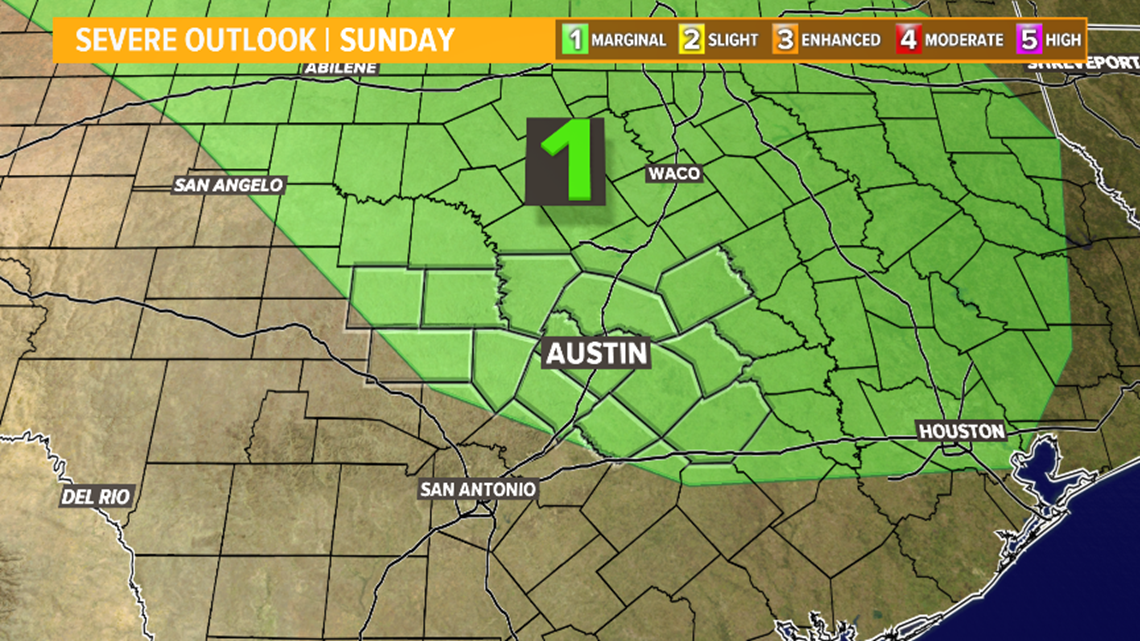
A few storms Sunday evening could be strong, with gusty winds and maybe some hail. The current outlook from the Storm Prediction Center outlines most of Central Texas in the "slight" – level 1 of 5 – risk for severe storms.

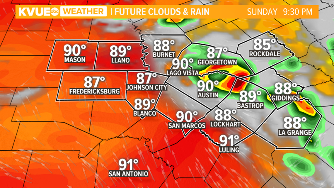
The latest computer models show scattered storms moving into eastern portions of the KVUE area after 8 p.m. Sunday evening. It's important to note that computer models tend to struggle with this type of set up, so it's difficult to pinpoint the exact placement of storms.
Regardless, scattered showers and storms will be possible Sunday evening into the early overnight, and a storm or two could be strong, especially if a more organized cluster of storms is able to develop.

Another round of rain and storms is then possible on Monday as the cold front likely begins to stall somewhere near Central Texas.
Not everybody will necessarily see rain on Monday, and the current forecast calls for a 40% coverage of scattered showers and storms.

After the rain and storm chances Sunday night and Monday, the second half of the week is looking hot and mainly dry.
The "cold front" will shift the breeze out of the northeast for the beginning of the week, and accordingly, afternoon highs will be noticeably cooler. Unfortunately, even with the cooldown, highs will be in the upper 90s to near 100 all week long. The second half of the week looks just about completely dry.
The KVUE Storm Team will continue to closely monitor the forecast. The extended forecast can be found below:

PEOPLE ARE ALSO READING:

