AUSTIN, Texas — Widespread showers and storms brought much-needed rainfall to the Central Texas region on Monday afternoon and evening. While not everyone received rain, some areas recorded several inches.


The National Weather Service recently released rainfall totals from across the area. The luckiest area was near Burnet with over 3.5 inches of rain.
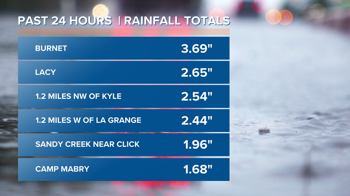
Here are some of the amounts from Monday's rain event:
- Burnet - 3.69 inches
- Lacy - 2.65 inches
- 1.2 miles NW of Kyle - 2.54 inches
- 1.2 miles W of La Grange - 2.44 inches
- 2.2 miles WNW of Bastrop - 2.41 inches
- Sandy Creek near Click - 1.96 inches
- 8.6 miles SE of Harper - 1.75 inches
- Camp Mabry (Austin) - 1.68 inches
- 2.9 miles NNE of Spicewood - 1.60 inches
- 0.5 miles N of Pflugerville - 1.21 inches
- Cedar Park - 1.18 inches
- Llano - 1.18 inches
- 4.3 miles NW of Lockhart - 1.18 inches
- Austin Bergstrom International Airport - 1.16 inches
- 5 miles ENE of Wimberley - 1.02 inches
- 1.6 miles WSW of Round Rock - 0.71 inches
- 6.9 miles NW of Luling - 0.59 inches
- 2.7 miles W of Giddings - 0.59 inches
- 2.2 miles NW of Georgetown - 0.49 inches
- 2.4 miles S of Taylor - 0.43 inches
- 5 miles NNE of Blanco - 0.11 inches
- 5 miles N of Fredericksburg - 0.02 inches
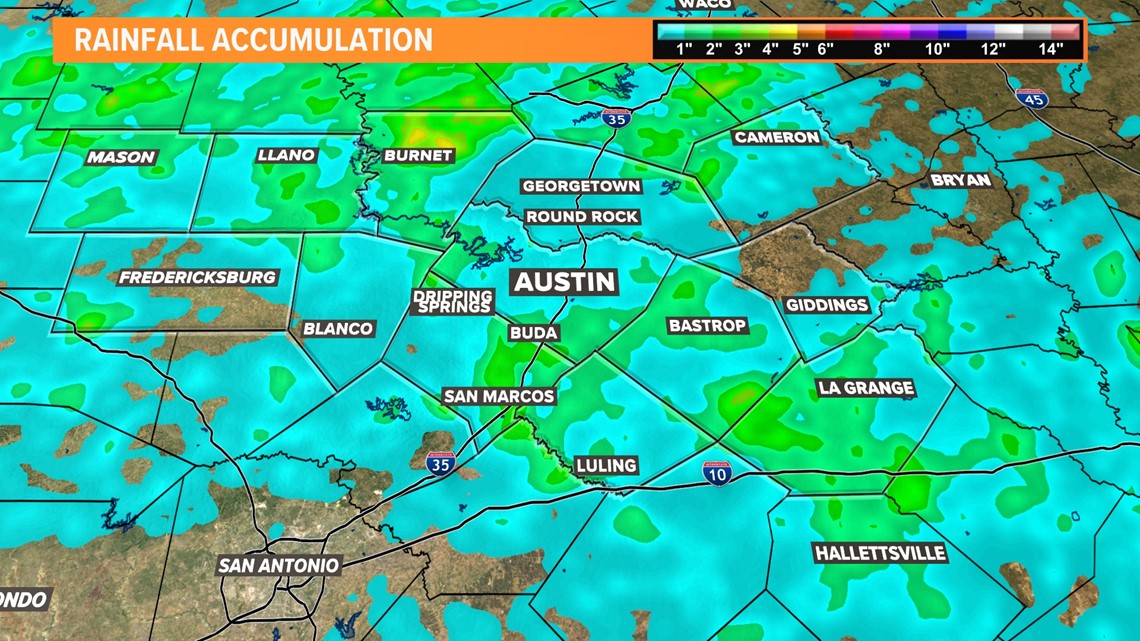
Austin even broke the daily record for rainfall at the Camp Mabry climate site with a total of 1.68 inches. The former record was 1.65 inches back in 1992. If you didn't see a total for your area, check out the radar-estimated accumulated rainfall in the graphic below:


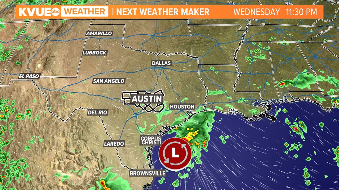
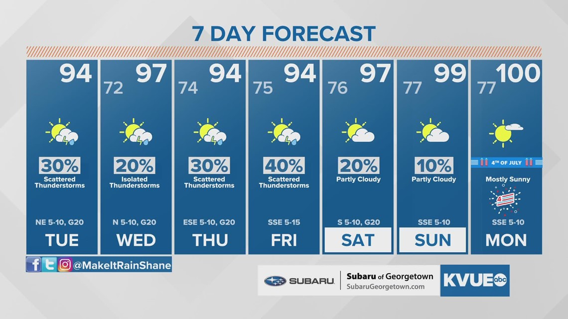
If you didn't receive rain on Monday, don't give up hope just yet! We'll have additional chances for rain later in the workweek due to an area of tropical moisture located in the Gulf of Mexico. While it's still too far out to determine any additional rain estimates, rain chances will be elevated Thursday and Friday.


We'll continue to monitor the forecast closely and provide updates on air and online. In the meantime, here is a look at your extended forecast:


PEOPLE ARE ALSO READING:


