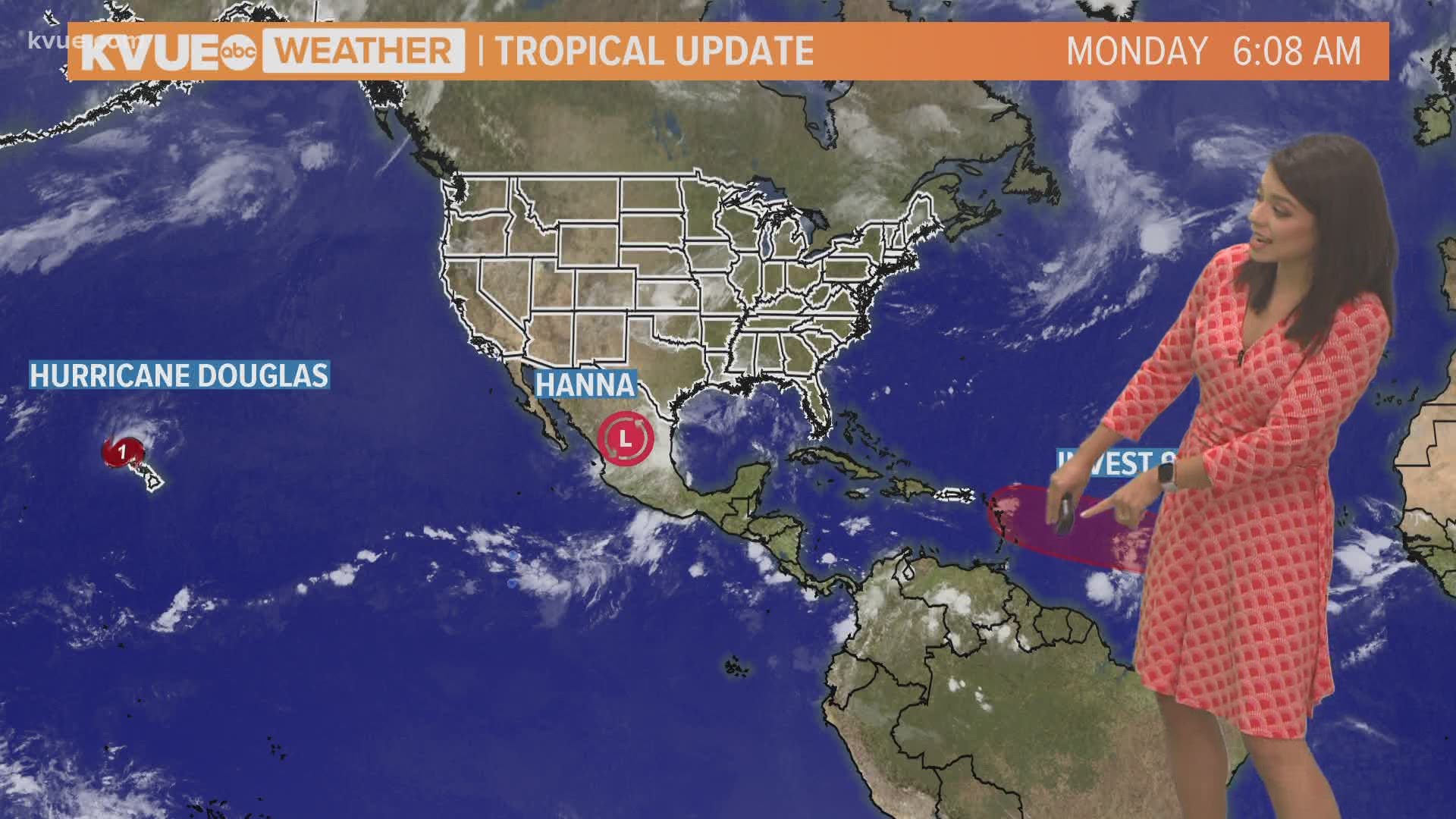
AUSTIN, Texas — As of Monday morning, Hanna continues to weaken and is considered a Tropical Depression over northern Mexico. Models continue to show the dissipation of Hanna over higher terrain this week.
Hanna made landfall on Padre Island shortly after 5 p.m. Saturday with maximum sustained winds of 90 mph. These wind speeds classified Hanna as a strong Category 1 hurricane.
Hanna is the first hurricane to make landfall in the 2020 hurricane season and the first hurricane to make landfall in Texas since Hurricane Harvey in 2017.
Hanna is the strongest hurricane to make landfall in Texas during the month of July since Hurricane Claudette in 2003. Claudette also recorded 90 mph wind speeds at landfall.


Central Texas was expecting some much needed rain as Hurricane Hanna's path stretched just south of the area. Due to a strengthening high pressure, Hanna's projected path shifted south, leaving Central Texas with less rainfall than anticipated.
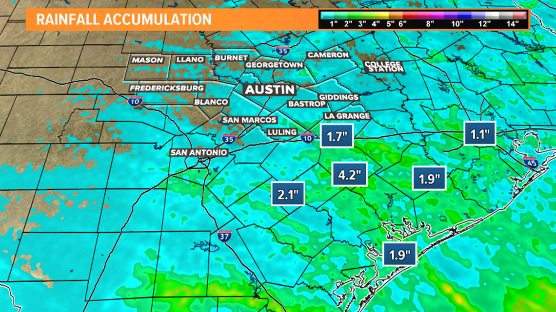
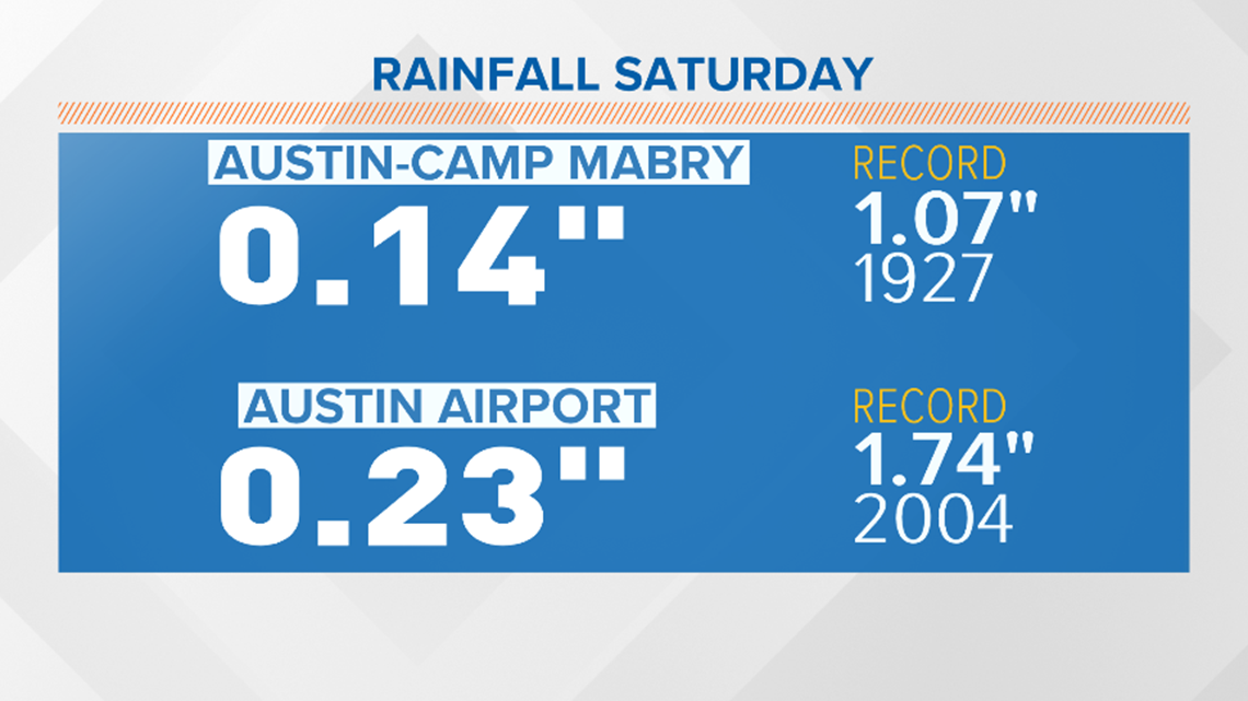
On Saturday, Austin picked up less than one-quarter inch of rain with weekend totals of less than half of an inch for many locations. Still, Sunday was considered the wettest day of July so far. Areas south and southeast of the KVUE viewing area accumulated higher rain totals.


Unfortunately, portions of Central Texas are in a rain deficit since the beginning of summer. This has led to drought conditions to return to our area.


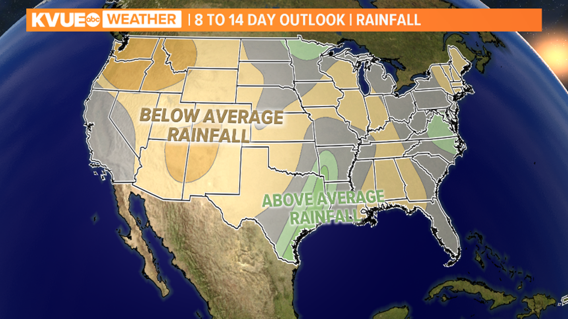
The precipitation outlook shows above-average rainfall in the next eight to 14 days along the Texas Coast.
PEOPLE ARE ALSO READING:

