
AUSTIN, Texas — While the 2024 Hurricane Season does not officially begin until June 1, we're already looking at a potentially troubling sign for the season to come, or even for it to start up earlier than normal.
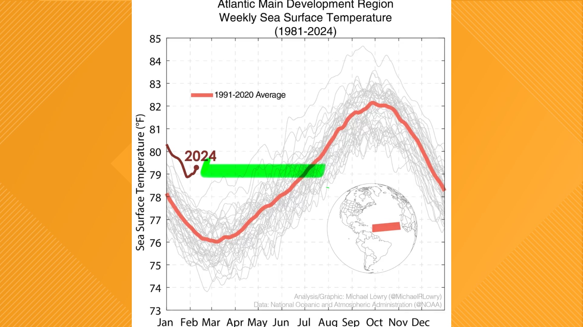
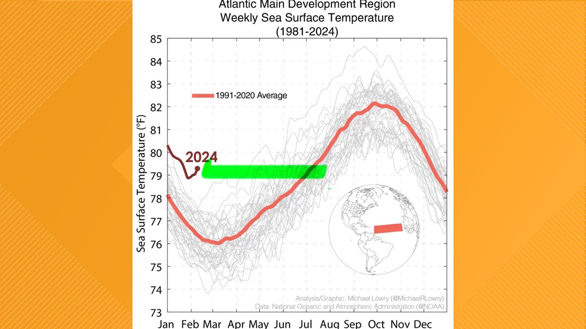
An analysis of the latest sea surface temperature reveals that much of what is known as the Atlantic Main Development Region, or AMDR, currently has above average sea surface temperatures, getting close to the 80s in many spots.
The AMDR is a region in the Atlantic that stretches from the Lesser Antilles all the way to Sierra Leone, Ivory Coast and the Bight of Benin in Africa, mainly north of the Equator. Sea surface temperatures are determined by buoys in the Atlantic that are compiled to create these averages.

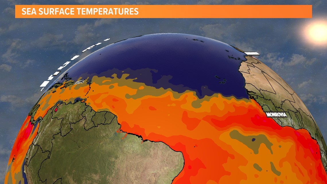
Current temperatures are measuring at around 10-15 degrees above average for this time of year across the entire AMDR.

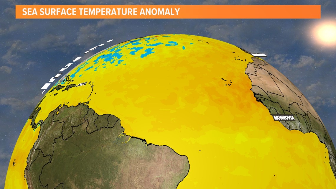
However, there's one troubling trend that is the most apparent with the latest sea surface anomaly.
It is not just that temperatures are sitting well above February averages, but it's that these temperatures are actually similar to averages typically seen in July.
To compare, July is typically the second month of Hurricane Season, and the season starts to slowly ramp up with tropical system formation around that point in the season.

However, it's important to note that while these averages do point to a potentially earlier start of and an active 2024 Hurricane Season, it's also important to note some mitigating circumstances that may limit storm development.
Firstly, this analysis does not account for wind shear, which does not aid in tropical storm formation, but does aid in storm formation on land over the United States and other areas conducive to severe weather.
Secondly, tropical systems typically form within the Caribbean Sea and the Bay of Campeche during the month of July, and both areas are NOT in the AMDR.
With all of this in mind, though, it is important to note that this summer could turn out to be a La Niña summer, which would also mean a more active hurricane season.