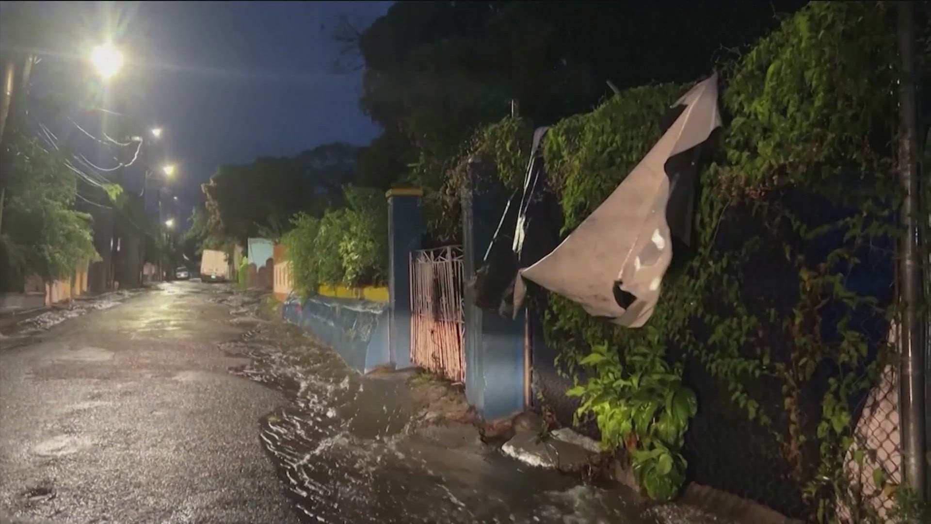
AUSTIN, Texas — When tropical storms and hurricanes form, they get a name, but they also get assigned a forecast track.
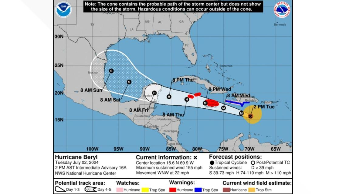
The official track used by media sources comes from the National Hurricane Center and is likely what will be shared around the internet when a major storm is coming. It can seem straightforward, but many misinterpret the forecast cone.
The first and most important thing to know is that the forecast cone is mostly about track. You can use it to get a rough estimate of where the storm's center will go. The opaque white area is the track the storm is expected to travel over the next three days and the dotted area is the fourth and fifth days after that.

RELATED: Hurricane storm surge: 3 Fast Facts
The opaque white and white dotted zones represent the area where the center of the storm system is expected to stay as it progresses. According to the National Hurricane Center, the storm stays within that zone 60 to 70% of the time.
This zone is NOT an indication of the size of the storm.
At times, if the storm is strong enough, there will be wind field estimates near the current storm center. This will show how far-reaching hurricane-force and tropical storm-force winds are. Tropical conditions can still occur outside of those areas, so you always want to pay attention to current watches and warnings near you so you can be prepared.

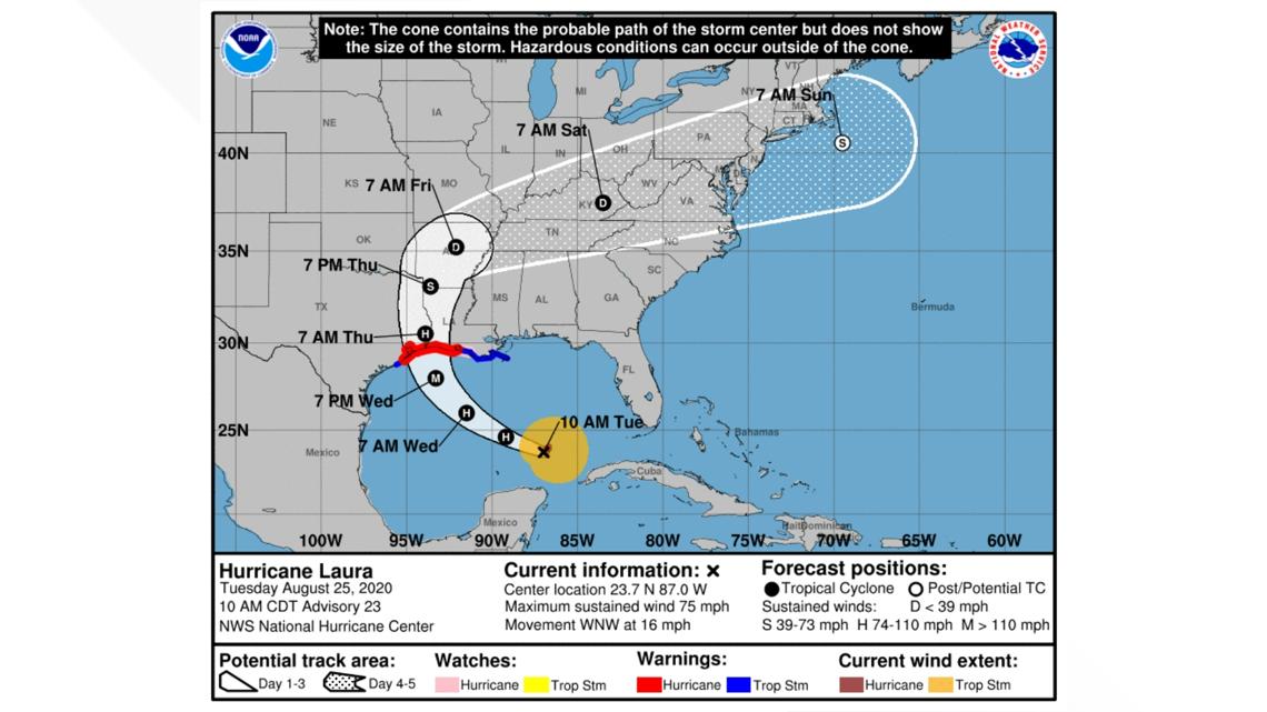
The forecast center of the storm is labeled in 12-hour intervals from the most recent recorded position of the storm. A timestamp and forecast storm strength will be indicated at each interval.
They will be marked with either a D, S, H or M, relating to the storm's expected strength. D stands for tropical depression, S for tropical storm, H for hurricane and M for major hurricane.
The forecast will also highlight areas of the coastline under watches or warnings, if there are any.

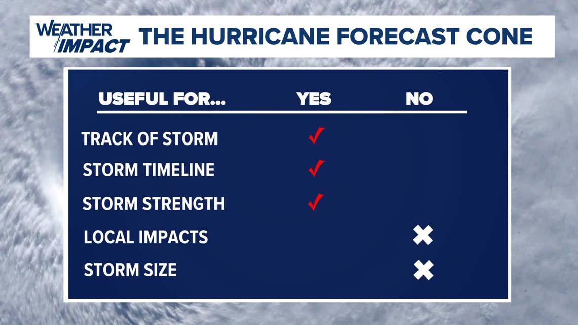
The forecast cone is not a good assessment of how impacts, wind, storm surge, heavy rain and tornadoes will affect your area. That's when you should turn to supplemental forecasts, either from the National Hurricane Service itself or from local meteorologists.