
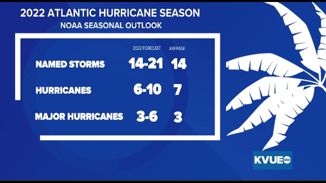
AUSTIN, Texas — The National Hurricane Center has recently released its latest outlook for the 2022 Atlantic Hurricane Season, and it paints a picture of an active season with between 14 and 21 named storms in the Atlantic.
The average amount of named storms is 14, so we're expecting a more active pattern on that front. The same could be said for hurricanes as well as major hurricanes, with an average of seven hurricanes every year being possibly surpassed with the forecast hovering between six and 10 hurricanes forming.
Three to six major hurricanes, or hurricanes that reach Category 3 strength or higher, are forecast. Three is the average amount.

In addition to this, sea surface temperatures are much warmer than normal in the Gulf of Mexico, as a result of a chilling development in the Gulf.
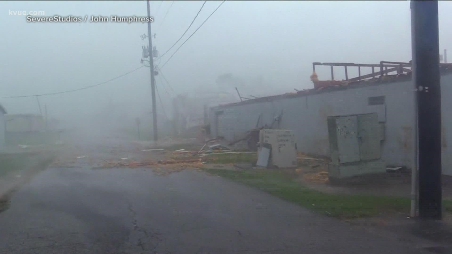
This is called the "loop current," and it has been responsible for many a major hurricane that had devastating impacts on communities across the Gulf Coast. Those include Hurricane Ida in 2021, which caused devastating impacts to southeastern Louisiana, and Hurricane Harvey in 2017, which devastated portions of the Texas Gulf coast and caused historic flooding in Houston.

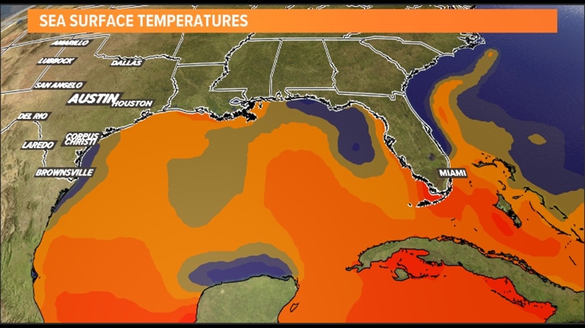
The "loop current" is like most ocean currents that we see across the globe, as it is basically a river in the sea. What the loop current does is carry warmer water from the Caribbean Sea into normally cooler water in the Gulf. What's chilling about this is that hurricanes don't just form over water, they form over warmer waters, such as the Caribbean Sea and near the Equator off the coast of western Africa.
According to National Oceanic and Atmospheric Administration (NOAA), the West African Monsoon, from which the cyclones from western Africa form, is "enhanced," meaning that stronger easterly waves can form off of the African coast. That results in stronger and longer lasting hurricanes.
Additionally, the loop current is saltier than the rest of the Gulf of Mexico and, as a result, ocean water mixing is much limited, meaning that it can hold heat at deeper depths, allowing for energy for storms to develop.
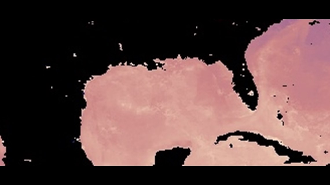
There is concern that this loop current is similar to the devastating 2005 Atlantic hurricane season, when three major hurricanes — Katrina, Rita and Wilma — crossed through the loop current, or large pools of hot water that spin off from the current, known as eddies, on their way to devastating impacts throughout the Gulf Coast.
The below image from the NASA Earth Observations, or NEO, illustrates how the 2005 Gulf surface temperatures were well above average, even during the month of May:

In addition to this, we are still in a La Niña pattern, which usually results in less shear, another catalyst for stronger hurricanes and other tropical systems.
However, we must always understand that this is only a preliminary forecast and much can change throughout hurricane season, especially when it comes to the strength of the loop current and whether or not any storms track into the loop Current or its adjacent eddies.
But if these forecasts for an active hurricane season verify, it would be the seventh straight above-average year. Since Atlantic and Caribbean basin sea surface temperatures overall are above average, this possibility exists.
PEOPLE ARE ALSO READING: