
AUSTIN, Texas — While Colorado State University predicted an above-average hurricane season for 2024, this has yet to fully materialize, even with Hurricane Beryl becoming the earliest Category 5 hurricane on record in the Atlantic basin and Hurricanes Debby and Ernesto following soon after.
We've seen a notable decline in activity since Ernesto's dissipation on Aug. 20. In fact, the Atlantic basin has yet to have a named storm since.
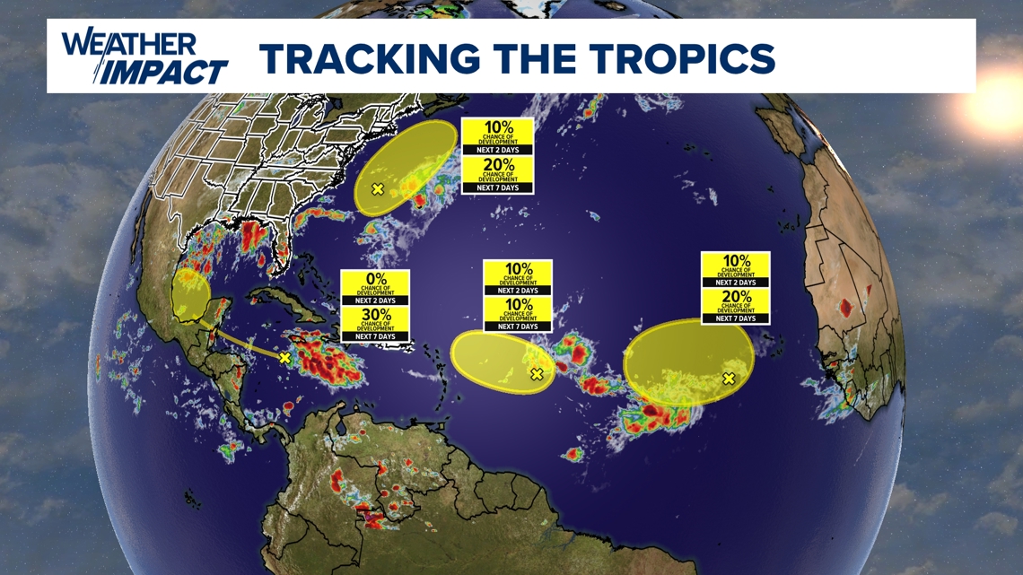
Although we are nearing the climatological peak of hurricane season, Colorado State University is now forecasting a 60% chance of below-normal Accumulated Cyclone Energy, or ACE over the next two weeks. Though there are four areas to monitor in the Atlantic basin, including a system headed for the Bay of Campeche, none of these are expected to materialize into a named system at this time.

Colorado State's analysis breaks down four reasons why the Atlantic basin's season hasn't materialized the way that it was expected to.
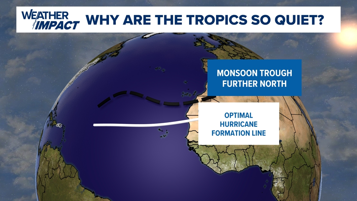
The first is that the monsoonal trough, which is responsible for tropical system formation off the coast of Western Africa, has been shifted too far to the north of the ideal track. Instead of storms forming off the coast of Gambia, Guinea Bissau and Senegal, these storms are trying to form off of Mauritania and Morocco. As a result, drier air is being pushed into the deeper tropical regions, limiting convection.

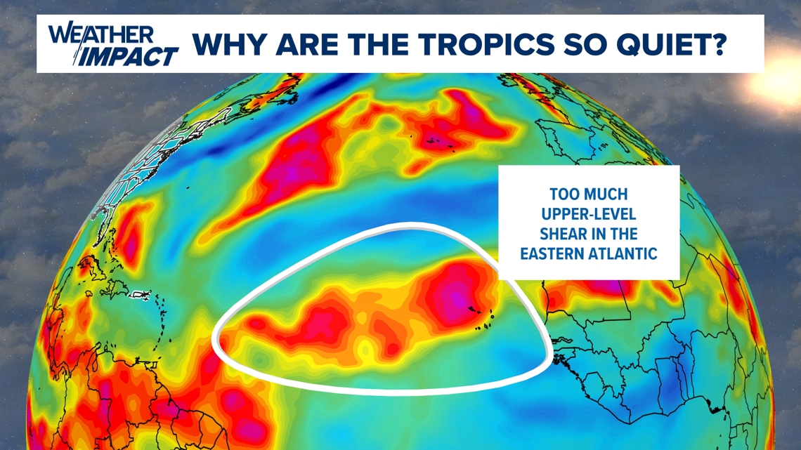
Secondly, we've simply had too much shear in the eastern Atlantic. While shear in the central and western Atlantic is reduced, tropical systems need time to develop and, usually, the more potent storms are the ones that come off the coast of Africa during this time of year. Those areas have the most shear in the Atlantic at present and, as a result, tropical development is further hampered.

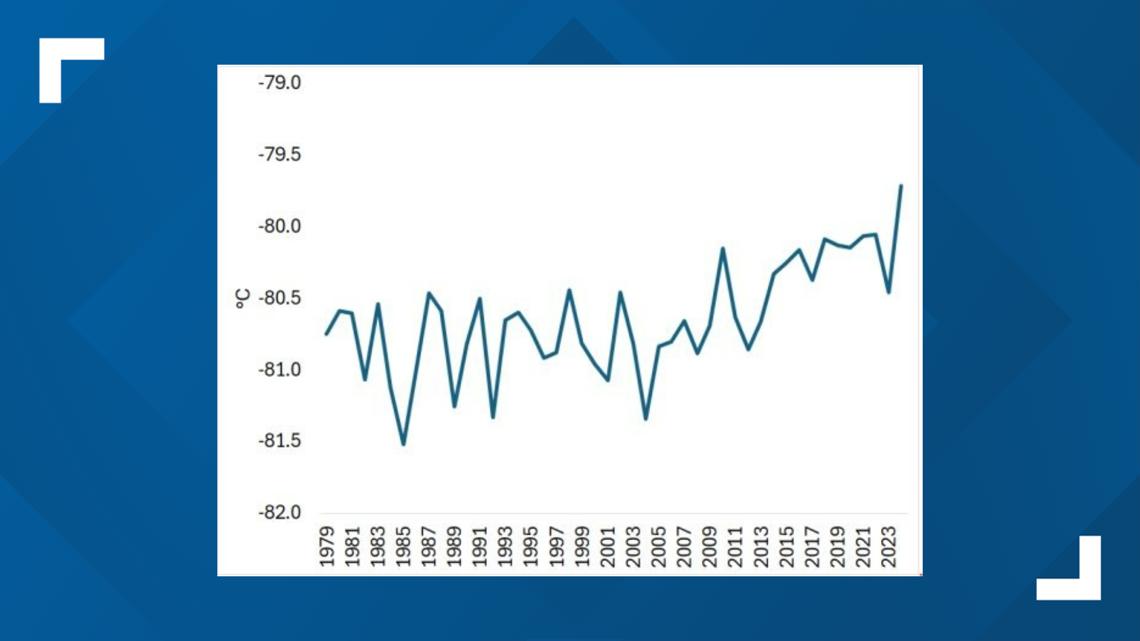
Additionally, for any storm to develop, you need warm temperatures at the surface and cooler air aloft. While sea surface temperatures would basically amount to these storms essentially taking in rocket fuel that could intensify them, there is also warmer air aloft, neutralizing storm development.
Because of this, storms can have a very hard time developing despite conditions otherwise being perfect.

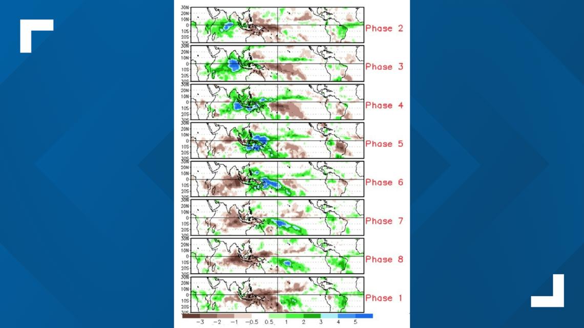
The final reason has to do with the unfavourability of development of what's known as the Madden-Julian Oscillation. This is where areas of the world alternate between moist air and drier air. The more frequent their movement, the stronger the oscillation and the better chance of lowered wind shear and favorable tropical development in the Atlantic basin.

While the chances for tropical development over the next two weeks are low, it's important to remember that it only takes one major storm locally to cause a major impact.
Stick with the KVUE Weather Impact team for all of the latest tropical updates.