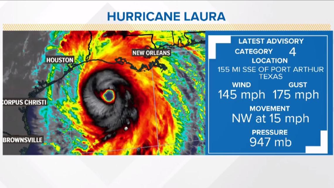
HOUSTON — The KHOU 11 weather team and National Hurricane Center are keeping a close eye on Hurricane Laura, which became a Category 4 storm on Wednesday afternoon.
The hurricane could keep its Category 4 status at the time of landfall, which is expected late Wednesday night into early Thursday morning near the Texas-Louisiana border. There is a chance the hurricane could drop back to a Category 3 just before landfall, but either way this will be an "extremely dangerous" hurricane, warns the National Hurricane Center.
We will continually update this page with the latest tracking information. Here are the latest images using guidance from the National Hurricane Center:
4 p.m. update | Aug. 26, 2020
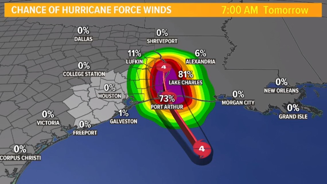
Hurricane Laura cone / track

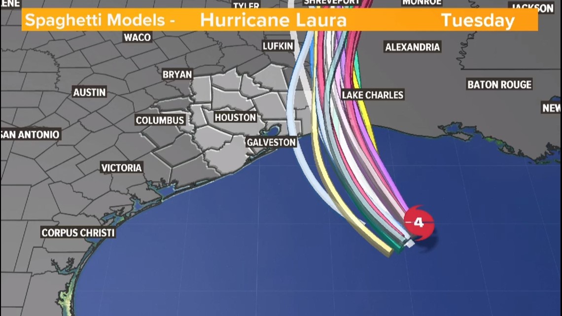
Laura spaghetti models

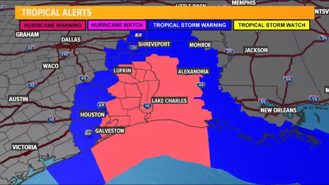
Tropical Storm Watches and Hurricane Watches

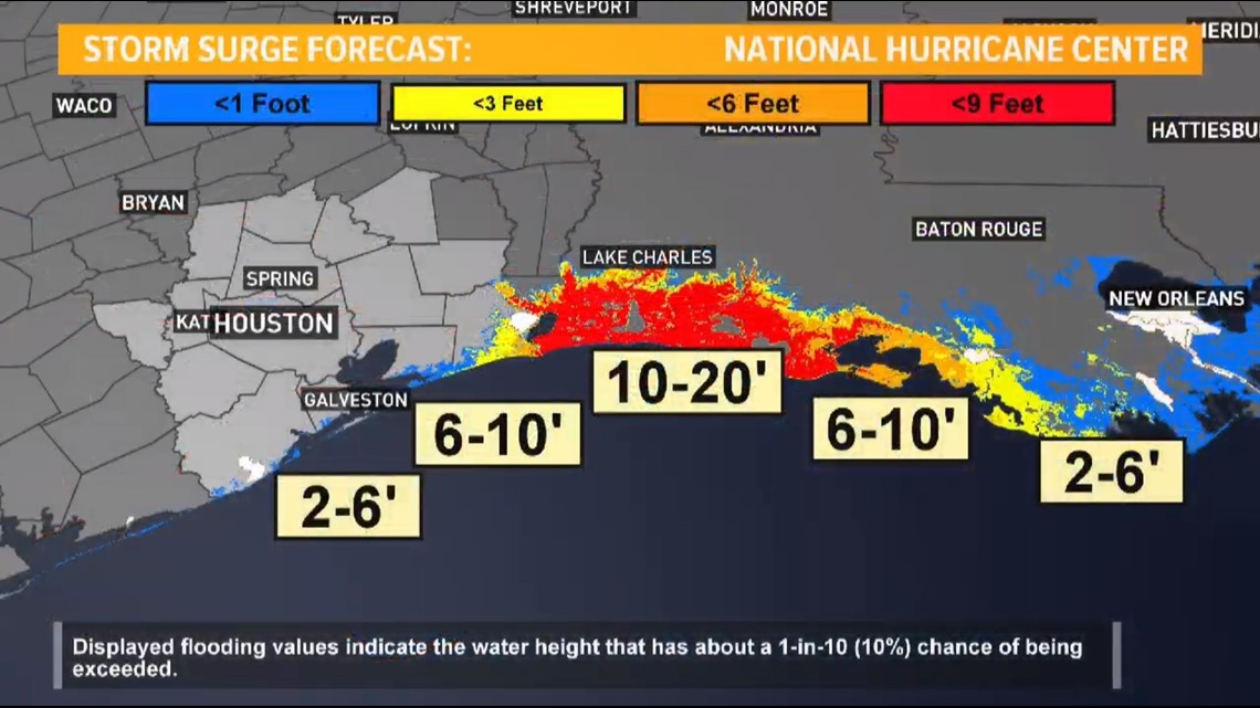
Storm surge forecast

Hurricane Laura stats

