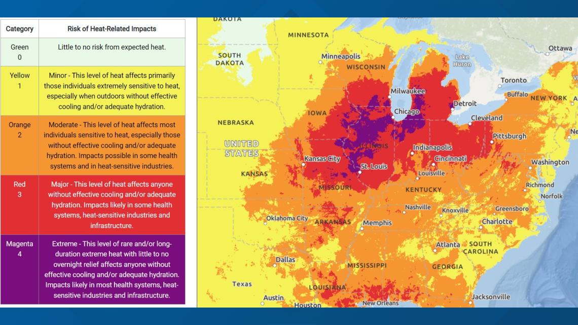
AUSTIN, Texas — The Midwest is in the middle of a heat wave that the National Weather Service (NWS) is labeling "extreme" due to high heat indices during the day and consistent heat overnight.
In its Excessive Heat Warning message on Tuesday, the NWS's Chicago office said "the magnitude of anticipated heat, combined with oppressive warmth at night will lead to hazardous conditions, particularly for the elderly and those with pre-existing health conditions."


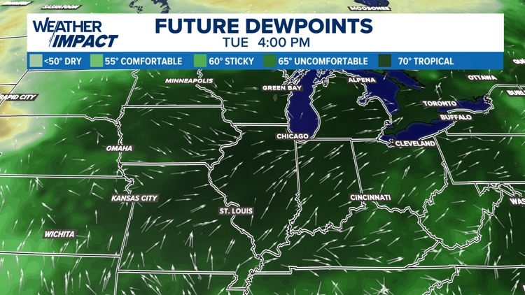
The mix of heat and humidity will put "feels like" temperatures between 110 to 115 degrees on Tuesday. While Austinites may be used to this kind of heat, Midwesterners certainly are not.
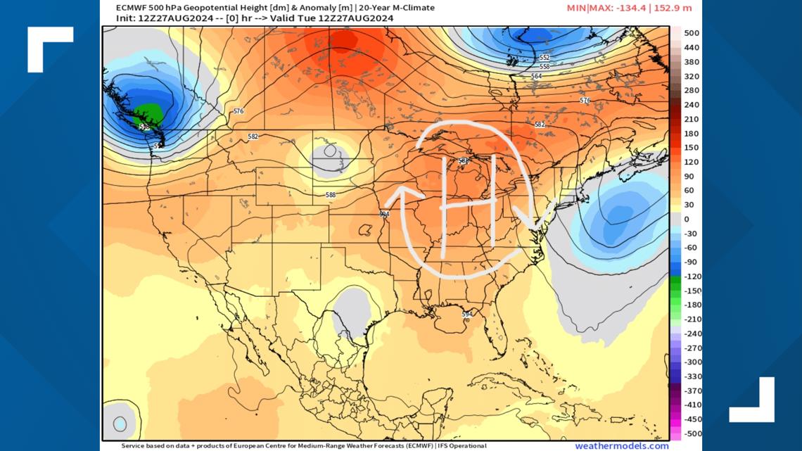
The reason for this oppressive humidity is actually due to a phenomenon that is unique to the Midwest. Strong high pressure – the same "heat dome" that can bring Texas waves of oppressive heat – has situated itself over the Midwest for the start of the workweek.


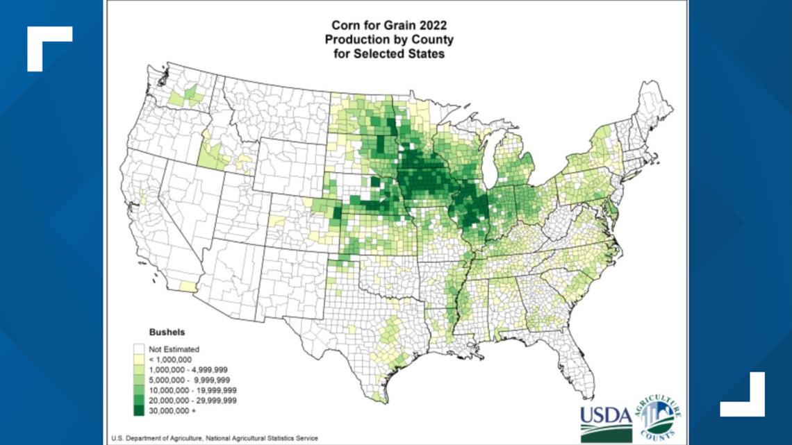
In a regular meteorological situation, this would just mean that hot, above-average temperatures were expected. But because the U.S. Corn Belt is also situated across the Midwest, the evapotranspiration of the crops – or, in layman's terms, the "corn sweat" – increases the moisture in the atmosphere, creating exceptionally hot and humid conditions outside.


This phenomenon has been well documented for years, and it is said that 1 acre of mature corn can add 3,000 to 4,000 gallons of water to the atmosphere on a hot day.
Because of this, Tuesday afternoon in the Midwest will feel quite tropical. Those unaccustomed to the high heat and humidity should take it easy.


The Midwest is forecast to see major heat impacts through Friday of this week.


