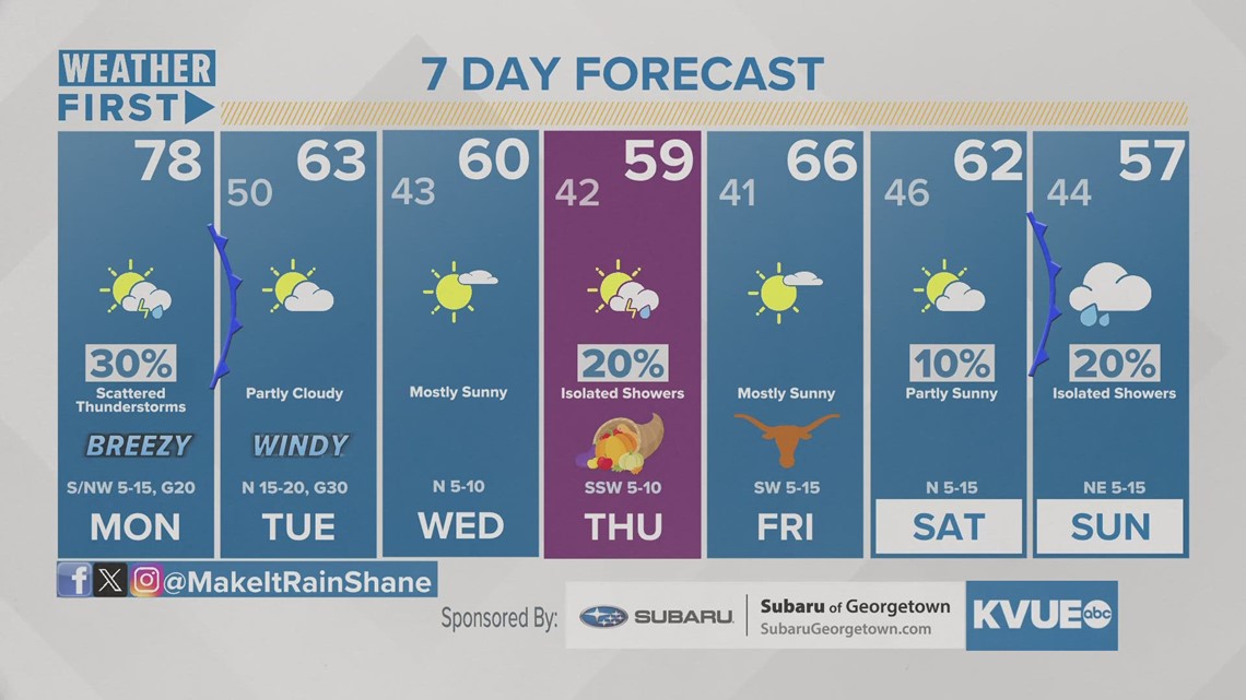
AUSTIN, Texas — We had a gloomy and dreary weekend, with one more round of rain expected for Monday before a dry stretch for the midweek.
We'll gradually warm up as we head into Monday before dropping into the 60s again for Tuesday. We should slightly warm up for Thanksgiving afternoon, with highs preliminarily in the upper 50s.
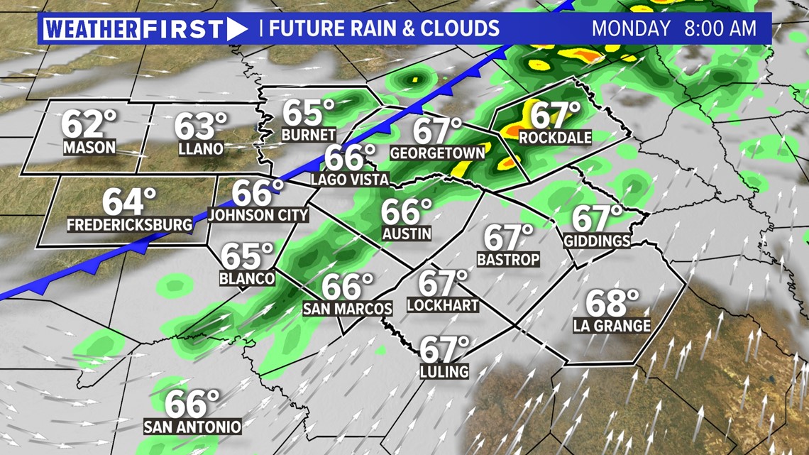
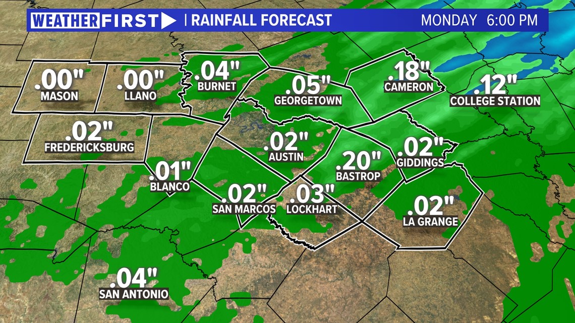
The main focus with this second cold front is the added moisture associated with it. This front will provide a lifting mechanism that will allow a few isolated to widely scattered showers for Monday, especially in the morning hours.

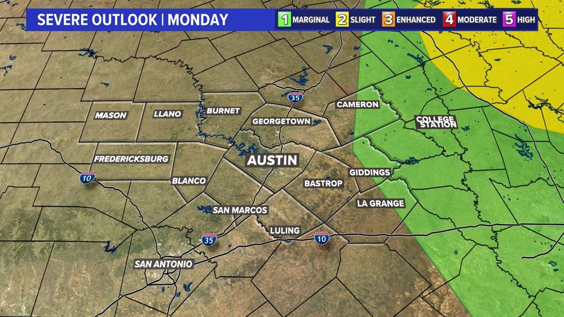
It is even possible that these storms in the Coastal Plains to be a bit on the stronger side. In fact, portions of Milam, Lee and Fayette counties are in the "marginal" – 1 out of 5 – risk for severe weather. Strong winds are the main threat with these storms, with no real risk for hail.

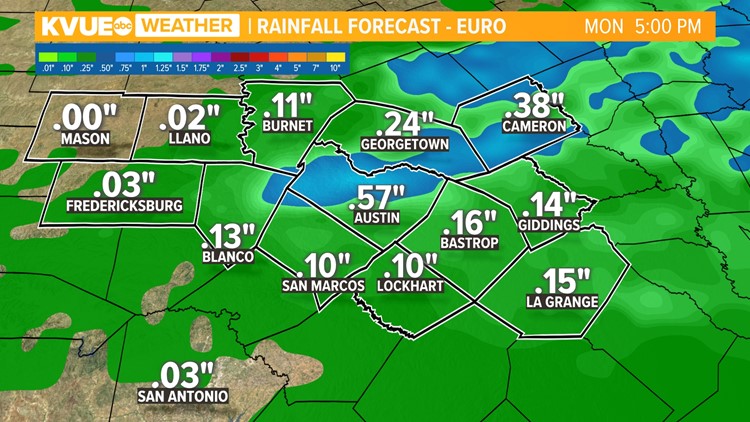
As far as rainfall amounts are concerned, we could have a widespread half-inch to an inch across Central Texas, with pockets of an inch-and-a-half plus possible, especially in the Coastal Plains, where there's more "access" to Gulf moisture. However, the latest trends point to slightly lesser totals, which would be a huge disappointment given our current drought.

However, as we head into Thanksgiving, models are pointing to an upper-level disturbance coming in from the southwest. This system has the potential to bring some more good rain to Central Texas, which would mainly fall on the actual holiday. It's good to have an indoor plan for your traditional dinner and football watching.

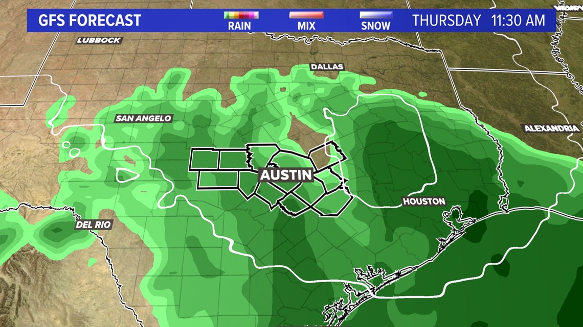
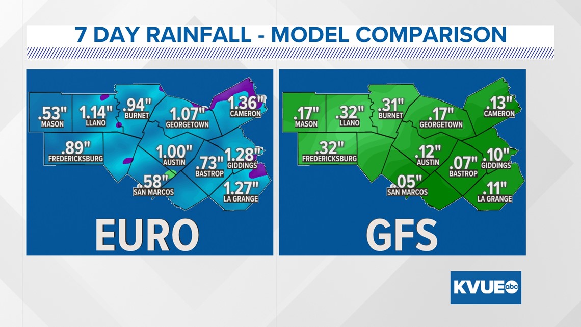
As far as rainfall amounts are concerned with this system, models have not necessarily been in agreement, but we could have around an inch of rain in spots. This will need to be hashed out as we get closer to Thanksgiving.

Stick with KVUE all weekend long as we continue to be "Weather First" as this system makes its way through Central Texas and as we get you ready for the Thanksgiving holiday.
In the meantime, your 7-day forecast is below.

