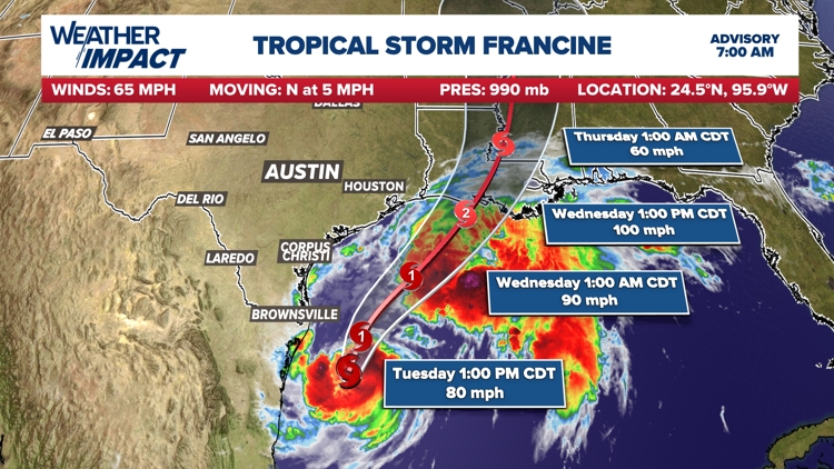
AUSTIN, Texas — Tropical Storm Francine continues to churn through the Gulf of Mexico and is now expected to become a hurricane by midday Tuesday.
While the latest forecast cone does not include any part of Texas, we could still see minimal impacts along the Texas coastline.


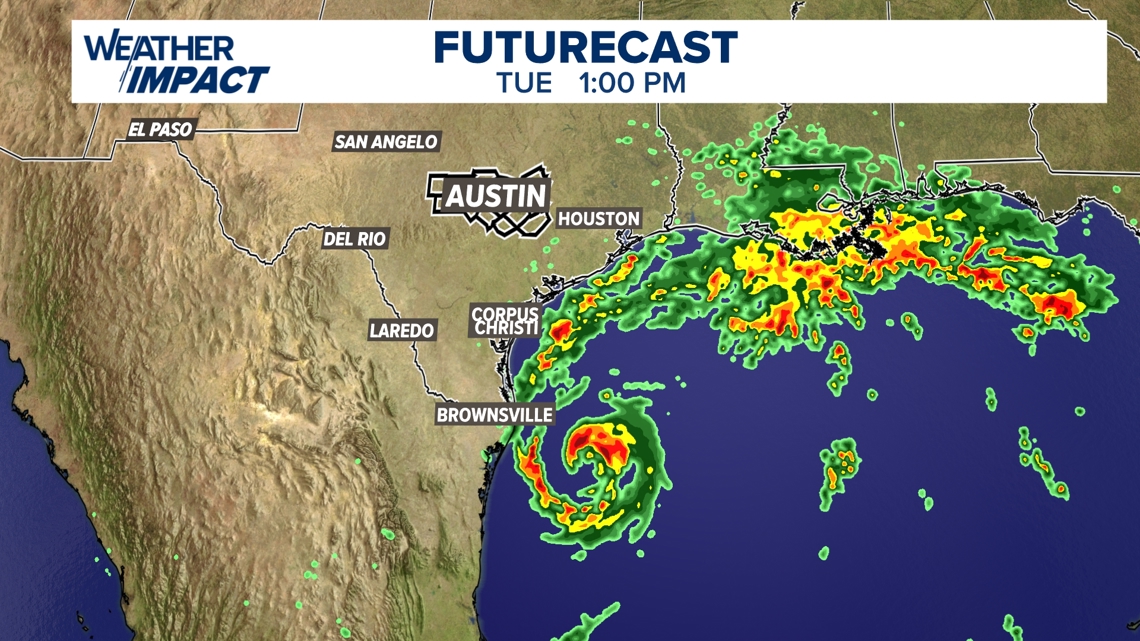
Tropical rain has already fallen in parts of South Texas as of early Tuesday morning. Rainfall projections range from a trace of rain up to 2 inches for Texas. Storm surge up to 3 feet will be possible. Locally in Central Texas, our forecast calls for isolated rain chances, mostly east of I-35, late Tuesday through Wednesday.

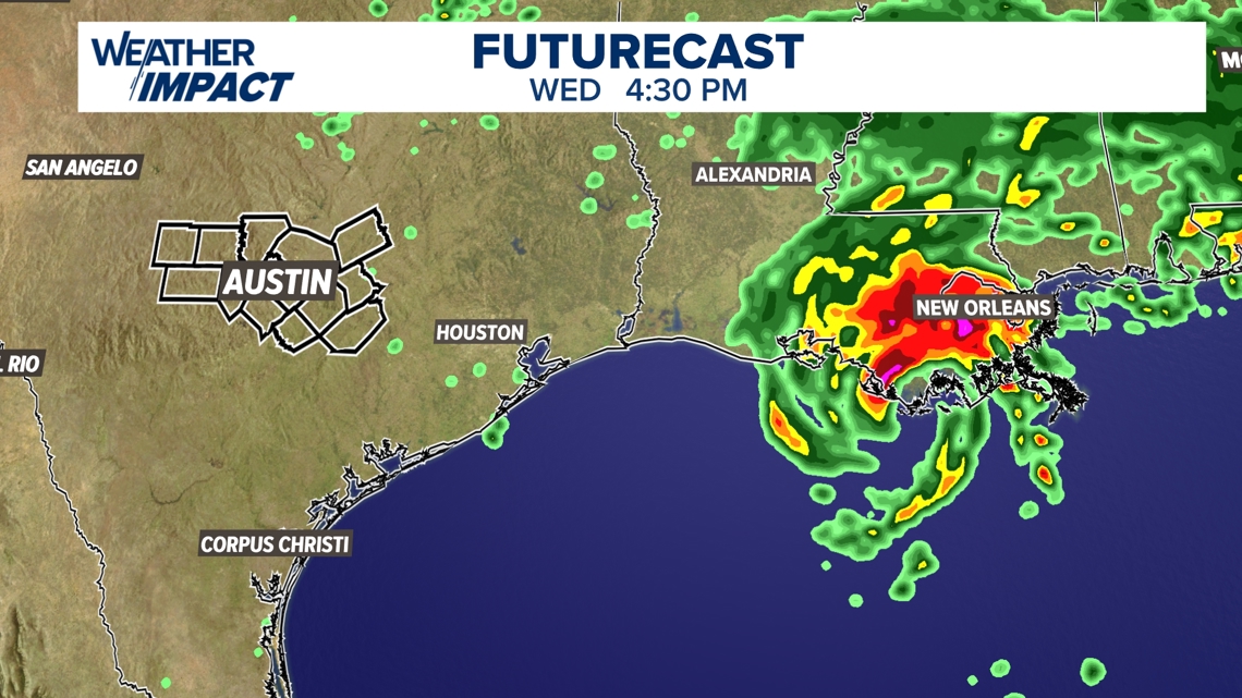
A majority of the impacts will be felt in Louisiana where a Hurricane Warning is currently in effect. The most recent forecast from the National Hurricane Center calls for storm surge up to 10 feet along the Louisiana coastline and rainfall up to 8 inches.

Stick with the KVUE Weather Impact Team for all the latest on this developing system.
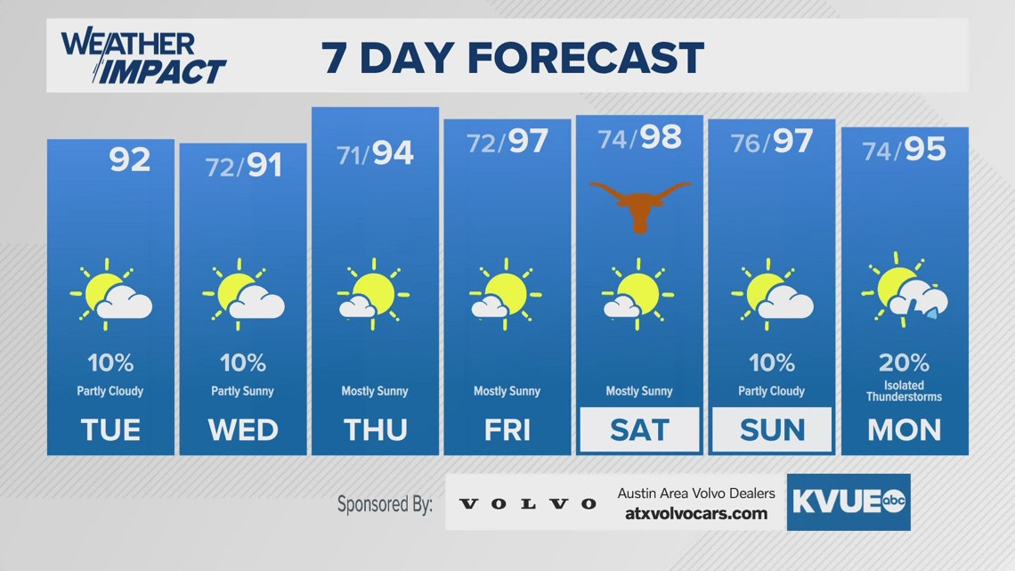
In the meantime, your seven-day outlook is below.