AUSTIN, Texas — This weekend has been a great one to spend indoors on the couch, snuggled up with your boo! We've already been chilly this week in Central Texas, but while we have trended colder for this past weekend, we haven't been as chilly Sunday.
A strong cold front has pushed through Central Texas. We expect to remain chilly with a cold rain for Sunday night after Saturday saw a light wintry mix in the Hill Country that did not result in accumulation.
Here's the play by play on the timing.
Timeline: Cold rain resumes Sunday evening
With the cold air already in place, a coastal low-pressure system develops over the Gulf, and we have all the ingredients for a cold and rainy day.
We'll remain chilly through the early evening hours of Sunday, but any shower activity looks to be scattered at best.

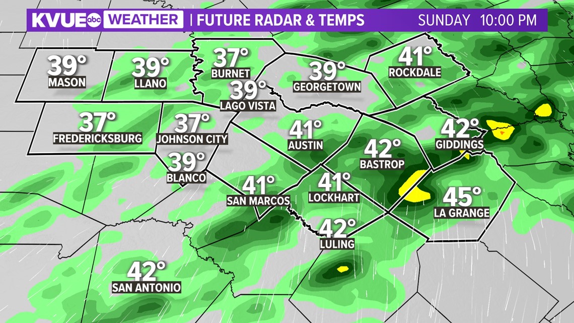
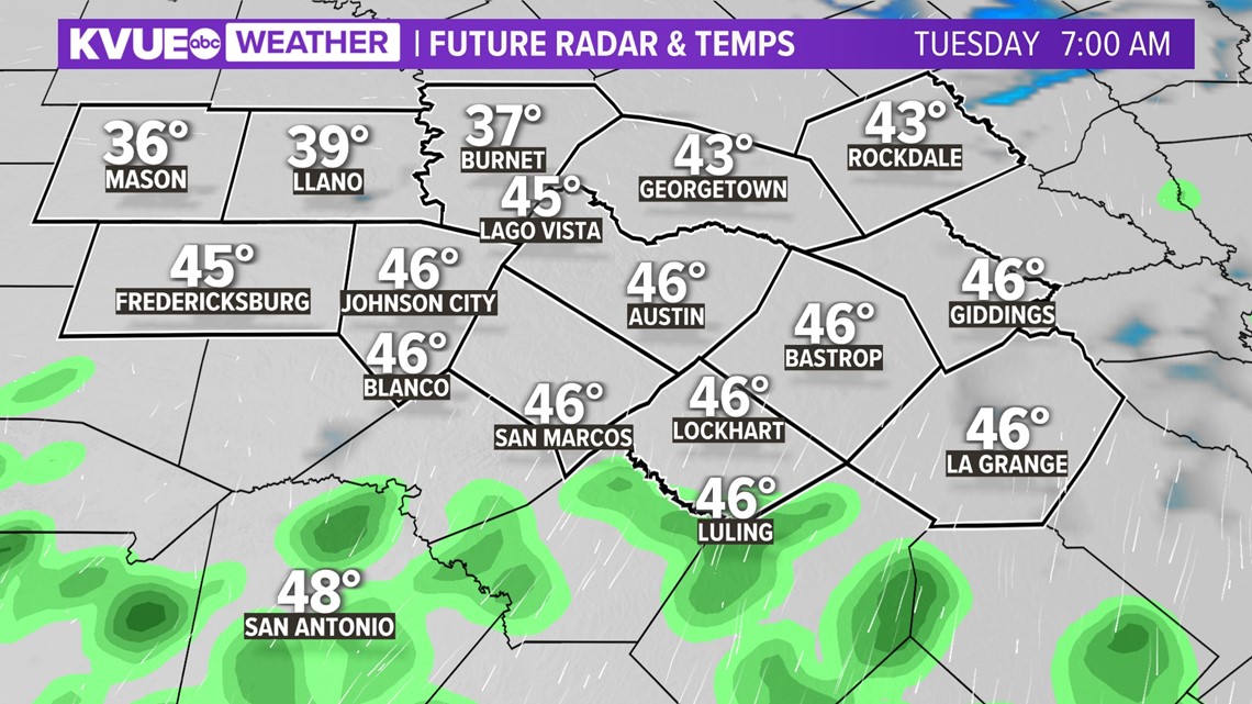
However, another plume of moisture arrives overnight Sunday night and could bring in more widespread rain to affect your Monday morning commute. Make sure you are slowing down and using those low-beam headlights!

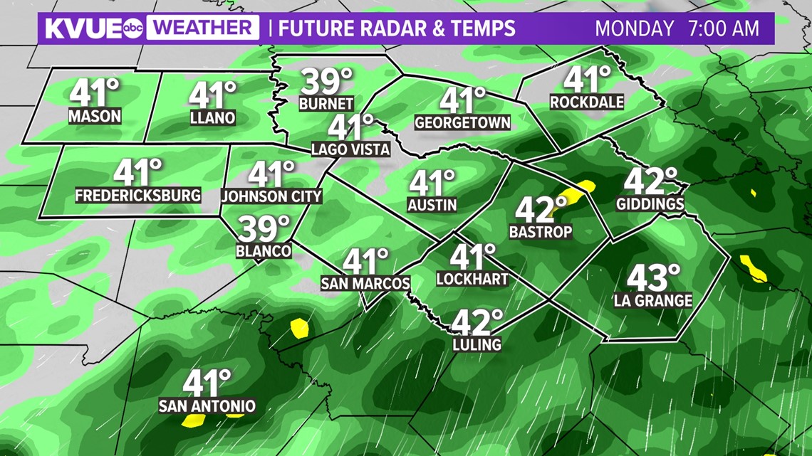
With a majority of the rain arriving Monday morning, the atmosphere will be overworked with all of the moisture, so we should see those rain chances taper off into some scattered showers as the atmosphere begins to go into recovery mode.

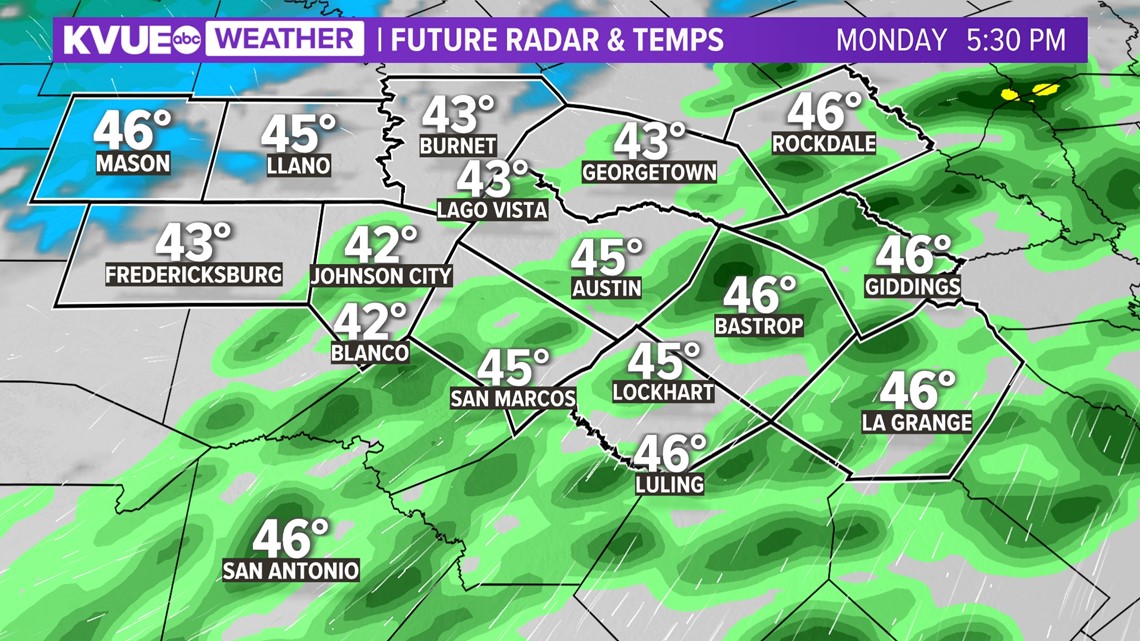
With that, the area of low pressure shifts off to our east later Monday night and we expect to mostly dry out later in the evening.

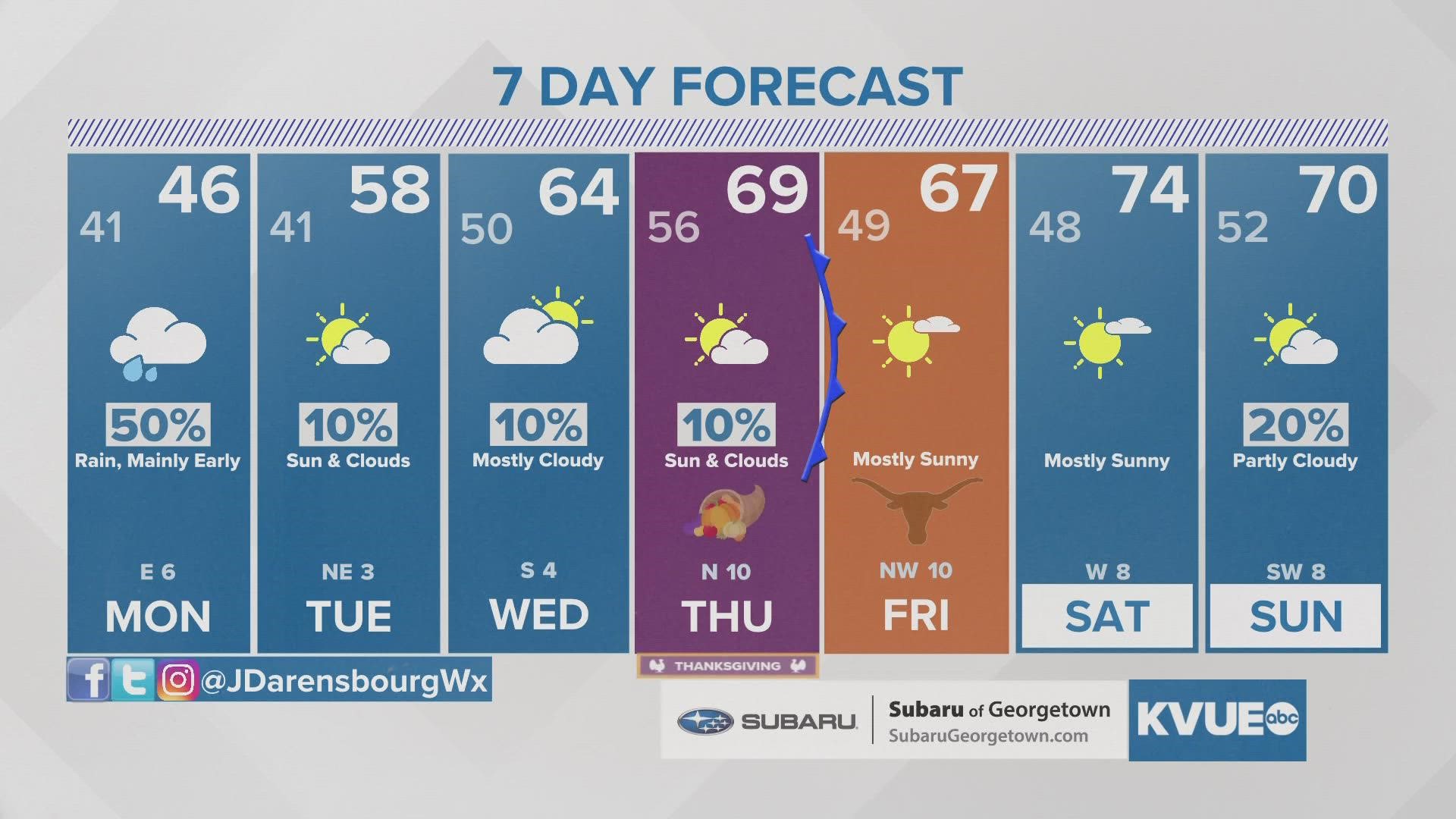
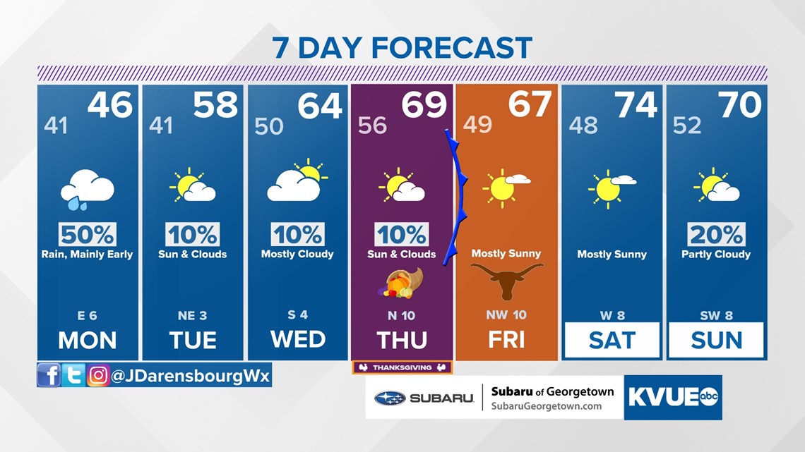
After that, it's possible that we'll have a warming trend for Thanksgiving (finally). We'll have more in the coming days.
Stick with the KVUE Storm Team for the latest on this developing forecast.
In the meantime, your seven-day forecast is below:

PEOPLE ARE ALSO READING:

