AUSTIN, Texas — After experiencing dry conditions for a majority of September, Mother Nature brought plenty of rain to Central Texas on Tuesday night.

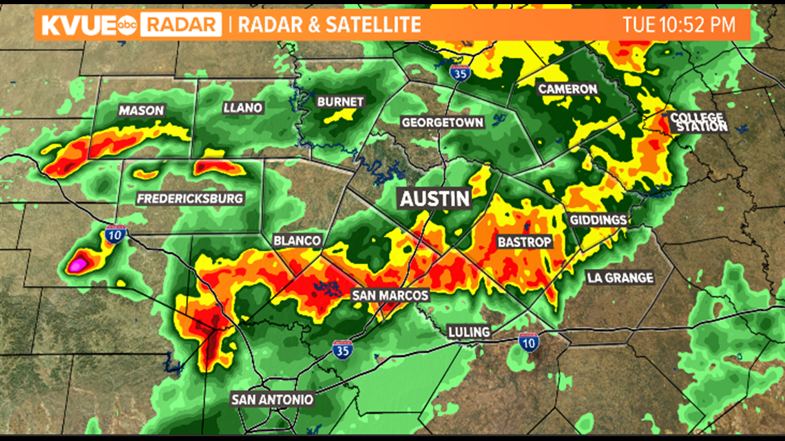
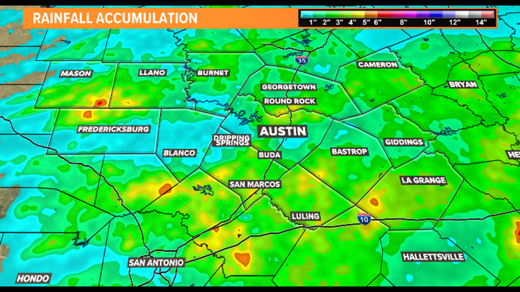
A series of storms created from an upper-level disturbance created hours of much-needed rainfall throughout the region. While the rain was widespread, some isolated downpours created larger rain totals across the KVUE viewing area. The National Weather Service collected rain gauge data from across Central Texas and released a report on Wednesday morning sharing the findings. The highest total of rainfall within the KVUE viewing area was near Dripping Springs with 5.85 inches of measured rain.

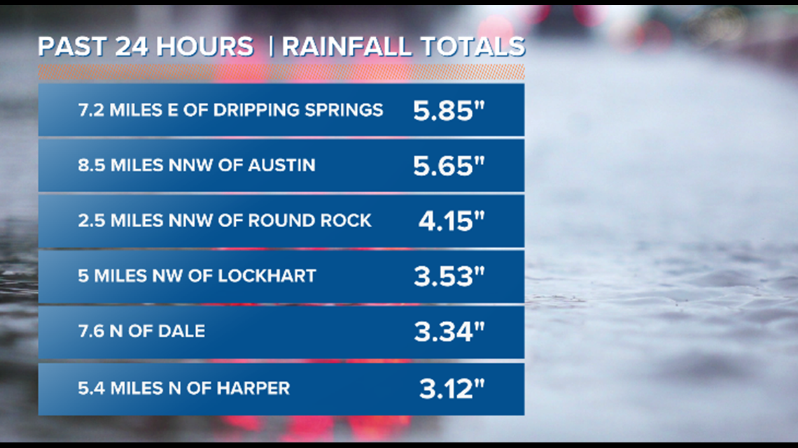
Rainfall totals for Camp Mabry and Austin-Bergstrom International Airport were more modest, with totals of 1.62 inches and 0.60 inches, respectively.
Here are a few additional rain gauge readings from across Central Texas:
- 3.1 miles west-southwest of San Marcos: 5.81 inches
- 5.1 miles west-northwest of Wimberley: 5.30 inches
- 6.3 miles south of Bee Cave: 3.93 inches
- 6.6 miles southeast of Smithville: 3.00 inches
- 11.6 miles south of Llano: 2.76 inches
- 0.8 miles west-northwest of Hutto: 2.70 inches
- 7.7 miles north-northwest of Schulenburg: 2.58 inches
- 5.6 miles east-southeast of Cedar Creek: 2.45 inches
- 2.5 miles north-northeast of Pflugerville: 2.45 inches
- 5.7 miles south-southwest of Bastrop: 2.31 inches
- 4.5 miles south-southeast of Georgetown: 2.19 inches
- 6.9 miles northwest of Luling: 2.12 inches
- Dime Box: 1.89 inches
- 2.9 miles north-northeast of Spicewood: 1.01 inches
- 12.4 miles northeast of Fredericksburg: 0.89 inches
Tuesday's storms weren't the only chances for rain in the forecast for this week. A second upper-level disturbance is expected to bring another few rounds of rain for the end of the workweek and through the weekend.

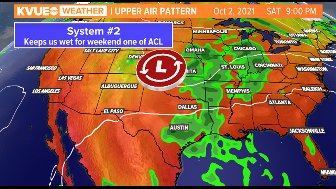
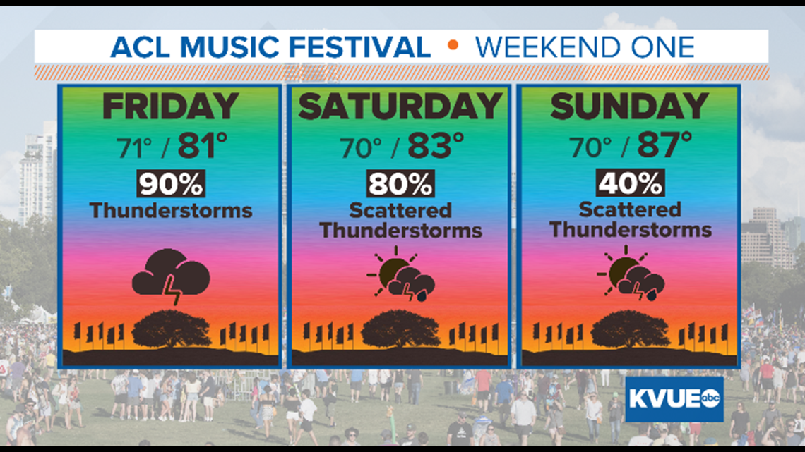
What does this mean for the first weekend of the ACL Music Festival? Unfortunately, it's looking like festival attendees will need to bring their ponchos and boots due to widespread showers expected on Friday and Saturday. Rain chances slightly lower for Sunday, but an incoming cold front still keeps scattered showers in the forecast.

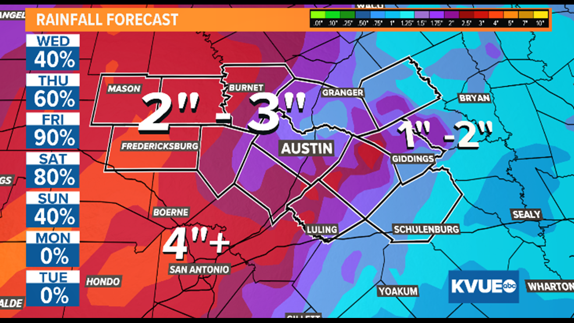
Saturated grounds from previous rounds of rain could create localized flooding concerns toward the end of the workweek and weekend. The most recent rainfall projections forecast the possibility of an additional 1 to 4 inches over the next seven days. Some isolated areas that are caught under heavier downpours could see up to 6 inches of rain.

The KVUE Storm Team will continue to keep a close eye on the forecast and provide updates on air and online.


