AUSTIN, Texas — For the first time in a long time, we have actual elevated chances for beneficial rainfall. Not only that: there are even possibilities for minor flooding in spots over the course of the remainder of the week.
Let's take a day-by-day look at how much rain we could receive, as well as the timing of the heaviest rainfall.
Saturday
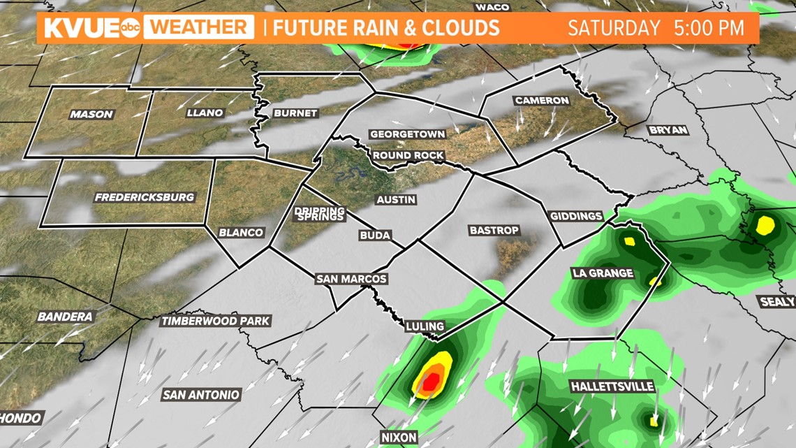
Scattered showers and storms remain in the forecast through at least the first half of Saturday. Rain chances decrease throughout the afternoon and evening, Drier conditions for the Texas and Texas State football games are expected.

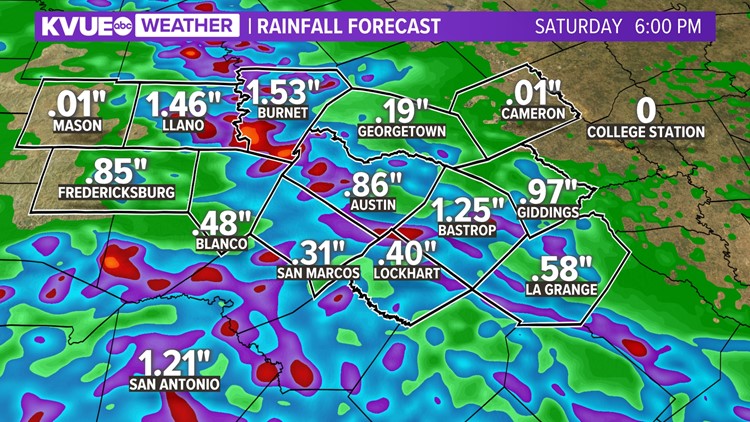
Rainfall Amounts
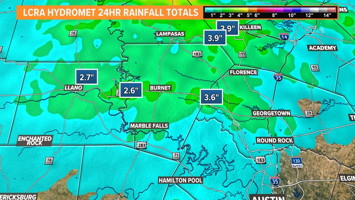
Estimated rainfall amounts from this mornings big storm reaches over 3" in spots. Storm spotter reports also have ranged from 3-5" rainfall rates. Official amounts will not be finalized for a couple days.

Rainfall is now letting up for the majority of the area, but still possible for the east side of Austin Saturday, here's our latest high resolution prediction.

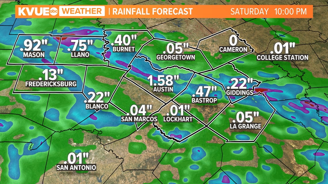
Summary
For the first time in a long time, we're expecting truly beneficial rainfall for all of the KVUE viewing area, which will come in rounds, so we do not expect any point between Wednesday and Saturday afternoon to be a washout. Those who receive the heaviest rainfall may have a minor flash flood risk, but this would mainly be along creeks and streams.
If the Hill Country receives the heaviest rainfall through this period, it's likely that, depending on runoff, we'll have some improvement in our Highland Lakes' levels, especially Lake Travis and Lake Buchanan.
Stick with KVUE for the latest on this developing forecast.
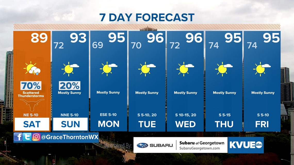
In the meantime, your 7-day forecast is below.