AUSTIN, Texas — Strong to severe storms produced hail and strong winds across Central Texas Wednesday evening. Wind gust reports were as high as 59 miles per hour in Fredericksburg. There was even a tornado-warned storm in Llano County, but it did not produce any reports of damage.
The widespread rain Wednesday evening brought the coolest temperatures we have seen in about a week. This cooler air should help limit the severe weather potential through Thursday morning, but additional storms will still continue.

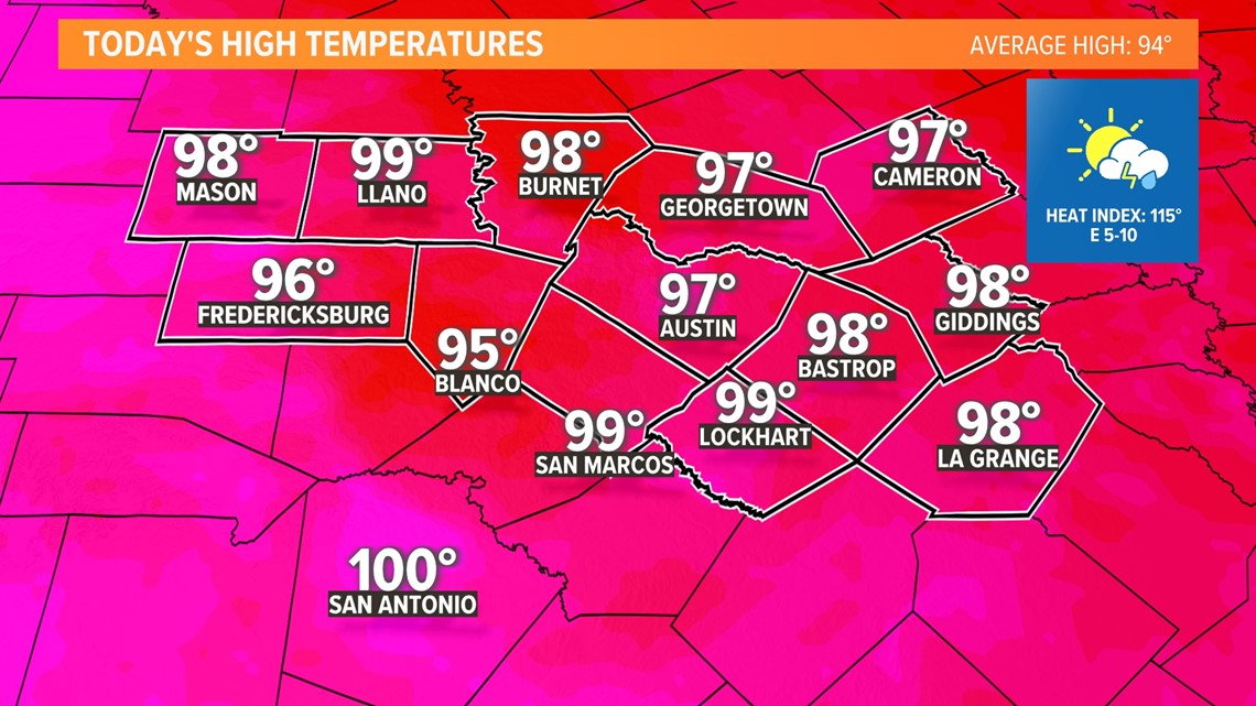
Thursday will still be hot, but not quite as hot as previous days this week. We expect an afternoon high near 97 in Austin, but the heat index could still be as high as 115.
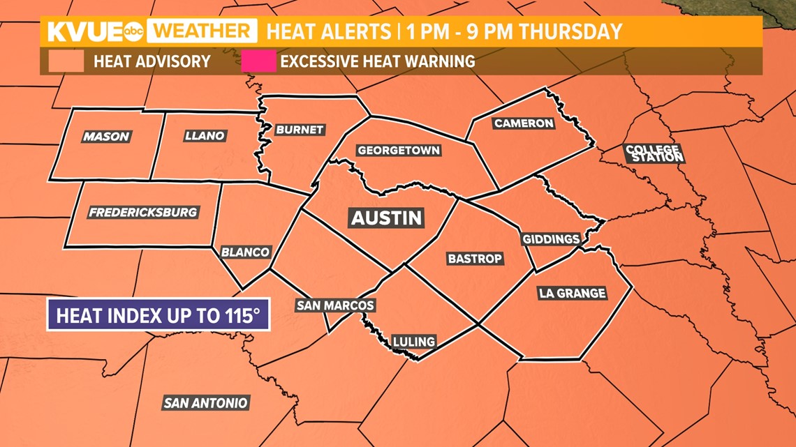
A Heat Advisory has been issued for Thursday from 1 p.m. to 9 p.m.

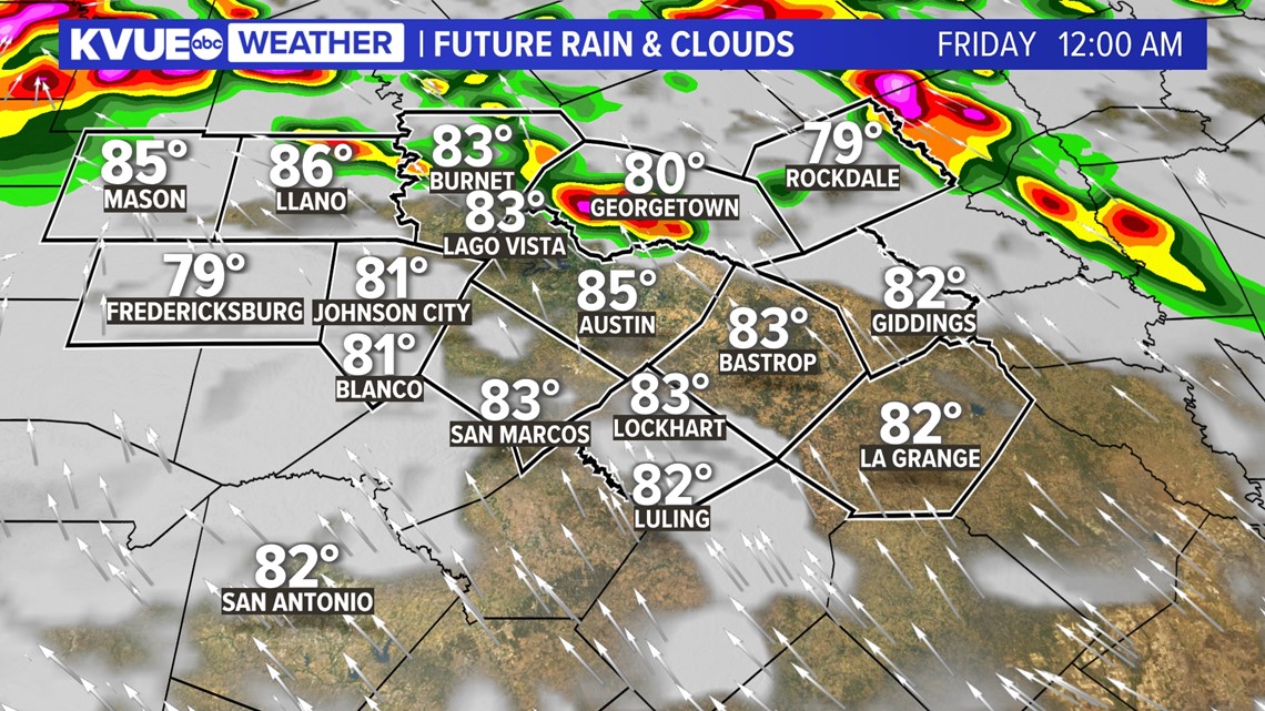
The heat ridge continues to shift to our southwest, providing another opportunity for storms during the evening hours of Thursday. Some of these storms could be severe if they develop, but this part of our forecast is still fairly uncertain.

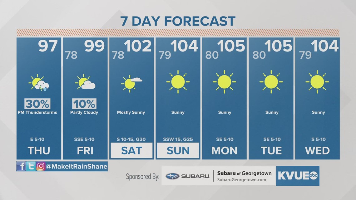
After a final storm chance on Friday, the heat dome strengthens and moves directly over Central Texas this weekend into early next week. This will ramp up the temperatures once again. We expect highs near 106 for Monday through Wednesday of next week.
The KVUE Weather Team will continue to closely monitor this developing forecast.
In the meantime, your 7-day forecast is below.

