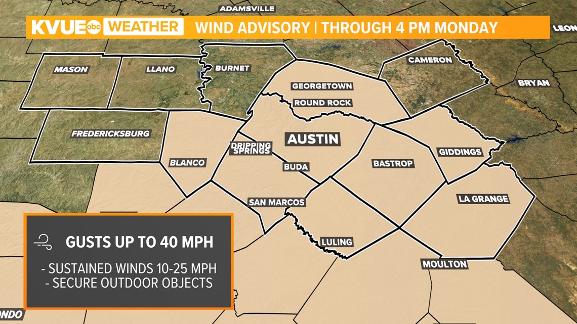
AUSTIN, Texas — *A Wind Advisory is in effect for Bastrop, Blanco, Caldwell, Hays, Fayette, Lee, Travis, and Williamson counties until 4 p.m. Monday. Gusts up to 40 mph will be possible along with sustained winds up to 25 mph. Secure any loose objects in your yard!
We skipped fall and jumped right into winter on Sunday and the bitter cold is still biting on Monday.
Temperatures will range from the upper 30s to low 40s on Monday morning. A strong wind will push "feels like" temperatures into the 20s for some spots, and they will likely hover right around freezing for much of the day. A Wind Advisory will be in effect for most of Central Texas through Monday afternoon.

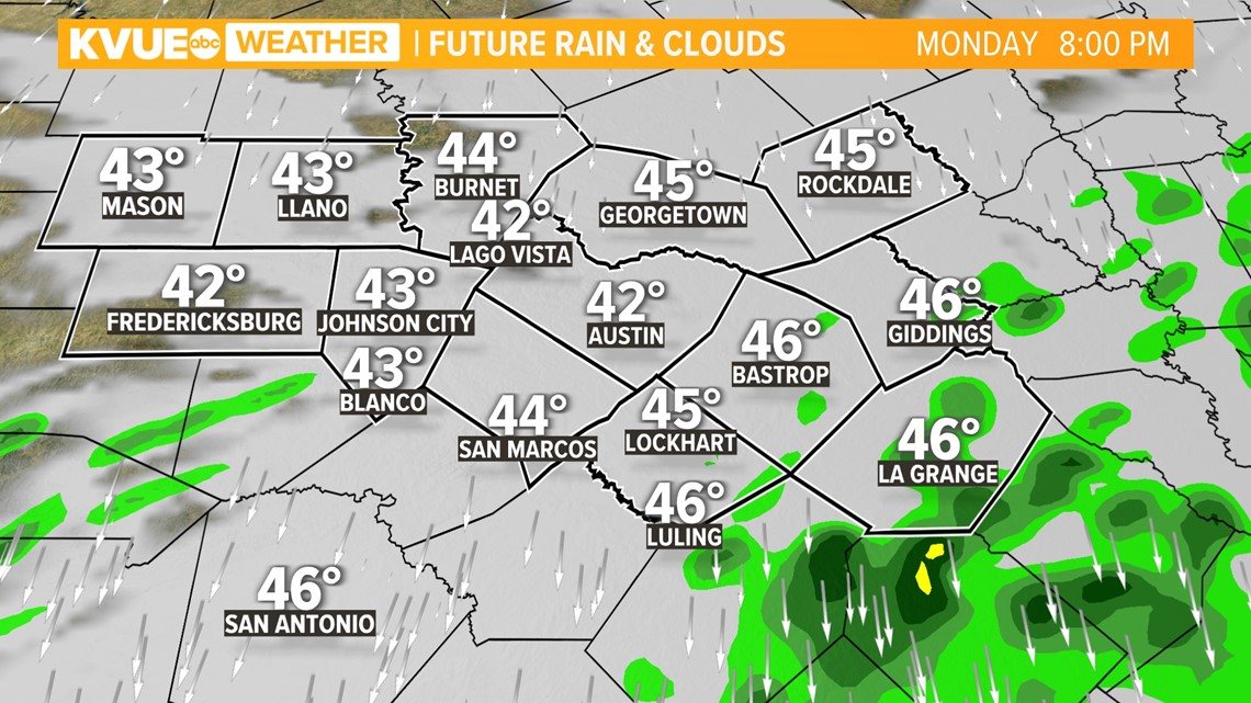
It won't just be cold and windy – we expect a widespread cold rain through Monday morning and mid-afternoon. This is a weather pattern that we call "overrunning," as moisture brings a chilly rain in the wake of the strong cold front.
Rain will be widespread prior to noon, and then will end gradually from west to east during the evening and overnight hours. We expect additional rainfall totals of a half-inch to 2 inches, which could cause a flooding concern over the already saturated ground.

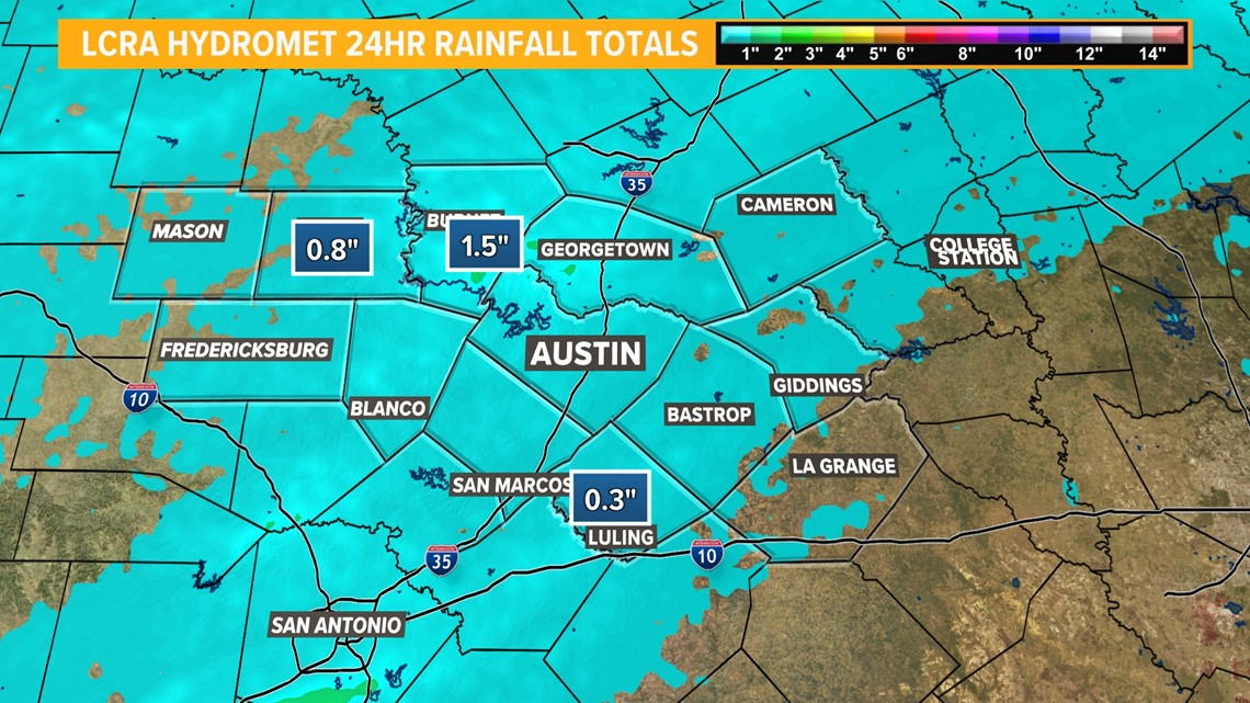
Conditions will be mostly dry by the evening, gradually drying out after a few extra downpours late tonight. Rainfall totals over the last 24 hours have match projections, with about an inch or more in the wettest places.

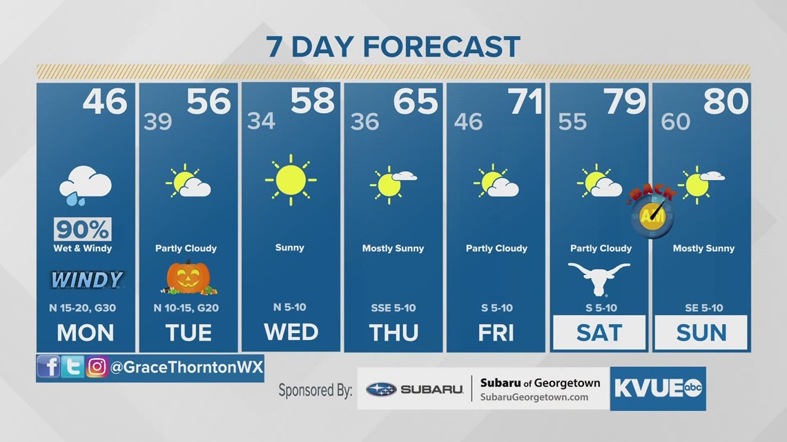
All of the rain will be gone by Halloween, so it will be a dry but chilly evening for trick-or-treaters, with temperatures during the evening in the low to mid-50s with a breezy north wind.

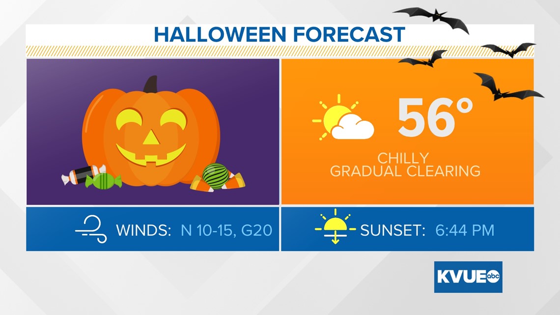
By the middle of next week, parts of the Hill Country and even the Interstate 35 corridor could experience the first freeze of the season, as lows there could get down to the mid-30s and possibly even lower 30s at times. We'll have more on that over the next few days.
The KVUE Storm Team will continue to monitor this developing forecast.
In the meantime, here is a look at your extended forecast:

