AUSTIN, Texas — It was a wet end to the weekend as widespread showers and storms moved across Central Texas on Sunday. Here's a breakdown of the rainfall totals across the area over the past 24 hours.
Almost all of Central Texas received some amount of rain, even if it was just a trace of several inches in certain areas. The largest rainfall totals were generally recorded along the Interstate 35 corridor, especially in Williamson County.
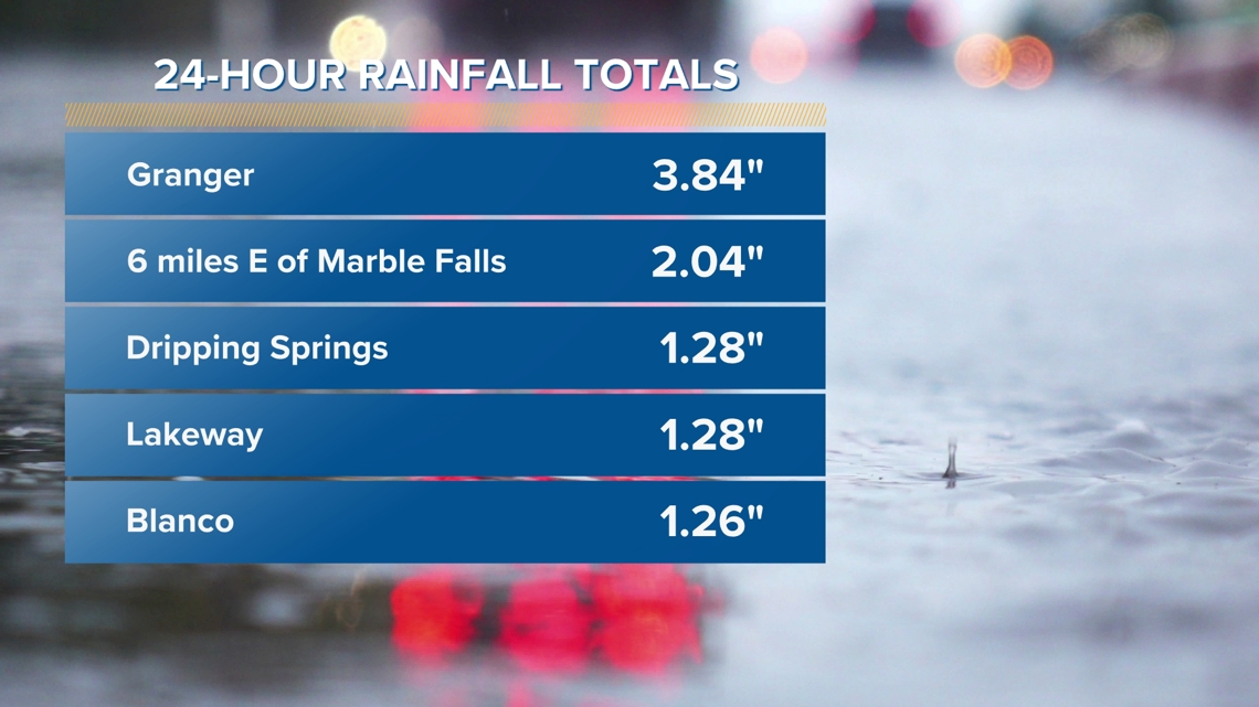
An official Lower Colorado River Authority (LCRA) rain gauge recorded a total of 3.84 inches in Granger. Camp Mabry received less robust rain with a total of 0.75 of an inch Sunday.


We are still currently trending ahead of our normal rainfall totals at that climate site, with a total of 11.88 inches so far this year compared to the average 9.62 inches. Below is a look at some other notable rainfall totals across the area:


Did this rain fall where it needed to in order to help our Highland Lakes system? The answer is technically yes, but just barely.
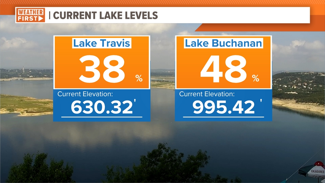
Lake Travis is still at 38% capacity and Lake Buchanan is still at 48% capacity, but both lakes did experience a minor increase in overall height. Lake Travis increased by 1.08 inches and Lake Buchanan increased by 2.16 inches.


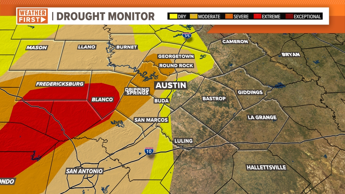
This past weekend's rain will be reflected on the upcoming drought monitor, which is set to be released Thursday. As a reminder, here is a look at the most recent drought monitor for Central Texas:


Thankfully, daily scattered rain chances are in the forecast Wednesday through the weekend. The KVUE Weather Team will continue to monitor the rain chances over the coming days and provide updates on air and online.


