AUSTIN, Texas — It has been a dry summer in Central Texas, with triple-digit highs becoming pretty routine, as well as heightened fire danger that comes with the lack of rain.
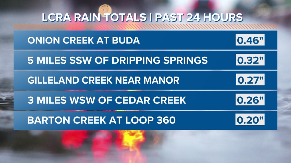
However, last Tuesday afternoon changed that narrative, if only for a moment. Outerbanding from what was then Tropical Storm Harold produced rain showers that were generally south of Austin and on into portions of Hays, Caldwell and Fayette counties.


The rain on Tuesday was not factored into the latest drought monitor, but even if it was it would not have made a big difference. All of the KVUE area is now experiencing either "extreme" or "exceptional" drought. This is the first "exceptional" drought for Austin since Aug. 23, 2022.
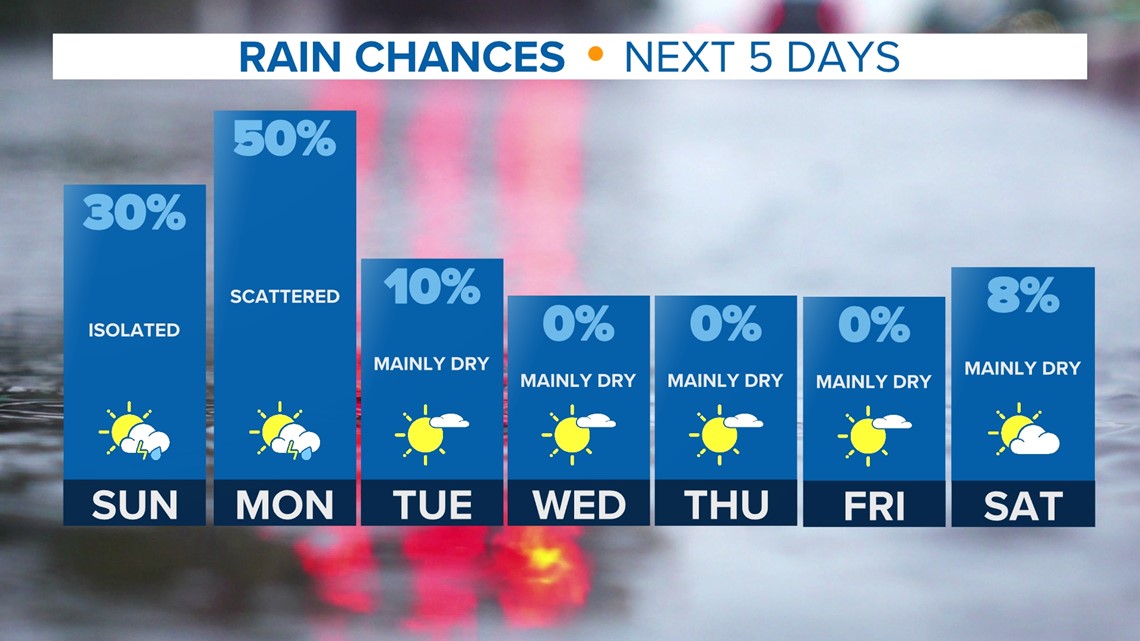
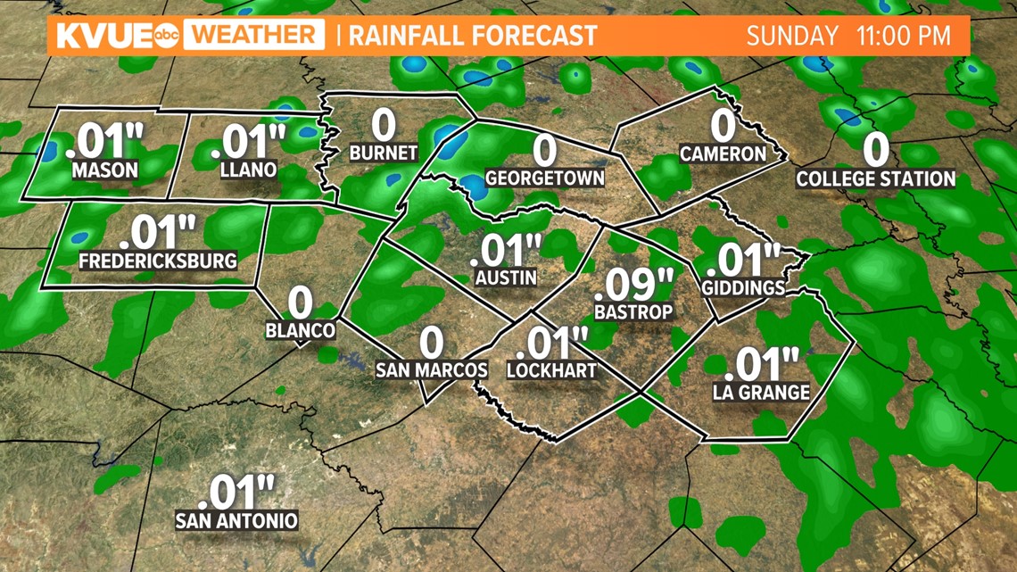
We have more opportunities for rain in the next 24-48 hours. Model data indicates a weak frontal system arriving in Central Texas on Sunday and Monday, and this could bring us more promising rain chances.


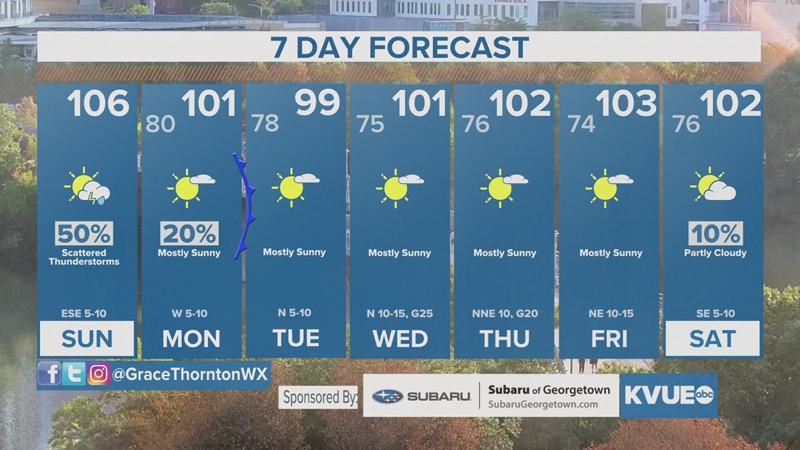
Behind this "cool front," we still have 100 degrees in the forecast for Austin on Tuesday and Wednesday of next week. However, if we're lucky, rain chances will trend higher and some area could be able to drop into the 90s.
Rainfall totals are fairly tame, with most neighborhoods only seeing a 10th to quarter-inch of rain.


We will be tracking these developments throughout the rest of the week and into the weekend, so stick with KVUE for the latest on this developing forecast! Let's hope for the totals to trend higher so we can alleviate this drought.
In the meantime, your seven-day outlook is below.


