The status of drought conditions continue to deteriorate throughout portions of Central Texas.
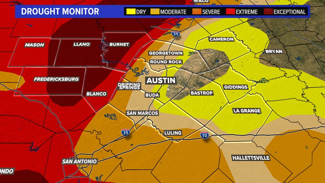
A new drought monitor is released each Thursday and the one from this week indicates larger patches of "exceptional" drought west of Interstate 35. This is the highest level of drought on the monitor scale.


A significant rain event earlier in the week brought hopes that conditions would improve the current drought status but, unfortunately, the heaviest rainfall totals did not align with the driest areas.
The I-35 corridor, including the Austin metro area, continues to experience varying levels of drought from "dry" to "severe" with driest conditions to the west.
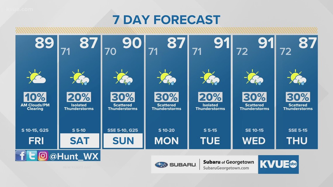
We will be monitoring elevated rain chances throughout the weekend and into the beginning of the next workweek. Unfortunately, current rainfall projections only call for totals of less than an inch.


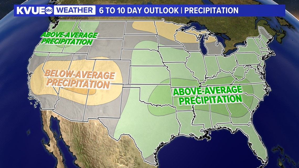
The extended 6- to 10-day precipitation outlook indicates the possibility of above-average Precipitation Outlook.
Here is a look at your extended forecast:


PEOPLE ARE ALSO READING:


