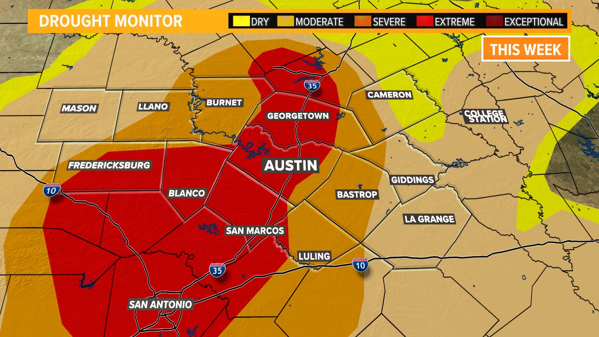
AUSTIN, Texas — It's Thursday, and that means a new drought monitor has been released.
Or should we say, new-ish?
This is because most drought metrics remained the same throughout the state, with only a half of a percent increase in the "extreme" drought category and a decrease in the "exceptional" drought of three-quarters of a percent.
Additionally, "moderate" and "severe" drought remained the same.
But the biggest changes came from areas in "abnormally dry" conditions and those without a drought designation. The "abnormally dry" category decreased by around 2% and the area not in a drought increased by roughly that same percentage.
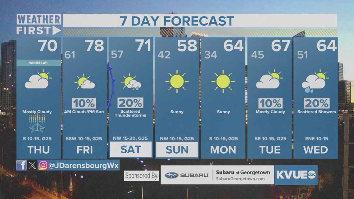
We have barely any rain chances in the next seven days, but the better chances looks to be east of Interstate 35 for Saturday as a result of a stout Arctic front, which could allow for a good chance of storms in portions of the Coastal Plains. For some of those, though likely east of the KVUE area, we could have one or two storms that will produce strong winds and maybe some hail.
A "marginal," level 1 out of 5, risk for severe weather is possible for those areas, with a 2 out of 5 "slight" risk possible for the Piney Woods of East Texas, on through Louisiana into Central Mississippi.
Stick with KVUE for the latest on your forecast.
In the meantime, your 7-day forecast is below.


