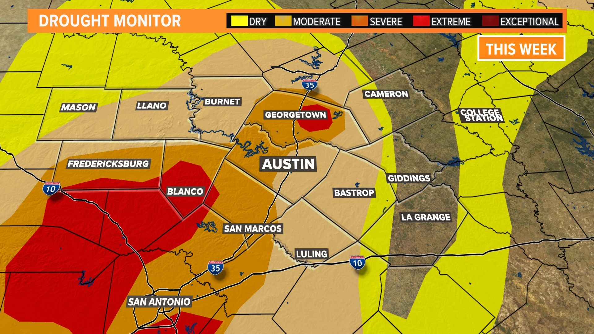
AUSTIN, Texas — We've had a very wet week across portions of Central Texas, but that heavy rainfall is only somewhat reflected in this week's drought monitor. That's because most of the rain fell Tuesday, after the 7 a.m. recording deadline for this week's drought monitor. We should see the full effects of the rain in next week's drought monitor.
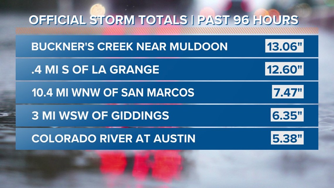
As for this week's rain, many areas in Fayette County got either up to or more than one foot of rain, which explains why we've had those flooding issues in the county. Some areas along the I-35 corridor also saw healthy rain totals, with a gauge near San Marcos recording nearly seven and a half inches of rain.


As a result of this, there are some positive updates this week, especially east of Interstate 35. Portions of Lee, Milam and Fayette counties are now no longer in a drought. That includes the cities of Cameron, Giddings, La Grange and Schulenburg. In fact, this is part of a 7% statewide increase in areas not in any level of drought.
In addition, some areas along I-35 dropped a drought level to "severe" drought, including San Marcos and Georgetown, and Austin dropped to "moderate" drought. Georgetown's improvement was part of the reduction of "extreme" drought in Williamson County.
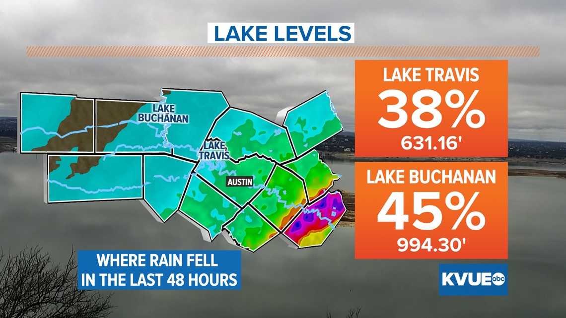
However, it's not all roses and flowers for this week. While we did see improvements, most of them were east of I-35. That means the Hill Country, and therefore our Highland Lakes system, was left high and dry, with no improvements. Lake Travis is still at 38% and Lake Buchanan is still at 45%.


A silver lining to this is that not only will all of this past week's rain be factored in for next week's drought monitor, but some areas could still see a few widespread showers and maybe more isolated downpours. Additionally, the six to 10-day precipitation outlook shows that the Hill Country has a higher chance of above-average precipitation than the Coastal Plains, which could benefit lake levels. However, this is not set in stone, so stick with KVUE for the latest on your forecast.
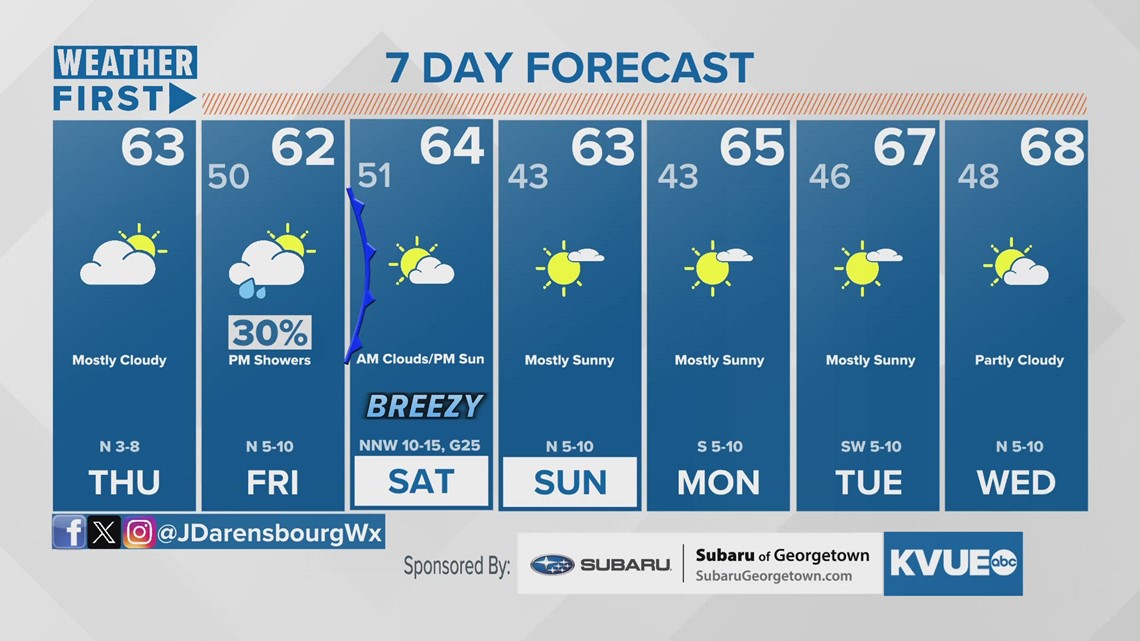
In the meantime, your extended forecast is below:


