AUSTIN, Texas — It's Thursday, and that means a new drought monitor has been released.
However, while we received a good bit of rain in the Hill Country Tuesday night, that was not counted on the latest drought monitor.
The heaviest rain fell after the 7 a.m. CT Tuesday's cutoff time for drought monitor records. As such, we were unable to see any change locally from the week prior.

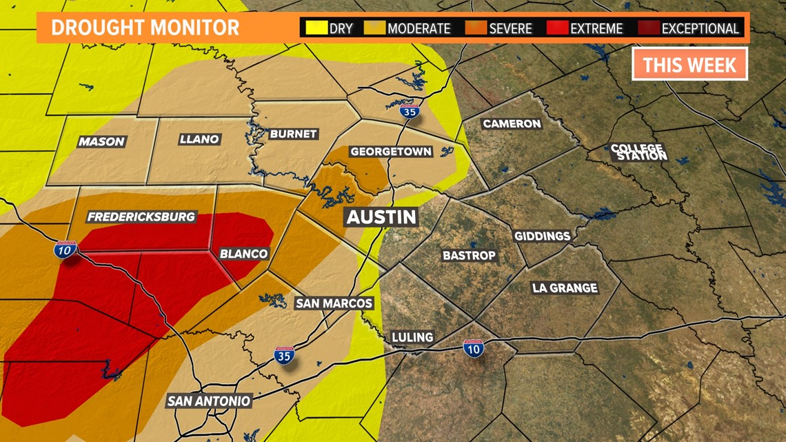
Not only did we see literally no change in the drought locally, but we also did not see much change statewide.
RELATED: Here's how hail gets its shape
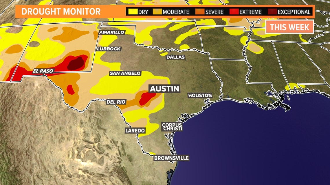
In fact, the only change across all of Texas was a slight addition of "abnormally dry" conditions in the Rio Grande Valley, almost exactly splitting Corpus Christi and Laredo.

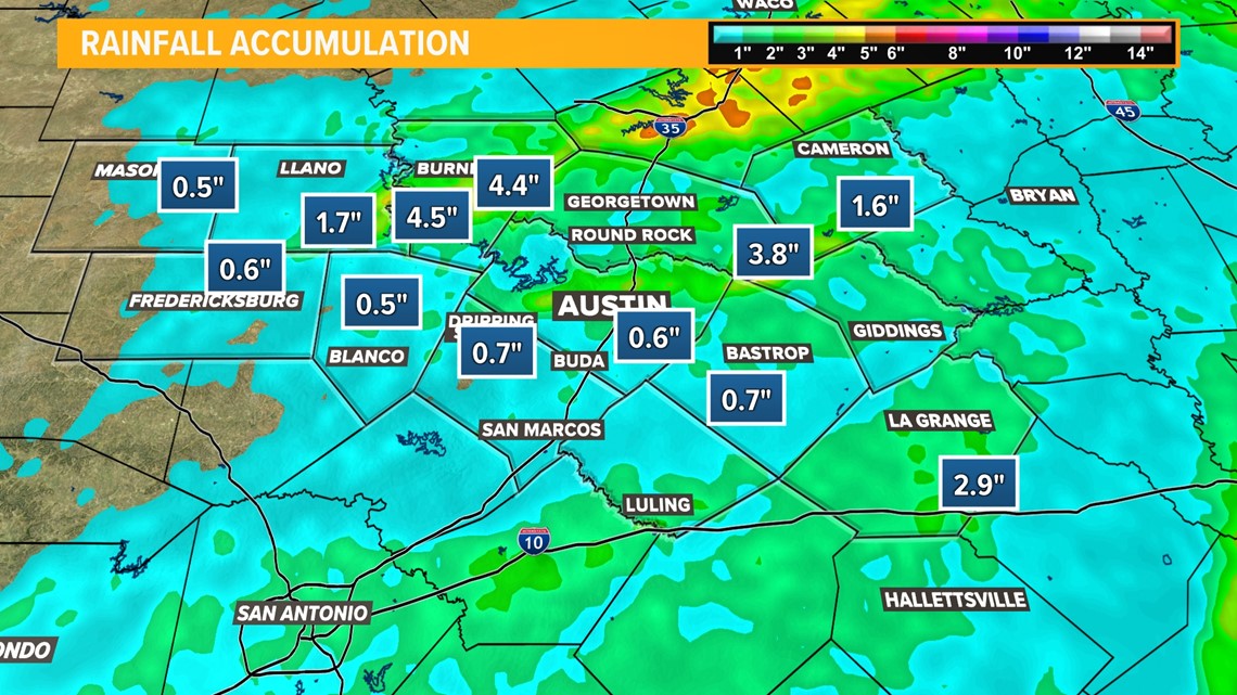
However, as we mentioned, most of this past week's rain did not fall in time to be counted. With that, there is hope, even as we expect to remain dry for the remainder of the week into the weekend. Check out some of these totals from Tuesday night's storms in the Hill Country!

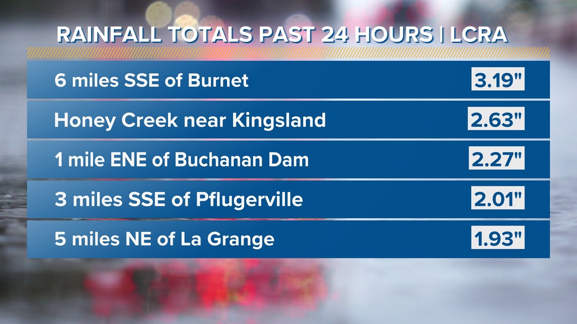
What's more, radar estimates show that some areas received more than that over the course of Tuesday night, including some estimates of up to 4.5 inches along the Colorado River northwest of Lake Travis!
In fact, some areas of Bell County, which is outside of the KVUE area and has been in moderate to severe drought, got up to 6 inches of rain from these storms.

Stick with KVUE as we continue to track the potential of the eventual eradication of the drought in Central Texas.
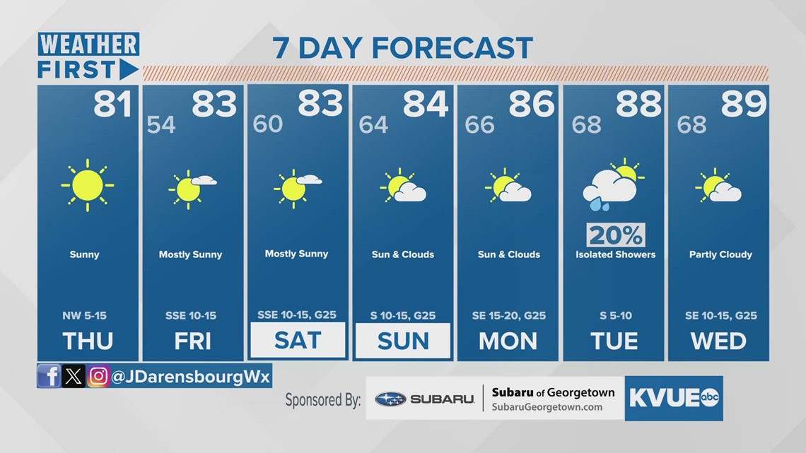
In the meantime, your seven-day outlook is below.

