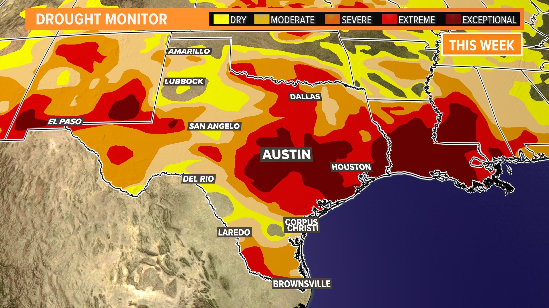
AUSTIN, Texas — Thursday means a new drought monitor has been released!
However, this did not account for Thursday's morning rainfall, as the cutoff time for this drought monitor took place at 7 a.m. Tuesday. Thus, there was virtually no change in Central Texas's drought monitor this week.
When taking a statewide view, noticeable positive changes are seen in the Texas panhandle and other areas of West Texas, such as the Lubbock area. In fact, the area without any form of drought -- including "abnormally dry" -- increased by around 4%, while the aforementioned "abnormally dry" metric and the "moderate" drought metric decreased statewide by around 3%.
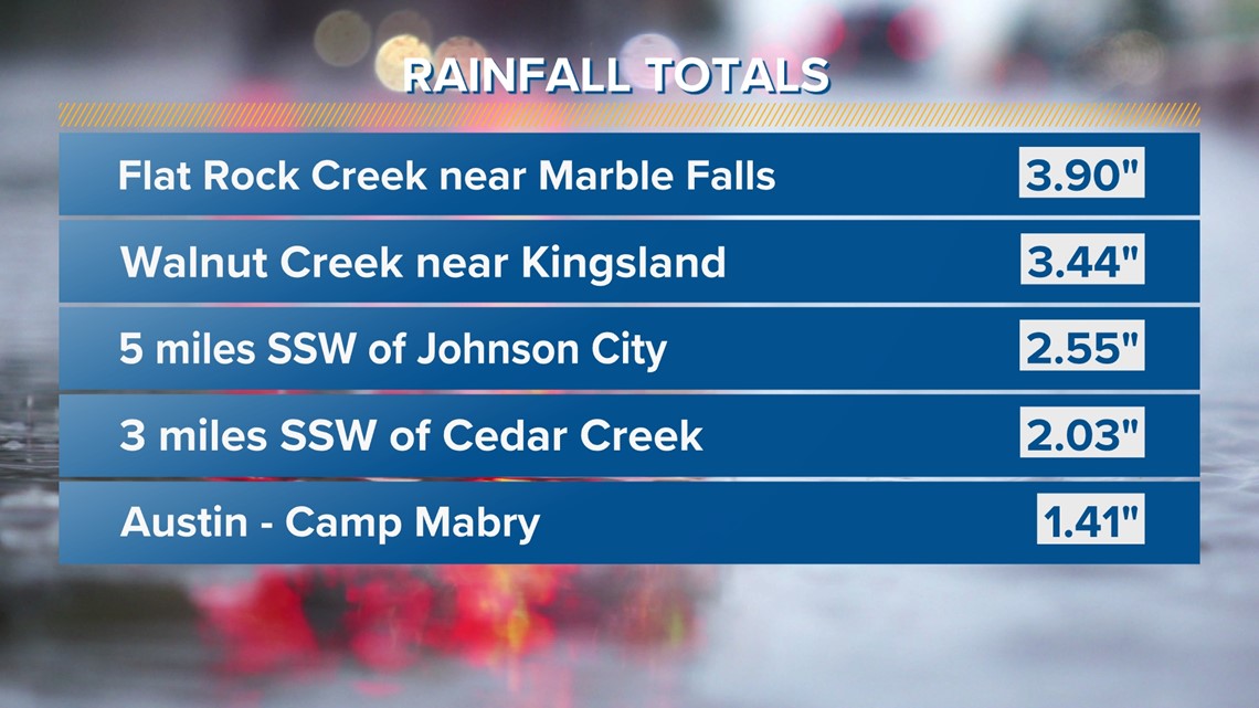
Next week's drought monitor may look a bit different from this week. That's because not only did all of Central Texas receive beneficial rainfall from the storms along that frontal boundary without any severe-warned storms, but we also had some areas in the Hill Country get some of the highest amounts.
In fact, a gauge near Marble Falls got nearly four inches of rain, and another gauge in Blanco County got nearly three and a half inches of rain.


All in all, we've had a really nice bit of rain, but it didn't count towards this week's drought monitor, even though we wish it did. However, this rain will really help us anticipate next week's drought monitor, which we expect to improve across our area, especially with October being our second-wettest month on average.
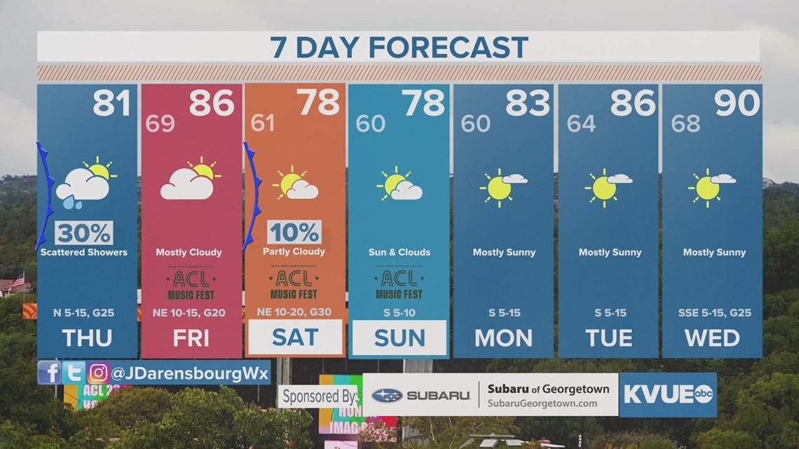
While we don't expect much rain in the seven-day forecast, we will continue to track things for you on KVUE and here on kvue.com and the KVUE app.
In the meantime, here is that seven-day outlook, which includes Weekend One of Austin City Limits (ACL).


