AUSTIN, Texas — After icy weather last week, we're now returning to a more active weather pattern for the middle of this week. This time around, fortunately, we're not expecting any form of wintry precipitation. However, we are expecting widespread rain and storms to continue through Wednesday morning.
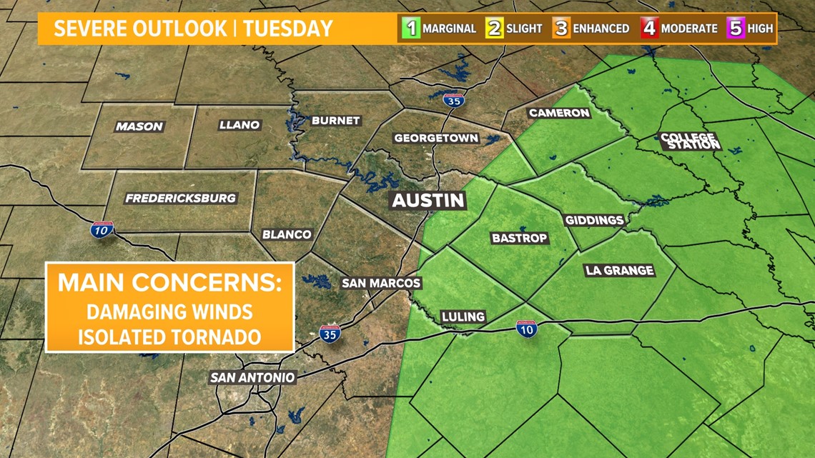
While we're not expecting any major issues with severe weather, there is a low-end threat for gusty winds and an isolated tornado. The Storm Prediction Center includes areas east of Interstate 35 in the "marginal" – level one of five – risk for severe storms.

Timeline: When to expect stormy weather
The cold front itself pushed through Tuesday evening, but behind it we are expecting more rain and storms to develop.
As temperatures drop to the 50s and 40s, a more stable air mass will be moving in. This should limit severe weather potential for the most part, but we still can't rule out a stronger storm developing with gusty winds or an isolated tornado.
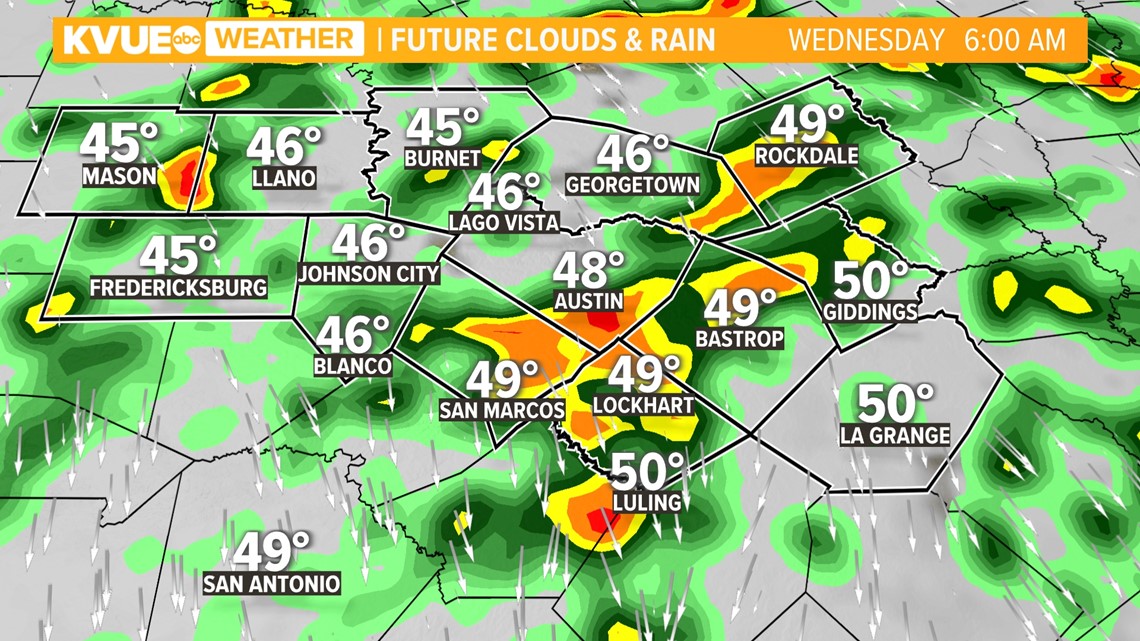
Wednesday morning will be chilly and rainy as widespread rain and storms continue. Fairly widespread activity will continue through the first half of the day.

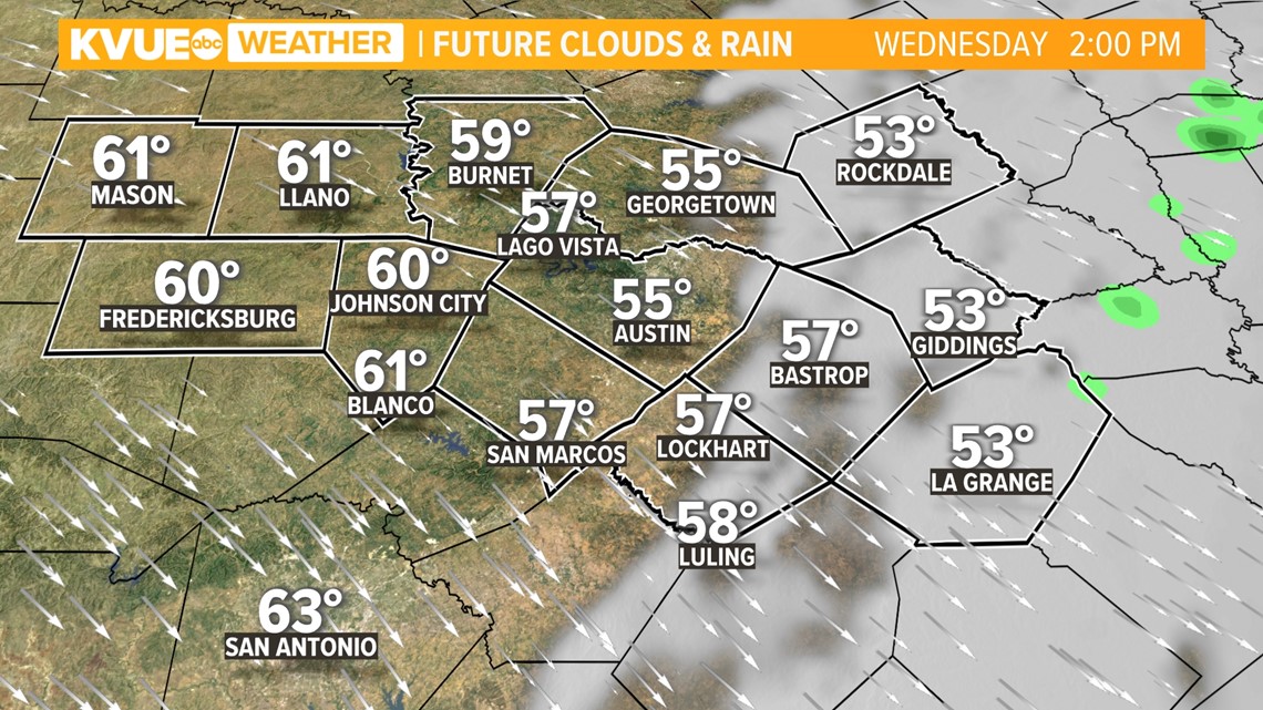
Cooler and drier air will take hold by the mid to late afternoon. Eventually, cloud cover will move out from west to east with afternoon highs down to the mid and upper 50s.

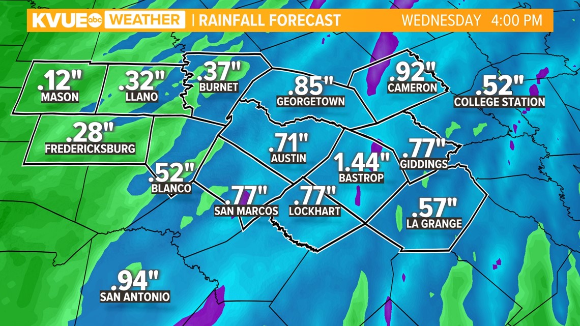
In addition to the gusty wind potential, there is also a low-end threat for minor flooding with a widespread half-inch to inch-and-a-half of rain likely along and east of I-35.

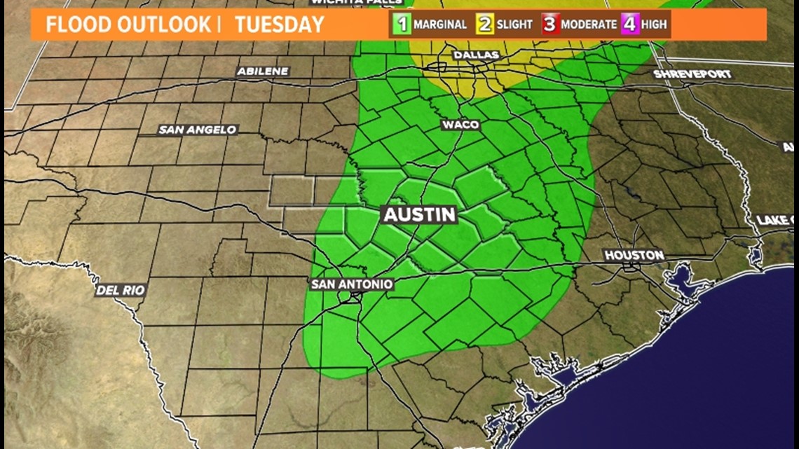
There could be pockets of two to four inches of rainfall in isolated spots, with the highest likelihood being in the Coastal Plains.

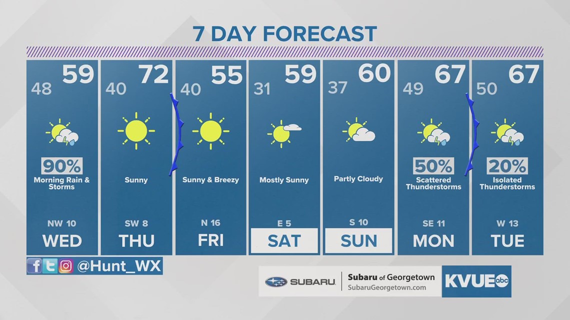
Following the rain, Thursday afternoon briefly returns to the 70s. A second cold front brings a strong surge of colder air ahead of the weekend but will not bring any additional precipitation.
The KVUE Storm Team will continue to monitor this developing forecast.
In the meantime, the extended forecast can be found below: