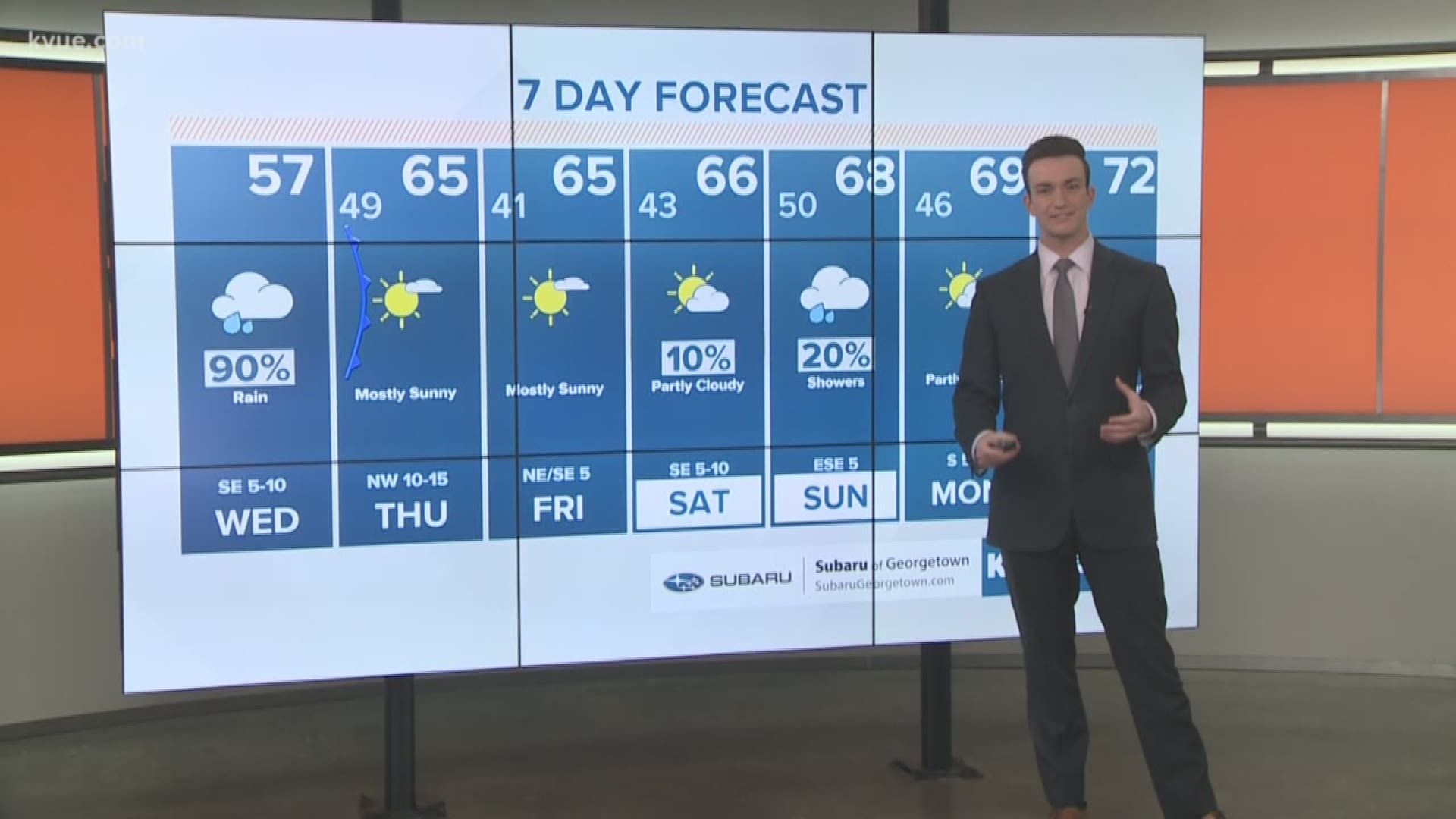
AUSTIN, Texas — Wednesday morning is off to a dreary start across central Texas. Showers will continue in to this afternoon, especially for areas east of the I-35 corridor.
An isolated storm is also possible this afternoon and early this evening as the rain moves out.
Much nicer weather will move in for Thursday and Friday with sunshine and afternoon temperatures in the 60s.
Here's a timeline on the departure of the rain...
Timeline:
Widespread rain will continue through Wednesday morning for most of central Texas. For the most part the rain this morning should be fairly light with temperatures warming in to the 50s by noon.
By late morning some areas across the Hill Country will begin the drying process as the rain moves eastward.

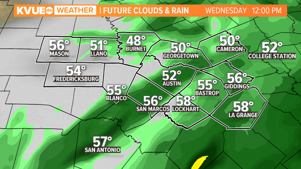
For the afternoon it will be areas east of the I-35 corridor that hold on to the rain the longest.
Afternoon temperatures will stay in the 50s for many areas, but some could warm in to the low 60s.

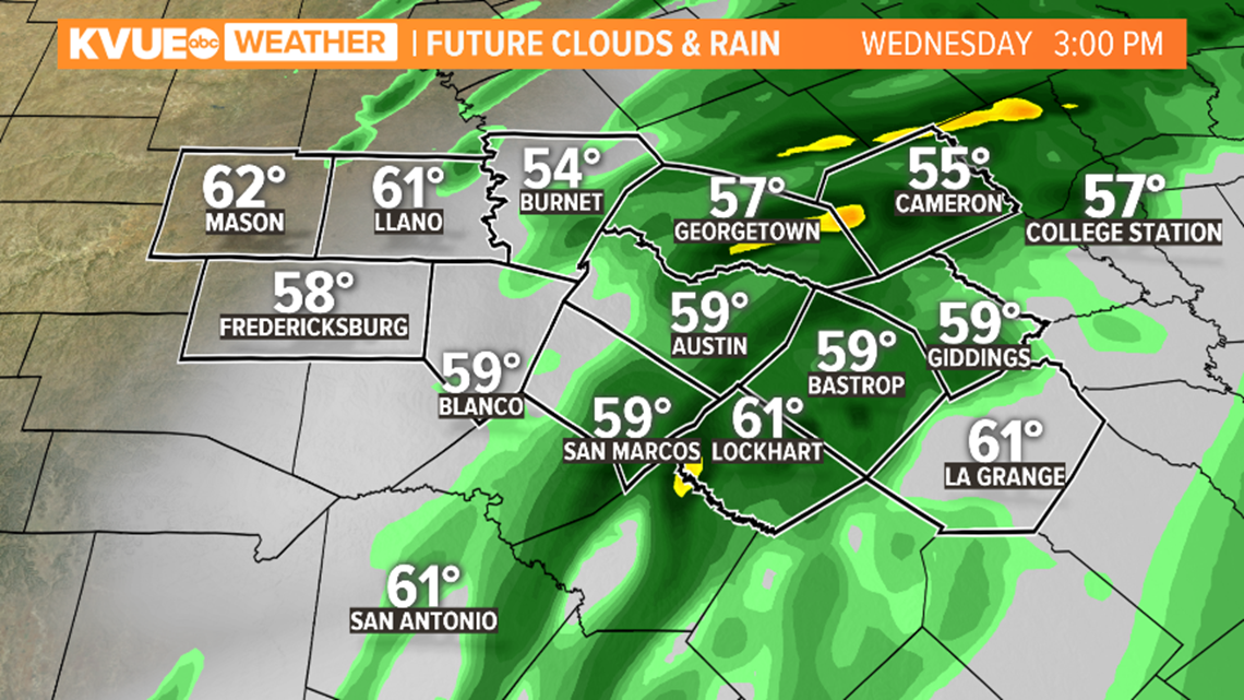
A few isolated storms could develop east of Austin for the afternoon and early evening.
Severe weather is not expected, but storms could produce some lightning and heavy rain.

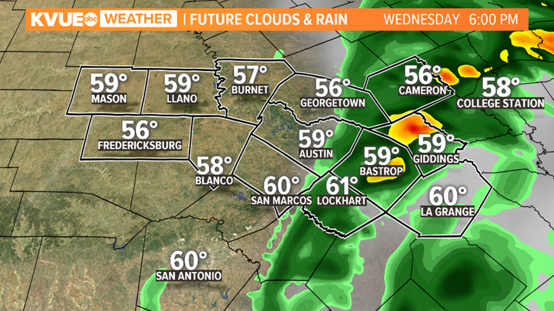
After 8 or 9 p.m. the rain and storms will be moving out of central Texas, and much nicer weather moves in to close out the week.
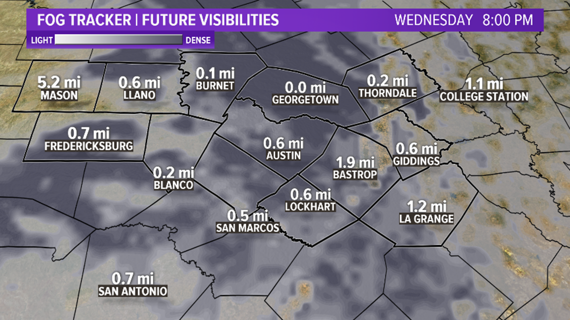
Along with showers, areas of fog will develop throughout Wednesday and could be dense in many spots starting Wednesday evening.

Rainfall amounts will range from a quarter of an inch for parts of the Hill Country to up to an inch for locations along and east of IH-35.


A cold front will move through on Thursday, so expect it to clear through the afternoon.
This cold front will also set us up for some great weather for the first part of next weekend.
PEOPLE ARE ALSO READING:

