AUSTIN, Texas — Widespread heavy rain and storms swept through the Austin area Monday evening. Fortunately, outside of a few hail reports in Blanco County there have not been any major issues with severe weather. The severe risk is now very low through the rest of the overnight as storms will gradually come to an end from west to east.
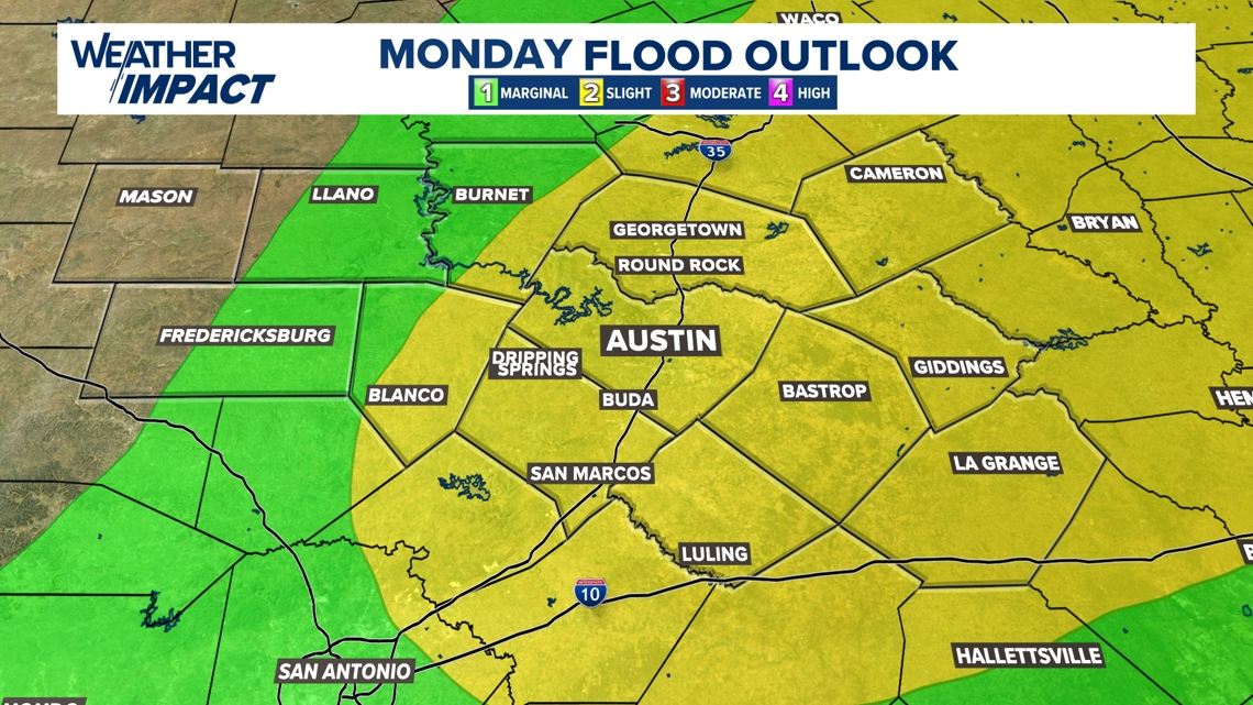
While the severe threat wanes, the minor flood risk will continue. Parts of Blanco County have received over 4 inches of rainfall, and there are widespread 1 to 3 inch totals across the Austin metro. Please continue to be mindful of low water crossings and any flood prone areas. Remember, turn around don't drown.
The flood risk will continue into the overnight for areas east of I-35.


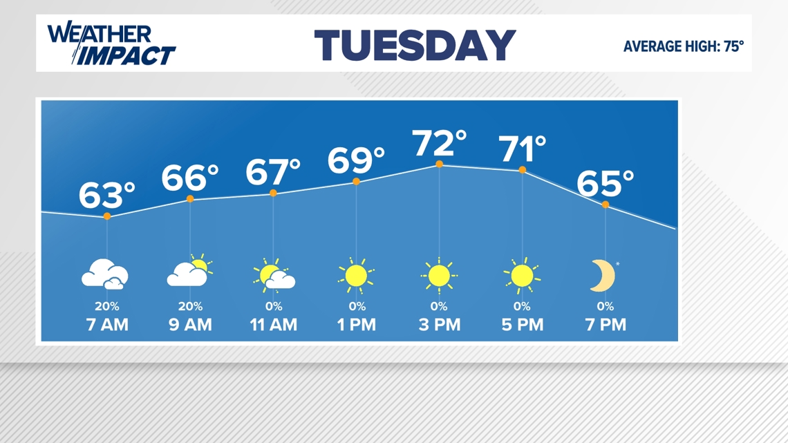
Rain for areas west of I-35 has ended for the night, and now areas east of I-35 will continue with rain and storms through the early overnight. After 2 a.m. things will begin to trend drier for the majority of our KVUE area. By Tuesday morning we're left with just a small chance for some lingering rain showers.


Clouds and a bit of rain in the morning will give way to sunshine and cooler weather for the afternoon on Tuesday. Weather will not be an issue for folks going out to the polls on Election Day. High temperatures will be in the low to mid 70s!


The KVUE Weather Team will continue to monitor this developing forecast.
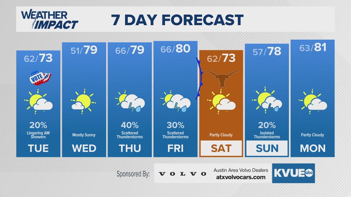
In the meantime, the extended forecast can be found below:


