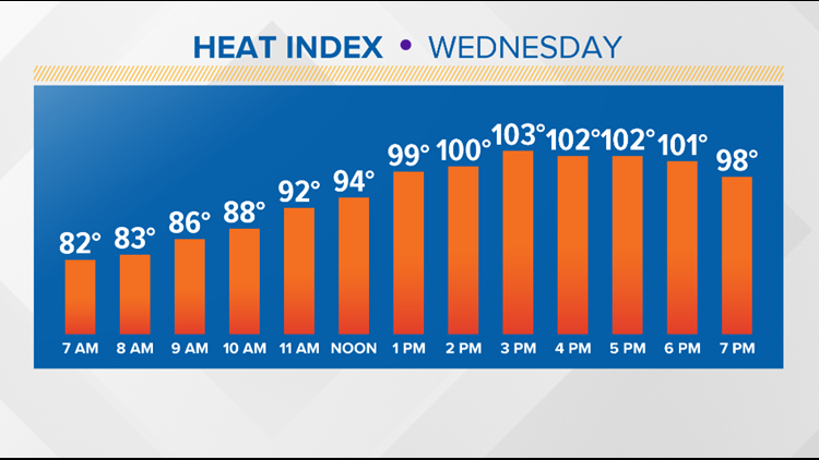
AUSTIN, Texas — We're going to get a taste of pre-summertime heat in Central Texas this week! A ridge of high pressure will slowly be building in, which will be responsible for decreasing rain chances and increasing temperatures along with triple-digit heat index values through at least the start of next week.
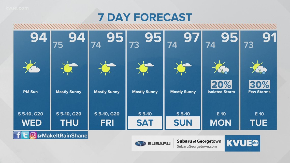
Rain chances are virtually gone for the entire week. Highs will be in the low to mid-90s for the rest of the week with heat index values in the triple digits. It will be important to stay hydrated and take multiple breaks if spending long periods of time outdoors.
The upper-level low responsible for our stormy weather will continue moving away to the northeast, and a ridge of high pressure will filter in from the southwest. This ridge will reinforce a hotter and drier pattern for the rest of the week.

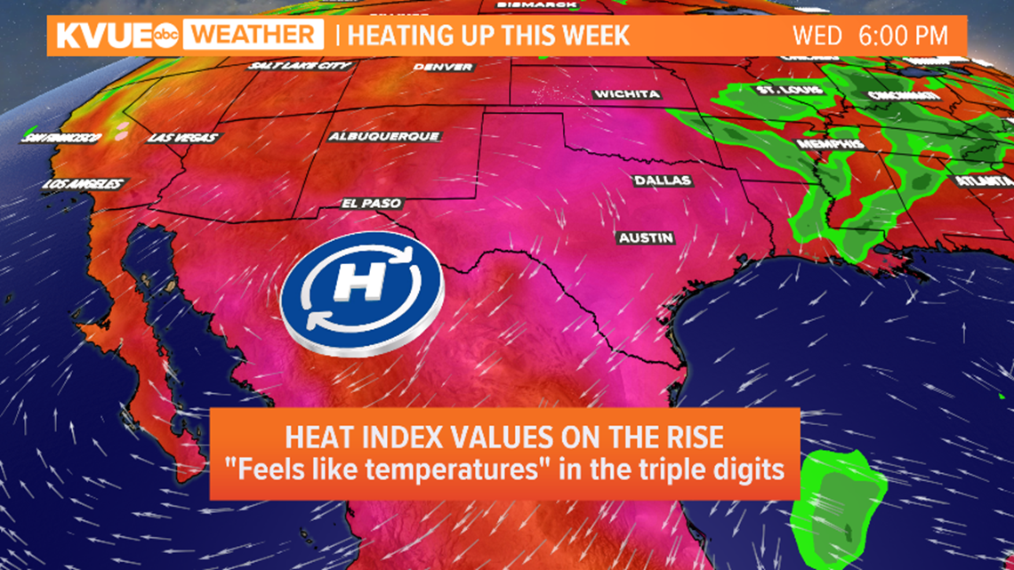
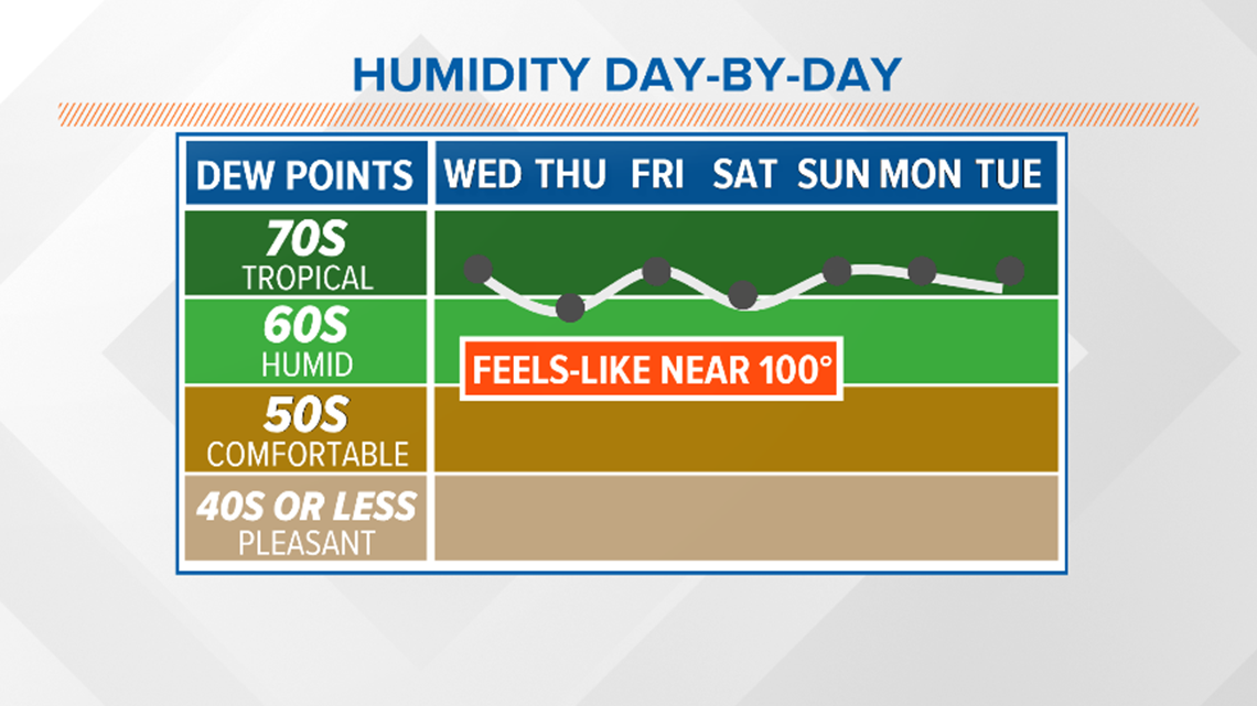
Temperatures will reach the low to mid-90s each afternoon, but tropical humidity will mean feels-like temperatures will be in the triple digits. The most humid weather is expected around the middle of the week.

Our ridge will briefly slide to the west late in the weekend. This will allow a disturbance to move in from the east to bring our next chance of rain late Sunday and into Monday. Forecast models have started trending drier for the end of the weekend and are beginning to push the rain chances back into the beginning of the workweek.
The KVUE Weather Team will continue to monitor the forecast closely.
In the meantime, here is a look at your extended forecast:

RELATED:


