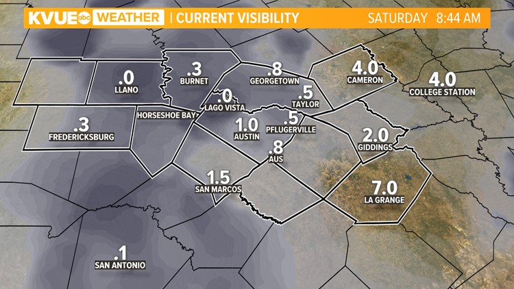
AUSTIN, Texas — The weekend is off to a dreary start with dense fog and scattered light showers. Visibility will be slow to clear throughout the morning with the densest fog located along and west of Interstate 35.


A coastal low-pressure system has formed to our south and is helping to usher in scattered showers and light drizzle for Saturday. This could even produce some thunderstorms east of Austin through Saturday afternoon.

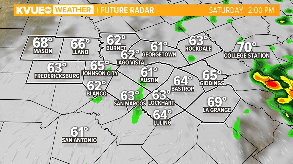
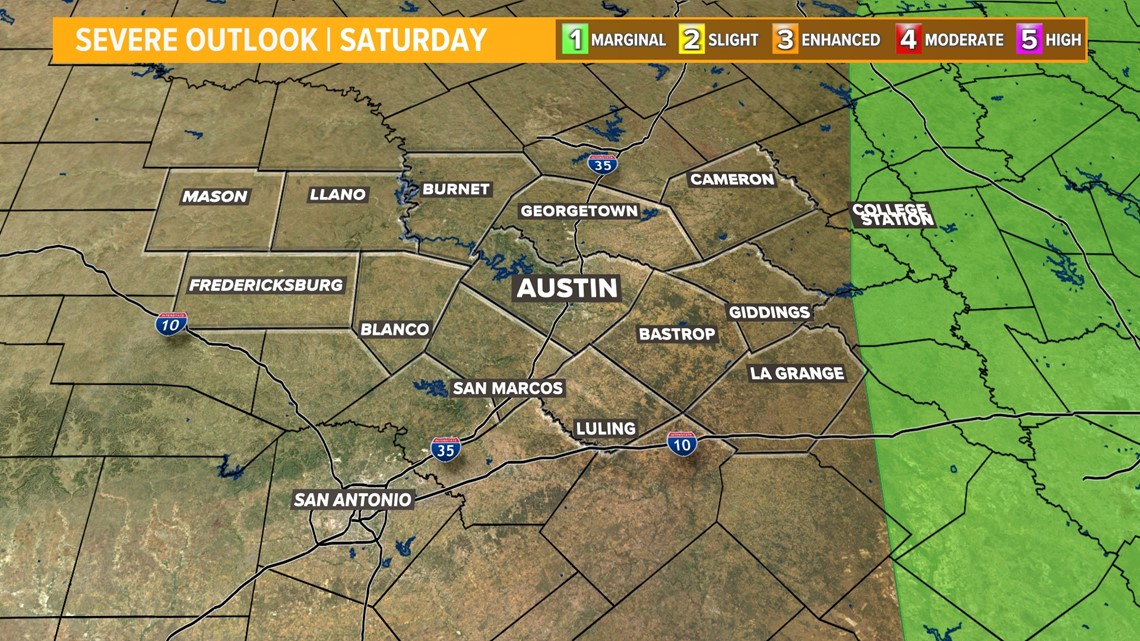
There is a low-end chance that one or two of those storms could be strong to severe, but the main severe threat will stay to our east.
The Storm Prediction Center has updated their severe weather outlook for Saturday and it no longer includes any portion of the KVUE viewing area. A "marginal" – level 1 of 5 – risk for strong to severe storms is possible to the east.

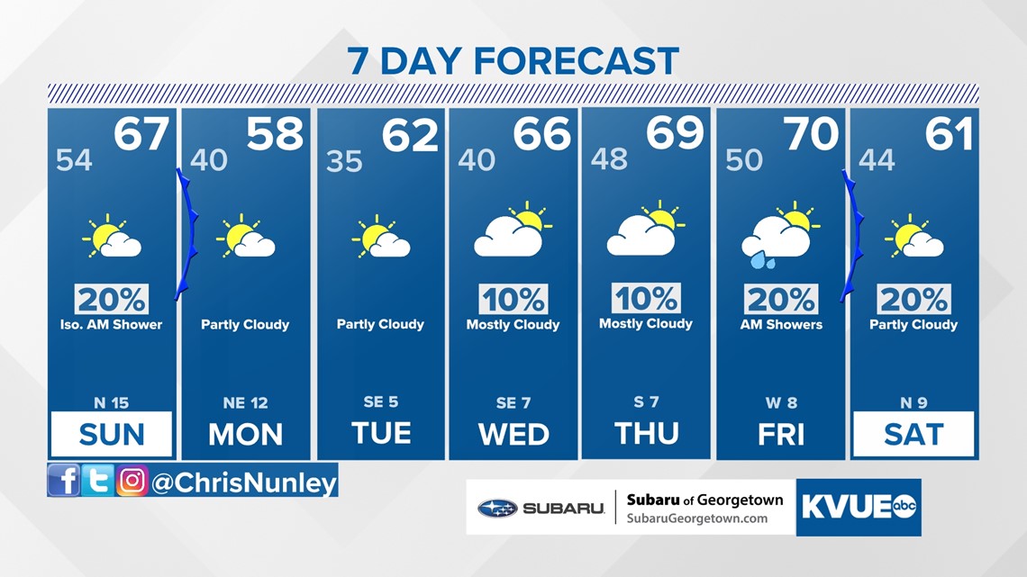
Temperatures will be warmer on Saturday thanks to the southerly flow, with highs likely returning to the 60s. Our next cold front will move through on Sunday, ushering in a breezy northwest or north wind by the afternoon. Highs on Sunday will still reach the 60s, but cooler air returns for Monday and Tuesday of next week.
Another disturbance around Wednesday and Thursday could bring some more rain to Central Texas but, as of now, we still don't have great agreement among the computer models. We'll continue to update the forecast as we fine tune the details.

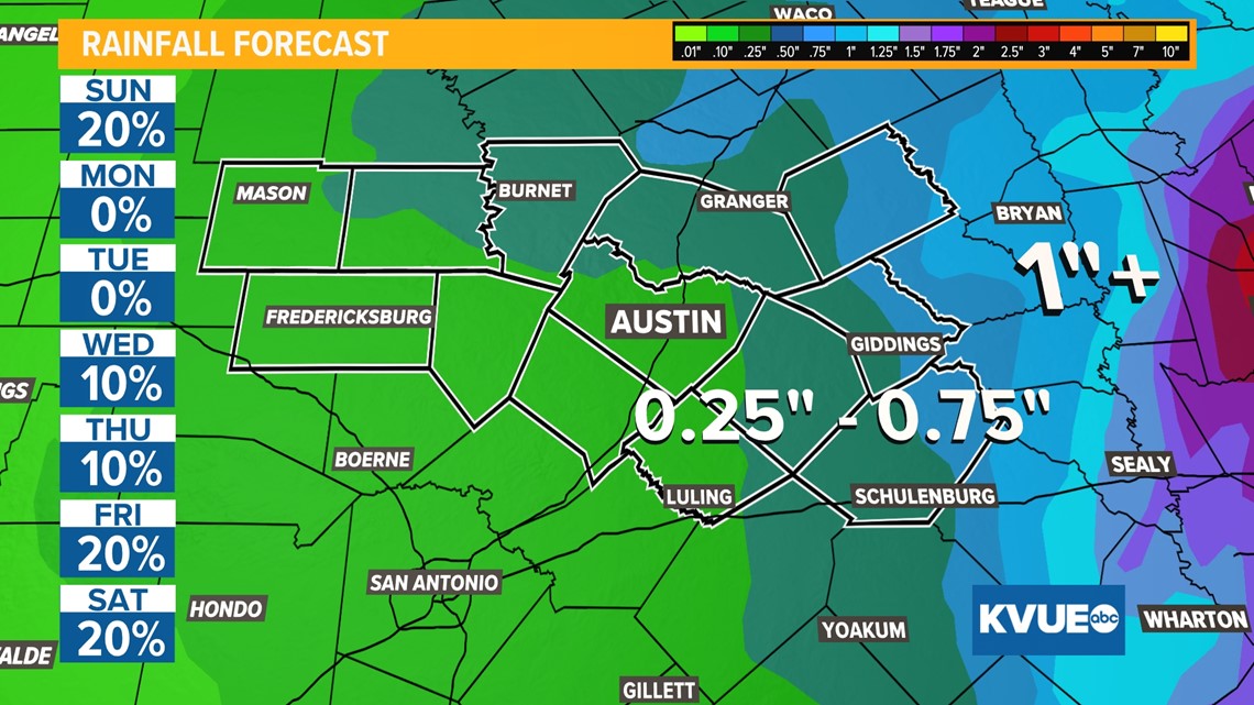
The KVUE Weather Team will continue to closely monitor this developing forecast.
In the meantime, the extended forecast can be found below:

PEOPLE ARE ALSO READING:

