AUSTIN, Texas — Editor's note: This blog is no longer being updated. Click here for the latest forecast.
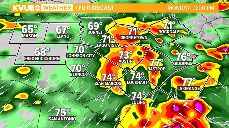
A cold front is sliding through Central Texas Monday morning, and the stage is set for several rounds of rain and storms through the day and night.
A Flood Advisory was put in place for parts of Travis and Williamson counties, and specifically Austin, Georgetown, Pflugerville, Round Rock and Taylor. The advisory was effective until 2:45 p.m.
Look for rain chances to gradually ramp up through Monday evening. It looks like rain and storms will be most widespread in the afternoon into the evening.
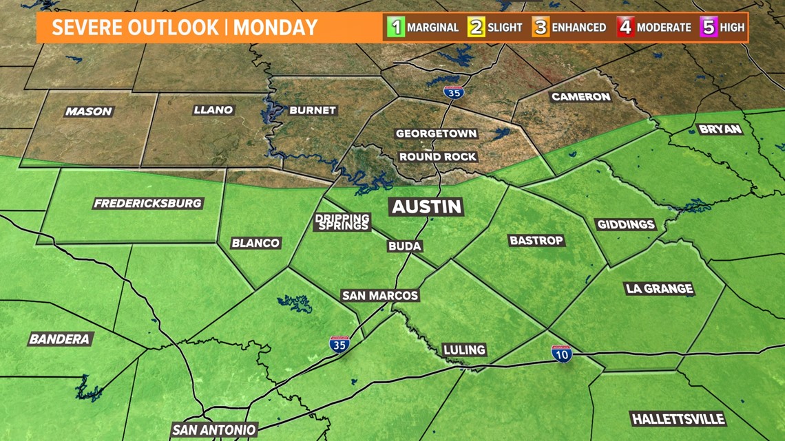
Heavy rainfall rates could lead to some isolated flooding but, overall, we're expecting this to be beneficial rainfall. There is also a low-end chance for a strong storm or two with large hail and gusty winds but, overall, the severe threat is low. A majority of the KVUE viewing area is under a "marginal" – level one out of five – risk for severe weather today.


Additional rounds of showers and storms will be possible overnight and even into Tuesday morning, but rain chances will then decrease from north to south through the day on Tuesday with drier weather by the afternoon.
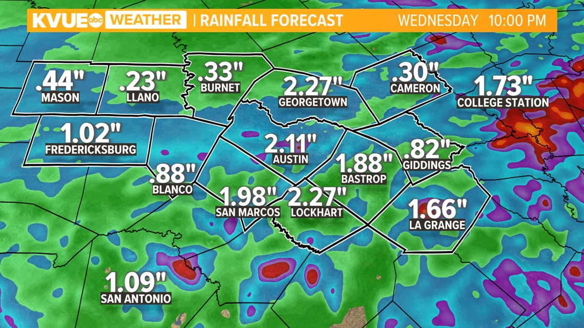
Altogether, rainfall totals could end up in the one-inch to two-inch range for much of Central Texas with isolated higher totals between now and Tuesday morning.


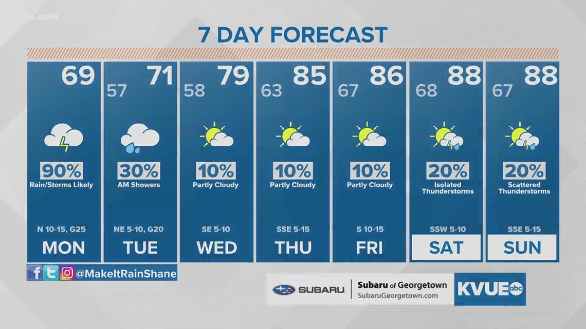
The heat ramps back up late this week with our next opportunity for rain and storms coming over the weekend.
The KVUE Weather Team will continue to closely monitor this developing forecast.
In the meantime, the extended forecast can be found below:


