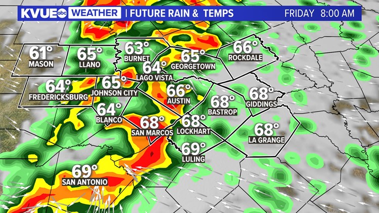
AUSTIN, Texas — Strong to severe storms continue to track eastward across Central Texas Friday morning. These storms brought widespread rain across the area for Friday morning and triggered several Severe Thunderstorm Warnings west of Interstate 35 earlier in the day.
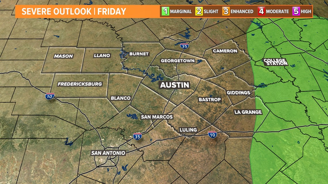
The latest outlook from the Storm Prediction Center continues to lower the severe weather threat for the rest of Friday. Only eastern portions of Fayette County remain under a risk for strong storms.

Timeline: Storms quickly pushing eastward
The latest model data brings the storms into the I-35 corridor and the Austin metro by around 7 or 8 a.m. Friday. This could provide a pretty messy rush hour commute. Give yourself extra time to get to work!
Storms could produce gusty winds, and there will be an isolated tornado threat.

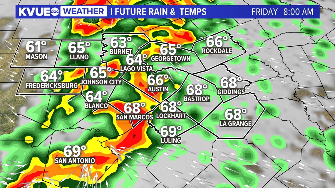
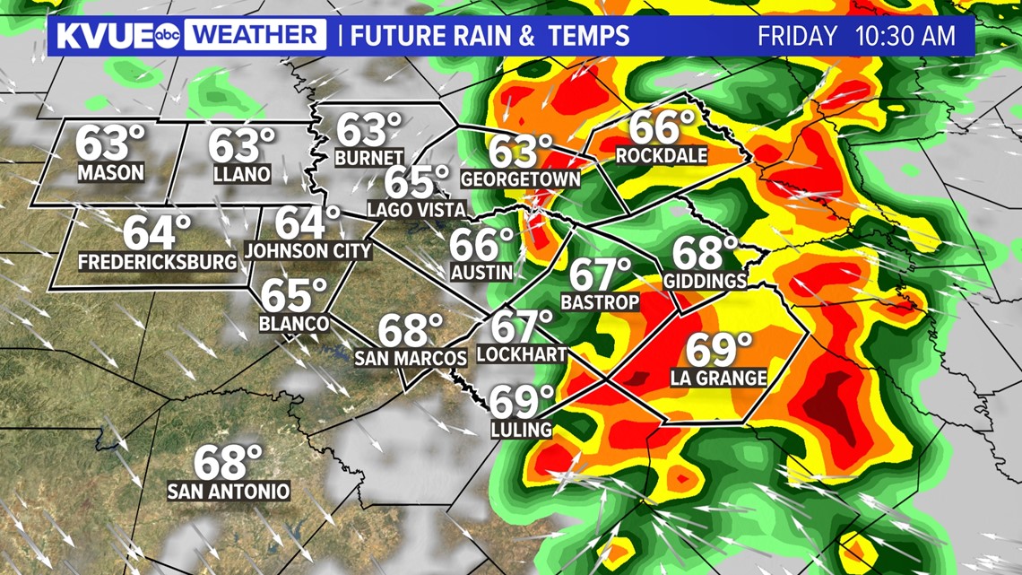
Storms quickly race eastward by the mid- to late morning hours with the continued threat for strong winds and an isolated tornado.
The storms are likely push out of our eastern areas prior to lunchtime as cooler, drier air quickly rushes in behind the cold front.

How much rainfall?
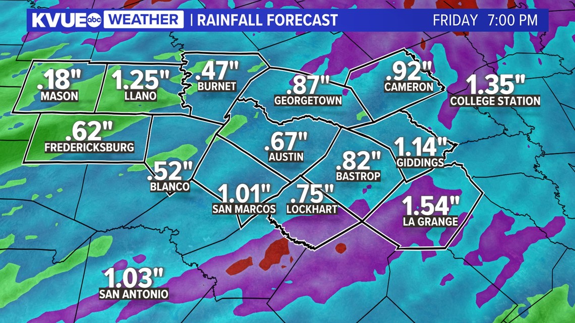
We're still on track for a widespread quarter-inch to 1.5 inches of rainfall. Some totals could be less across the Hill Country, where storms will initially be more scattered.
Likewise, some totals could exceed one inch for areas southeast of Austin.

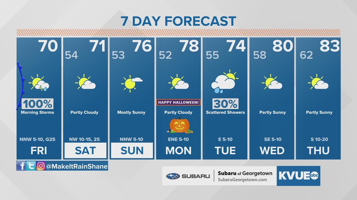
Behind the storms, the weekend looks fantastic with fall-like weather. The Halloween forecast should be nice with highs in the upper 70s. We'll be monitoring the potential for another round of showers to move in late Monday night through Tuesday.
The KVUE Weather Team will keep a close eye on this developing forecast.
In the meantime, the extended forecast can be found below:

PEOPLE ARE ALSO READING:


