AUSTIN, Texas — Happy Fourth of July!
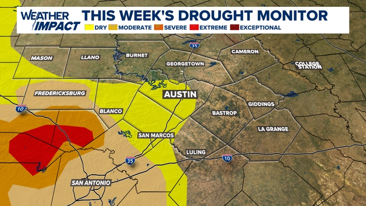
It's also Thursday, so a new drought monitor has been released. Due to the holiday, the drought update took place on Wednesday instead of Thursday.
The latest update shows Austin, along with much of Travis and Hays counties, back in the "abnormally dry" category. This is part of an 8% statewide increase in areas currently in drought compared to last week. Additionally, areas in the "extreme" drought category have increased by roughly 3%, although no such areas exist in Central Texas.
Drought-busting rain ahead?
While we have been dry for most of this past week, a couple of systems this weekend could lead to an active pattern in Central Texas.
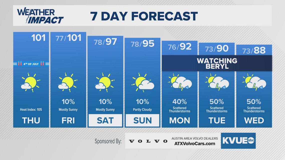
First, a weak "cool front" could slide in for late Friday into Saturday, which could lead to isolated rain chances that are minuscule at this time. Secondly, we've been tracking Hurricane Beryl, and the latest data has Central Texas getting better rain chances for the upcoming week.

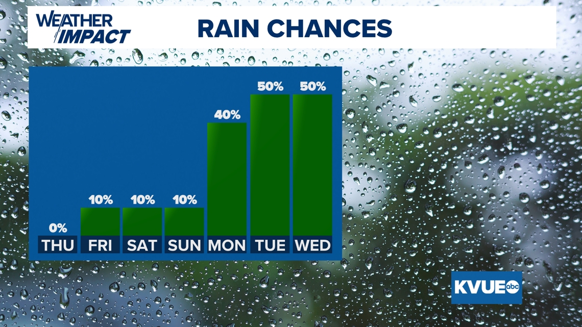
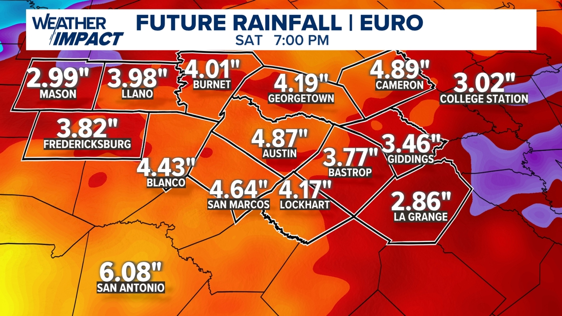
Additionally, we're tracking rainfall totals that, while varied, are trending higher for the start of next week. For example, the European model shows many areas getting between 4 to 5 inches of rain with isolated higher totals, which would pose a flooding concern.
However, we're still several days out, and with the uncertainty of Beryl's track, there's still room for it to change. Additionally, the European totals run through Saturday, July 13, so not all of the rain described here would be as a result of Beryl.

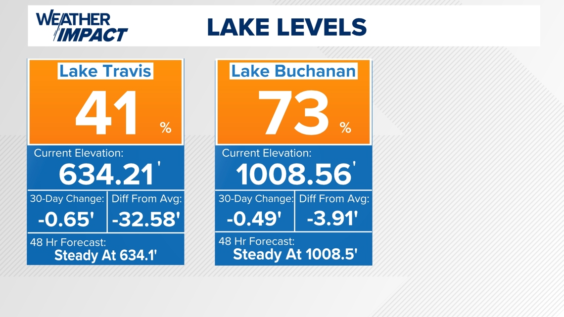
This rainfall, especially if the heaviest of it falls in our Highland Lakes system, could result in a large rise of both Lake Travis and Lake Buchanan. Both lakes have been slowly trending lower, but these upcoming systems could change that. Lake Travis is down to 41% and Lake Buchanan is at 73%.

Stick with KVUE as we continue to track Texas's drought. Your seven-day outlook is below.

