
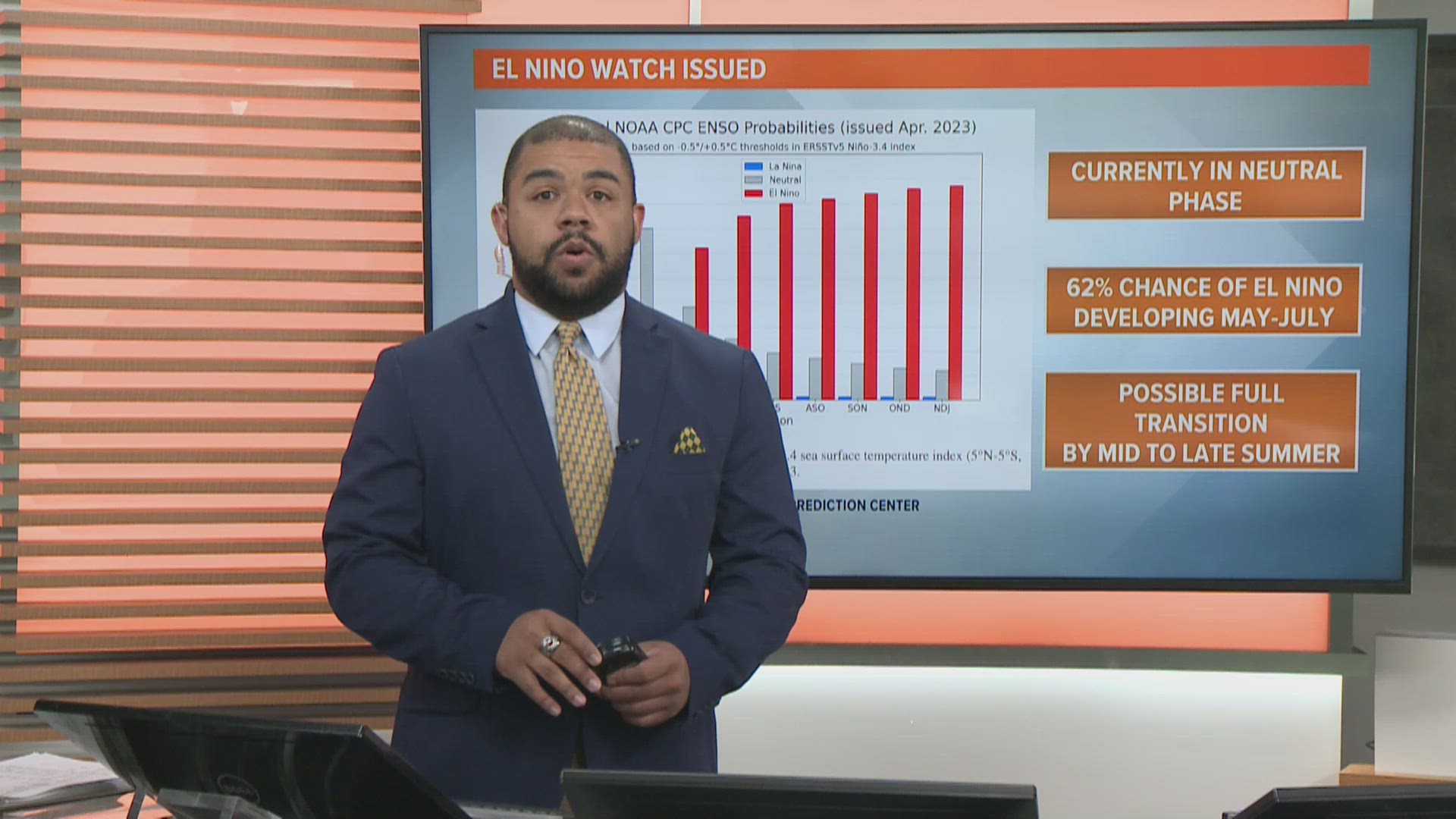
AUSTIN, Texas — One of the biggest and most impactful global weather phenomena is El Niño – the upwelling of warm waters across the equatorial Pacific that influences temperature and precipitation patterns across the U.S., as well as impacting hurricane season.
As of June 2023, climate scientists have declared El Niño to have developed and expect it to continue through the fall and winter seasons. Scientists can use the development of the Pacific El Niño in order to predict wetter, drier, warmer or cooler trends in the next few months.
But what if there were two El Niños?
This is somewhat recent research, but climate scientists have also unearthed another smaller El Niño-type of phenomenon in the Atlantic, plainly called the "Atlantic Niño."

The National Oceanic and Atmospheric Association (NOAA) has a blog devoted to monitoring El Niño conditions and, in 2020, it highlighted the Atlantic Niño, calling it El Niño's "little brother."
The post by Dr. Sang-Ki Lee explains, "Like El Niño, Atlantic Niño is characterized by warmer-than-average sea surface temperatures in the eastern equatorial basin and weaker-than-average trade winds throughout the east-central equatorial Atlantic."

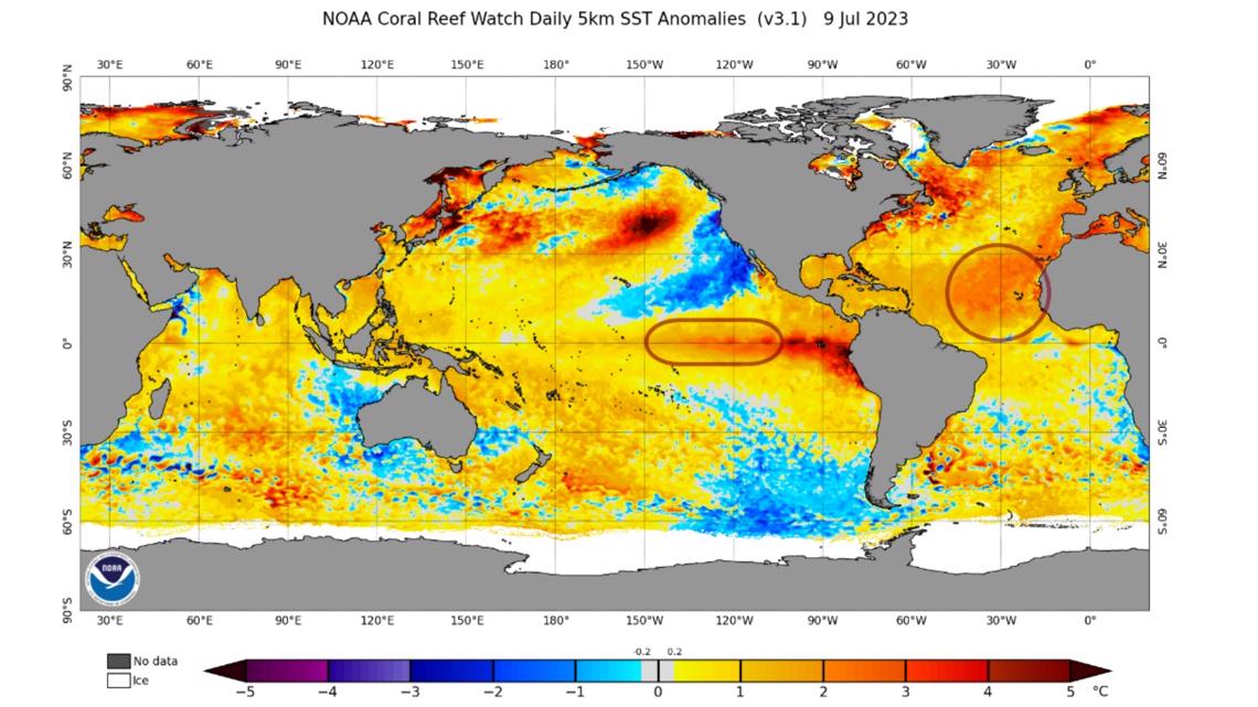
In the most current sea surface temperature map (shown above), the two areas of Pacific and Atlantic El Niño are outlined. But even without the guidelines, it's easy to spot the above-average temperature regions.
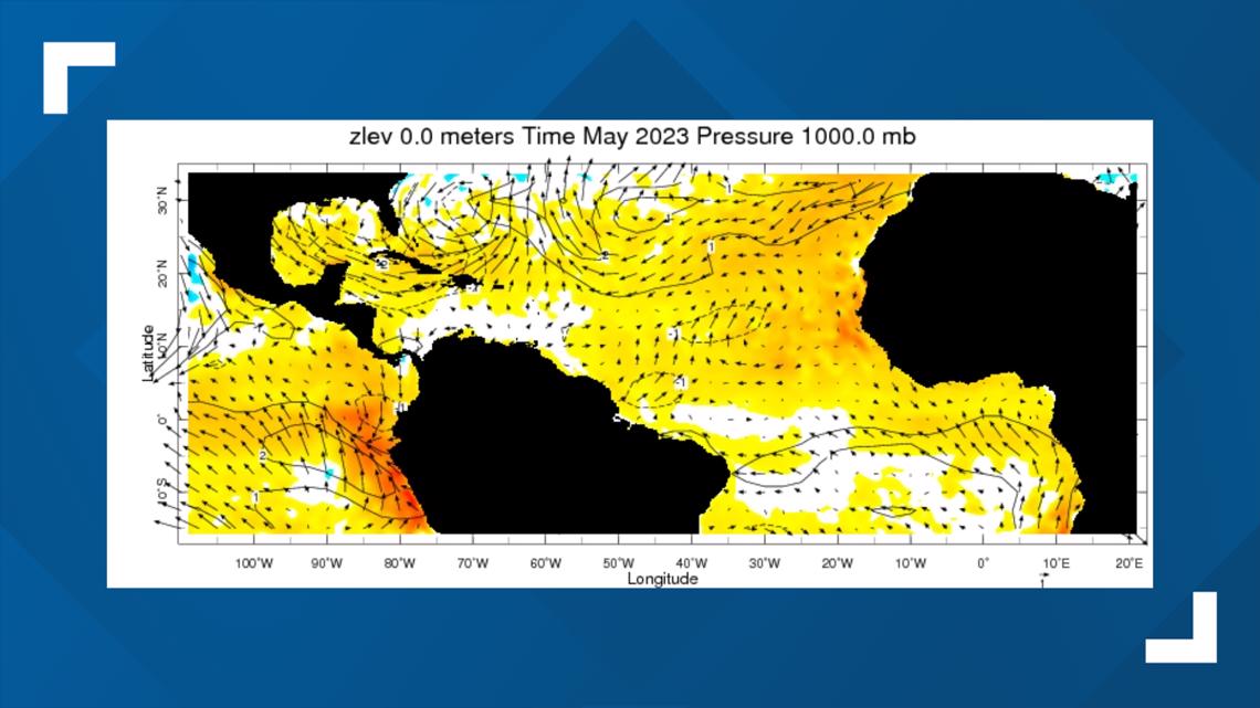
Wind anomaly maps have not yet been released for this area for the month of June, but back in May, off the African coast, one can note a generally weak wind pattern, overlaid on top of warm sea temperatures.

Dr. Sang-Ki Lee also reveals that the Atlantic Niño has been known to disturb the summer monsoon in West Africa, causing coastal areas to experience above-average rainfall and the Sahel region (just south of the Saharan Desert) to experience less rain.

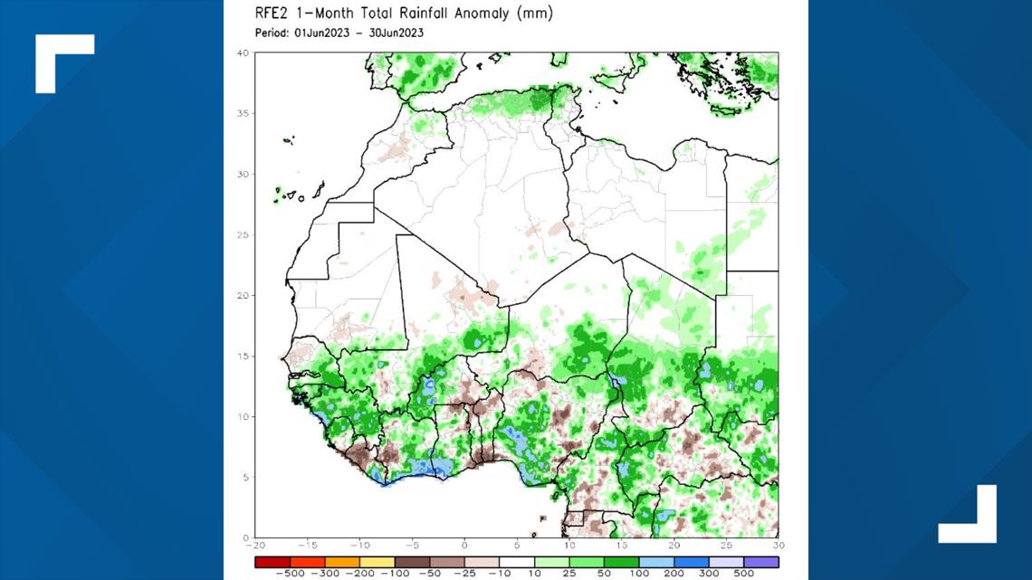
Judging by last month's rainfall patterns, it looks like coastal areas did record overactive precipitation, but the Sahel region also saw a mix of wet and dry patterns.
Looking at the past month's SSTs and precipitation patterns, some conditions do suggest that the Atlantic Niño is occurring at some level. But there is now another sector to look at: the tropics.
In a recent publication, Dr. Lee and other climate scientists discovered the Atlantic Niño can increase the formation of tropical cyclones that form off the coast of West Africa.

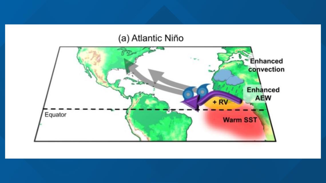
The gist of this phenomenon is that warmer sea surface temperatures and stormier weather overall (convection) add more "fuel," or energy, to African easterly waves. The atmospheric "waves" set the stage for tropical development in the Atlantic throughout hurricane season.
Tropical Storm Bret and Tropical Storm Cindy, which both occurred in June, may have been able to better organize and strengthen with help from the Atlantic Niño.
As we head through the bulk of hurricane season, from August to October, we will have to see whether the Atlantic Niño makes a notable impact on NOAA's forecast for an "above-average" season.