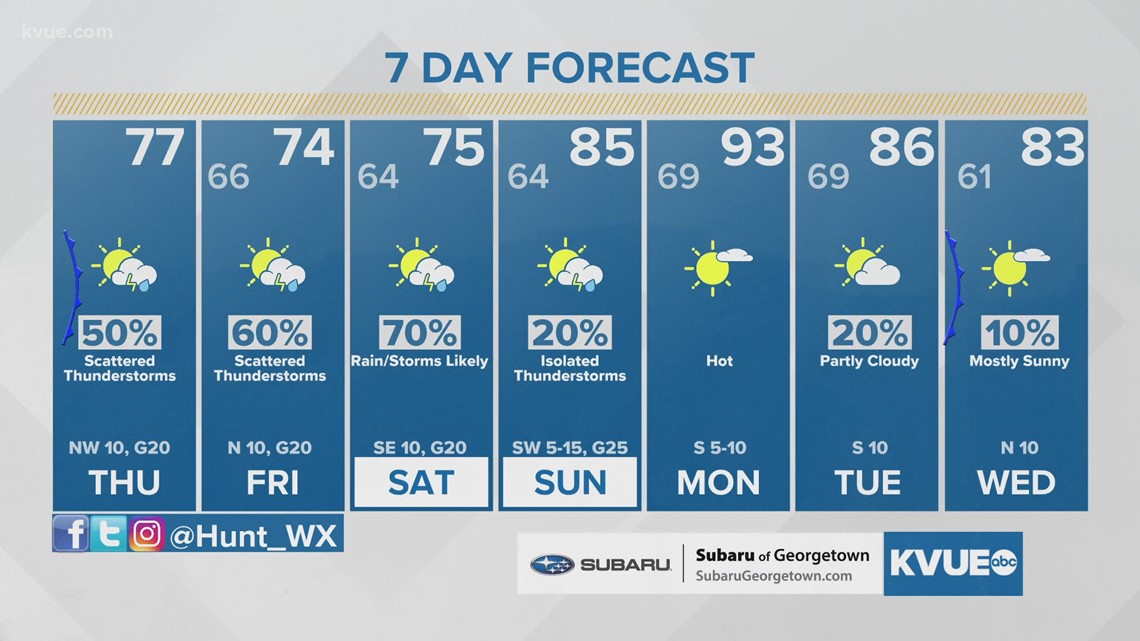
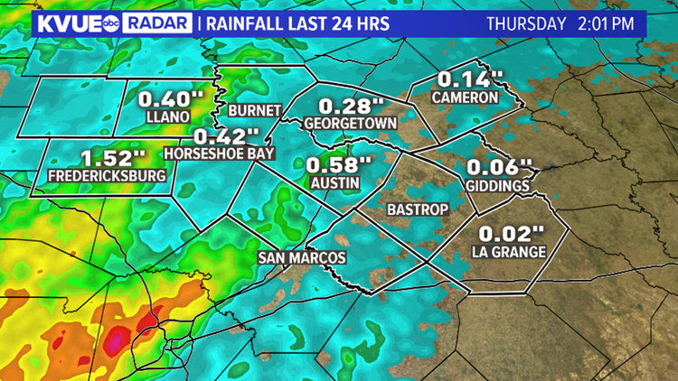
AUSTIN, Texas — The sound of heavy rain and thunder may have woken you up last night, especially if you live west of Austin. Over 2 inches of rain fell for some locations across the Hill Country. Amounts were lower for areas east of the Interstate 35 corridor, but more rain and storms are in the forecast as we head into the weekend.
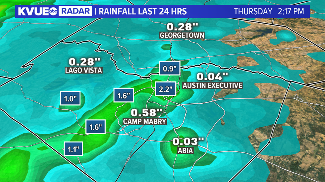
The official observing site at Camp Mabry in Austin reported just over a half-inch of rain, however, radar estimates suggest totals between 1 and 2 inches were more widespread for parts of Travis County just north and west of the city.

The highest totals by far fell across the Hill Country, where radar estimates show a widespread swath of 1 to 3 inches of rain for portions of Gillespie, Llano and Burnet counties. Training of storms in this region resulted in heavier totals.

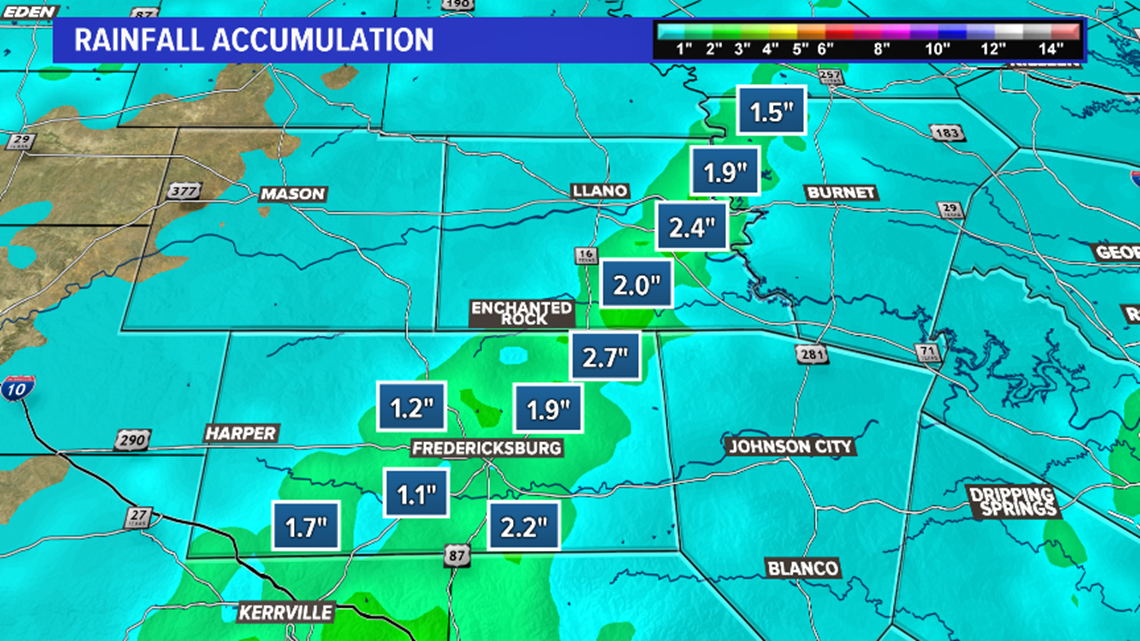
This was beneficial rain given the drought conditions we continue to face here in Central Texas, and more rain is on the way between now and Sunday morning.
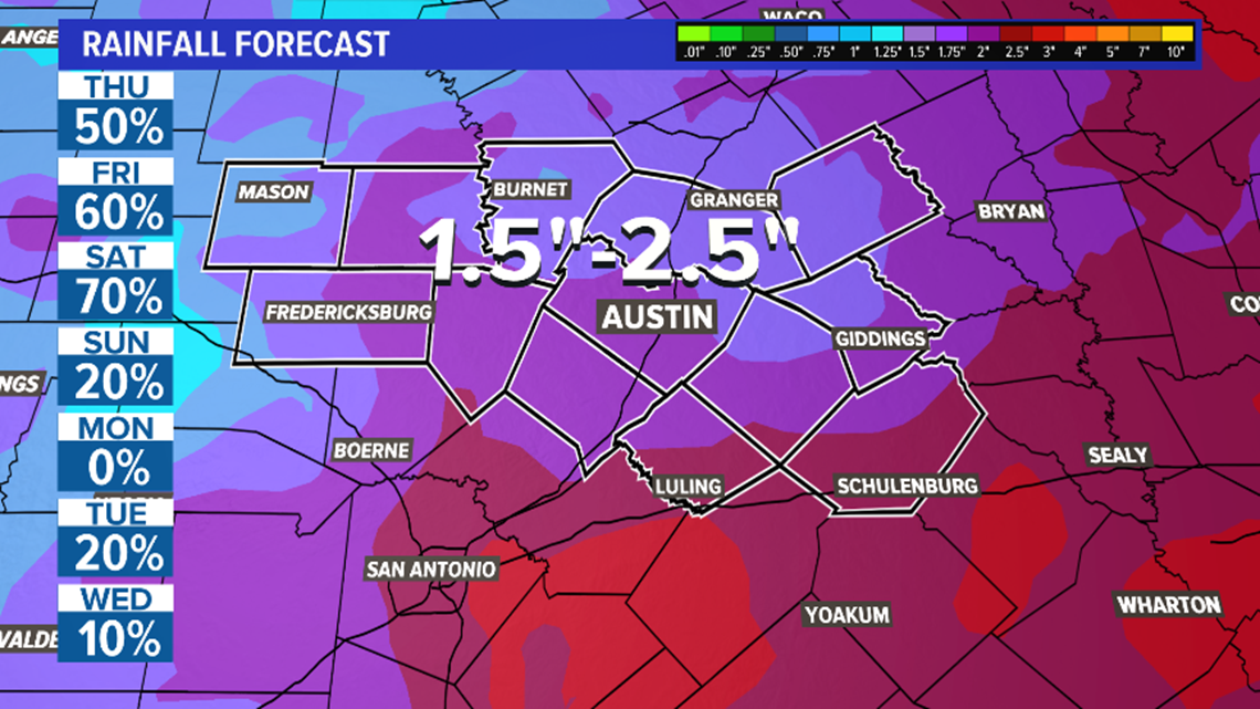
Again, this is good news assuming we can avoid issues with flooding and severe weather. We'll have to keep an eye on the flooding potential, especially across the Hill Country, with another 1.5 to 2.5 inches of rain possible through this weekend.
There is also another chance for a few strong to severe storms Saturday and Saturday evening.
RELATED: Scattered showers continue Thursday afternoon in Central Texas; more rain and storms on the way

The KVUE Storm Team will continue to monitor this developing forecast.
Be sure to download KVUE's app to check radar and get updates on stormy weather: kvue.com/app. Also be sure to follow KVUE on Facebook, YouTube, Twitter and Instagram.
The extended forecast can be found below:

