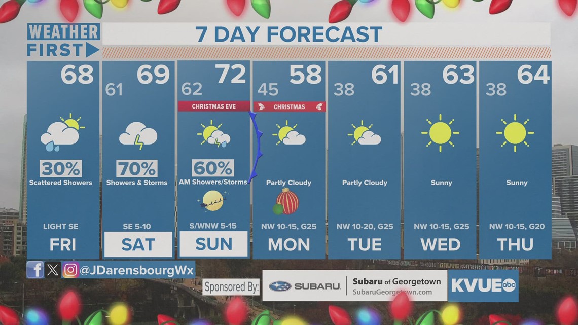
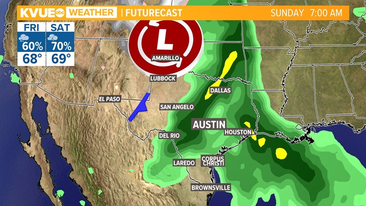
AUSTIN, Texas — While we've had somewhat of a dry stretch that was accompanied with a cedar spike to start the workweek, things may change as we head into the back half of the week before we head into the holiday weekend. And they may do so in a very interesting way.
We're expecting a good bit of rain with this system, especially as we head closer to Christmas. Here's the latest on timing as it pertains to holiday travel, as well as how much rain we could be seeing locally as a result.
Timing
Thursday looks wetter than Wednesday, with most of the rain looking to stay a bit west and north of Interstate 35, which would be great for our Highland Lakes system but not so much so for any holiday travels to the Hill Country.
Friday's rain becomes more widespread as moisture out ahead of the upper-level low increases and the low itself getting closer, causing the lifting mechanism necessary for showers to develop.

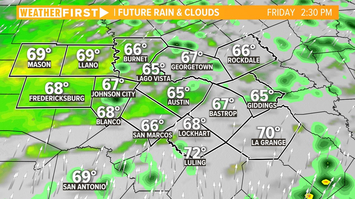
As we head into the holiday weekend, we could have somewhat of a dry lull early Saturday – even though our rain chances are still at 30% to 40% – before two cold fronts arrive for Christmas Eve.
The timing of this has changed a bit, with most of the rain fall expected Saturday overnight and early Sunday.

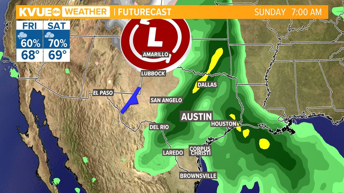
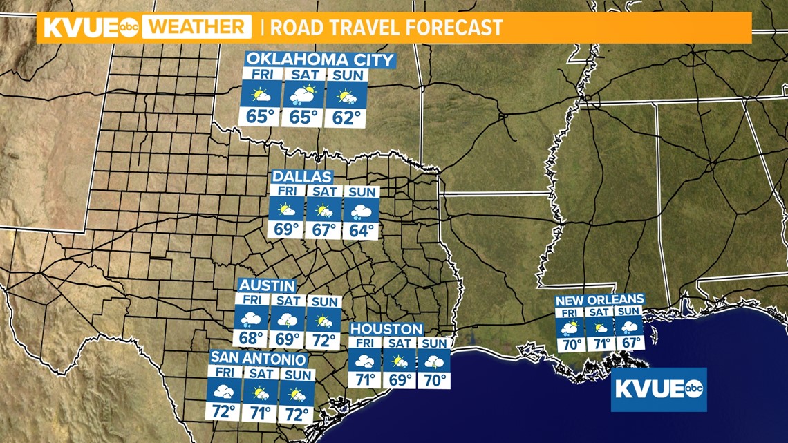
As for other areas that may be affected by this system, we could see the best rain chances in Dallas and San Antonio, in addition to Austin, for Thursday and Friday. But Houston's chances don't really start until Friday, and the best rain chances across Louisiana look to be mainly during the weekend through Christmas morning on Monday.

Totals
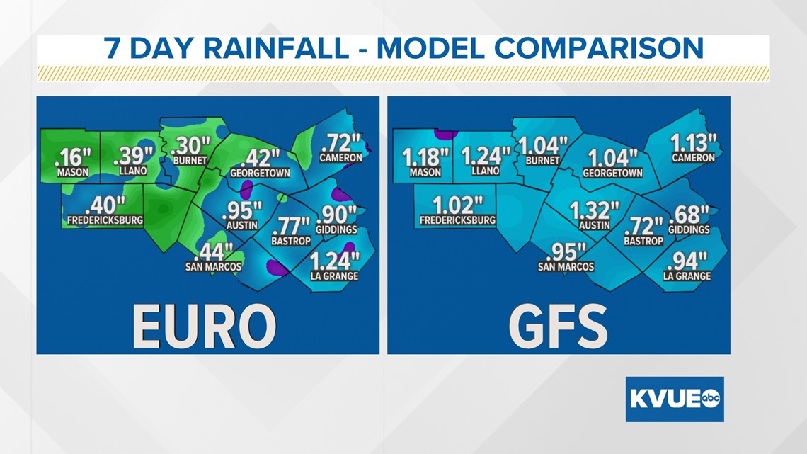
Forecast rainfall totals have varied quite a bit over the past several days. As of early Thursday morning, rainfall estimates range from a half -inch to 2 inches with some isolated higher totals.

Stick with KVUE for the latest on your forecast as the holiday weekend approaches, especially with travel.
In the meantime, your 7-day outlook is below.

