AUSTIN, Texas — This story has been updated since it was originally published. For the most recent version, visit here.
While we had a very nice weekend across Central Texas, there could be some changes on Monday. We're tracking the potential for showers and maybe a couple of storms, which may be on the stronger side. Here's the latest.
Timing
We're targeting a window of later Monday afternoon into Monday evening for any strong storm development, as an upper-level disturbance passing from northern Mexico moves toward Central Texas. Light drizzle or isolated pockets of rain are possible for the afternoon and evening, but most remain dry.

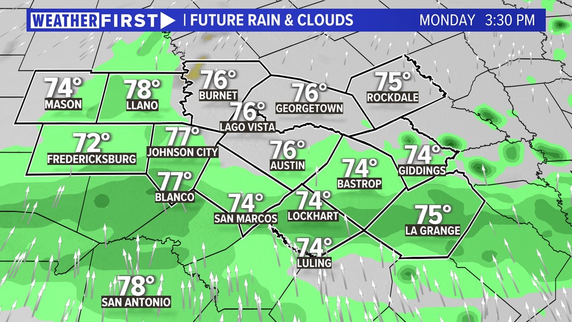
There is the potential that one or more storms that pop up could be on the stronger side, so let's break that down.
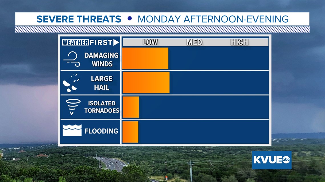
Conditional Risk
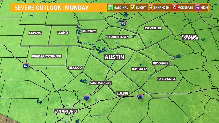
All of the KVUE area is under a "marginal" - 1 out of 5 - risk for severe weather, as there could be some pockets of heavier rain, and even the potential for a strong storm or two if a "capping" inversion is broken.
A "cap" is where temperatures increase with height instead of decrease like the atmosphere normally would, thereby limiting storm development.

If a storm were to pop up, the main threats would be hail and damaging winds. The tornado and flood threat are very much on the low end.

While we do not necessarily anticipate any strong to severe storms with this upcoming system due to the strong cap in place, you should still stick with KVUE for the latest as we track everything in case a strong storm does pop up.
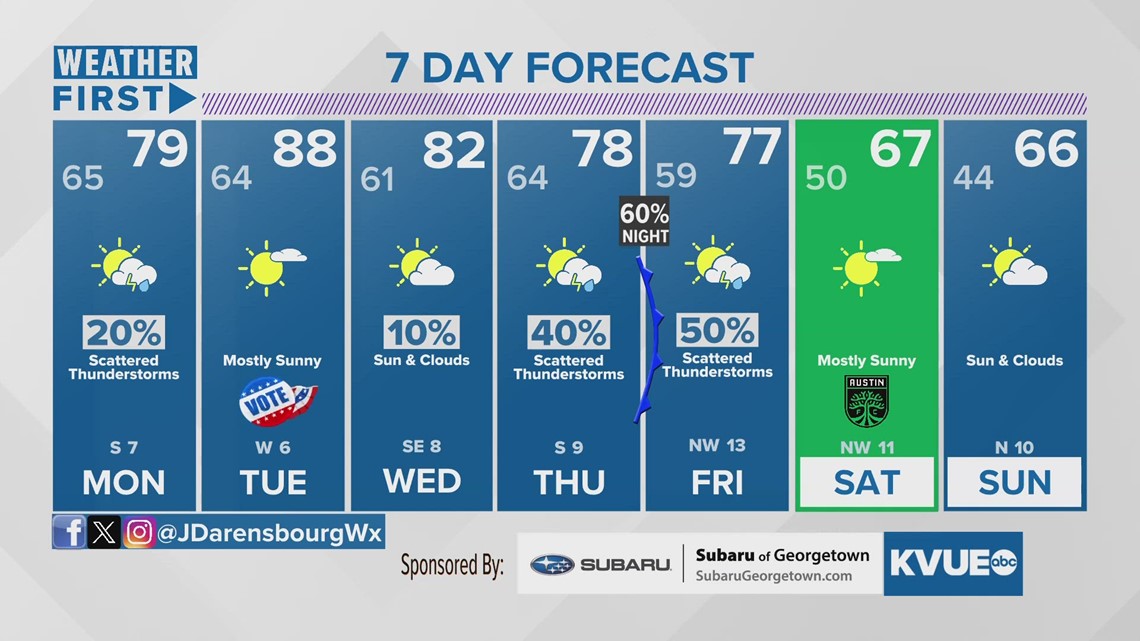
In the meantime, your extended forecast is below.