AUSTIN, Texas — Editor's note: This weather blog is no longer updating. Click here for Oct. 16's weather blog.
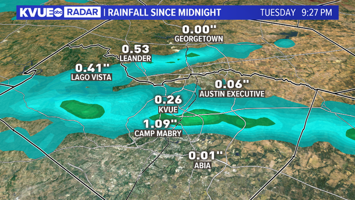
Tuesday evening showers added up to as much as an inch of rainfall at Austin's Camp Mabry and a half-inch in Leander.

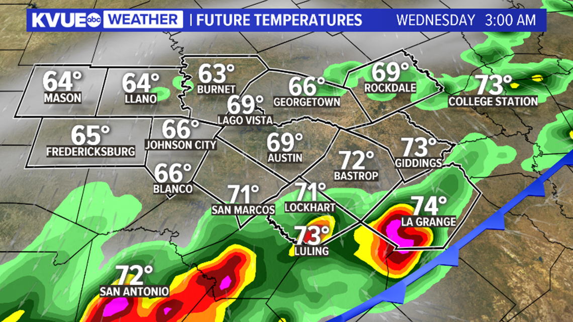
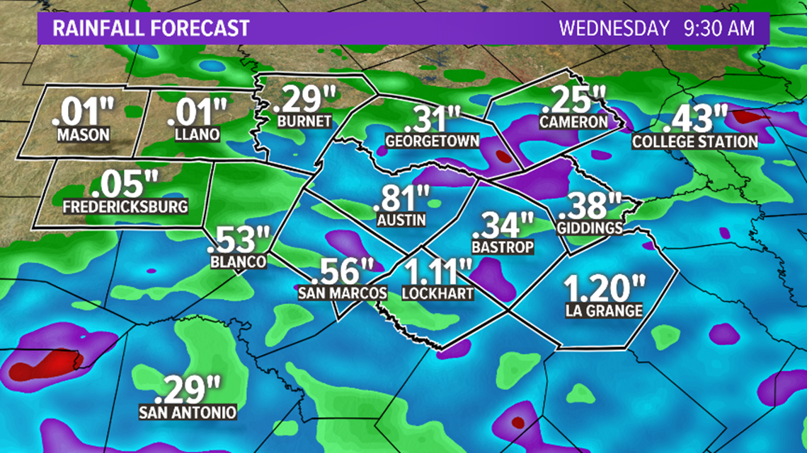
Additional showers and thunderstorms are expected ahead of a front after midnight through the early morning hours of Wednesday. The best chance for rain will be for areas south and east of Austin. We can't rule out the potential for a few storms to produce gusty winds and small hail.

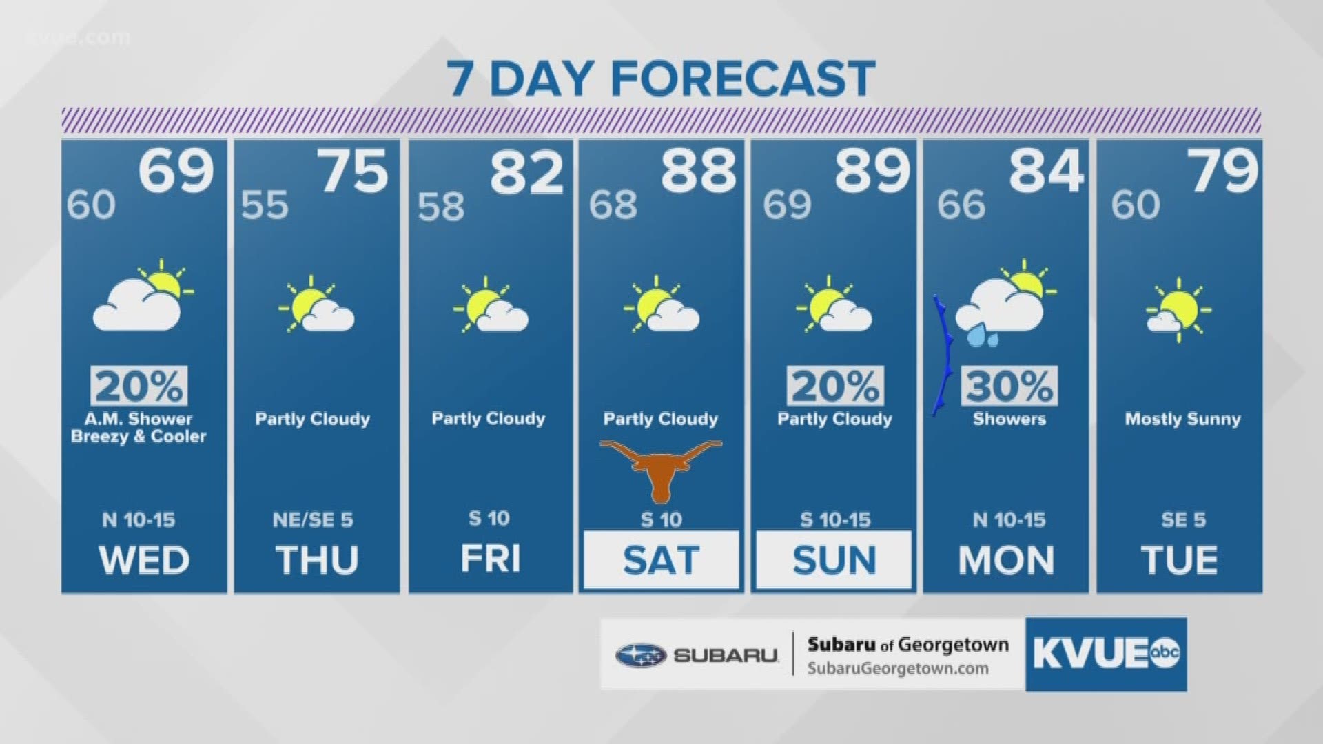
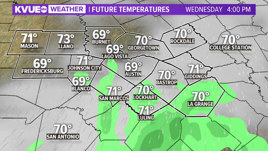
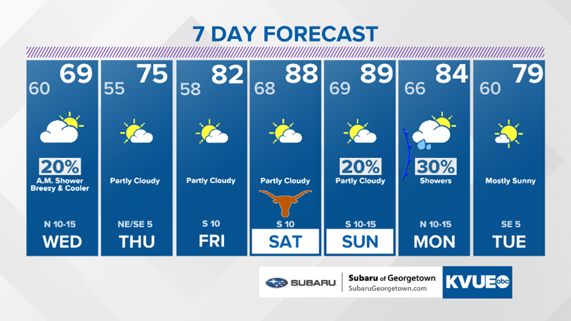
A shower is possible Wednesday morning, but we expect a mainly dry afternoon with a breezy north wind at 10 to 15 miles per hour and highs in the upper 60s.

Rainfall amounts will be below one inch for most locations.

Highs will be in the mid 70s Thursday, low 80s Friday and upper 80s this weekend.

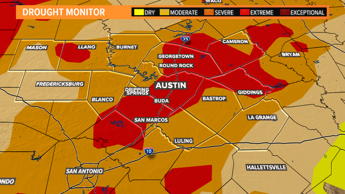
Rain is needed due to our growing drought conditions. The latest drought monitor has portions of Central Texas in the "Extreme" drought category.
Pockets of heavy rainfall as the front moves through could lead to minor flood concerns.

Download the KVUE News app so you can stay ahead of the storm: kvue.com/app. And be sure to follow KVUE on YouTube, Twitter, Facebook and Instagram.
PEOPLE ARE ALSO READING:

