AUSTIN, Texas — Editor's note: This blog is no longer updating. For the latest, click here.
It's been a quiet evening here in Central Texas, and through the overnight we're expecting just a few isolated showers or some patchy mist and drizzle. So nothing too heavy overnight, however, the latest hi-res models are now showing a higher storm chance around the middle of the day on Monday.
This will all depend on what happens with storms to the north, but as of now, it looks possible that an organized batch of storms develops to our north overnight, and then moves into Central Texas by around lunchtime on Monday. These storms would then quickly dive southward through the early and mid-afternoon.

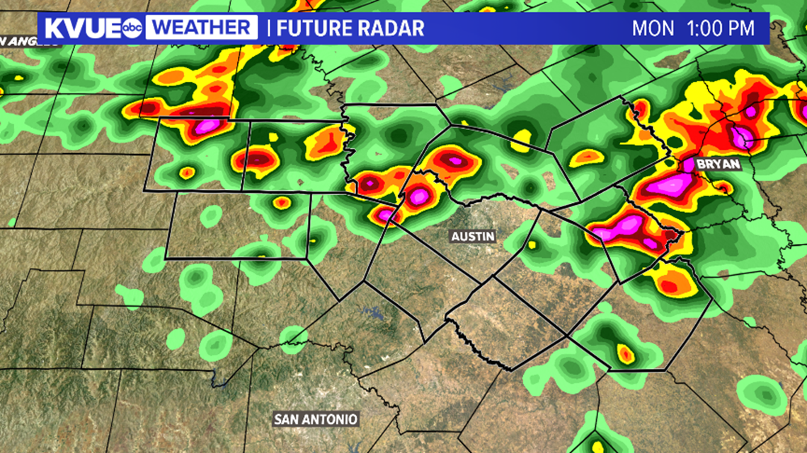
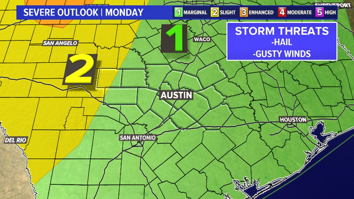
It's not a guarantee that things play out this way, and some of our other computer models are not very aggressive on the storm chances Monday. Either way, it's possible that a few storms tomorrow could be strong to severe, especially if the organized storms from the north do in fact hold together into Central Texas. The main threats will be hail and damaging wind gusts.

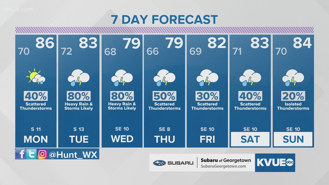
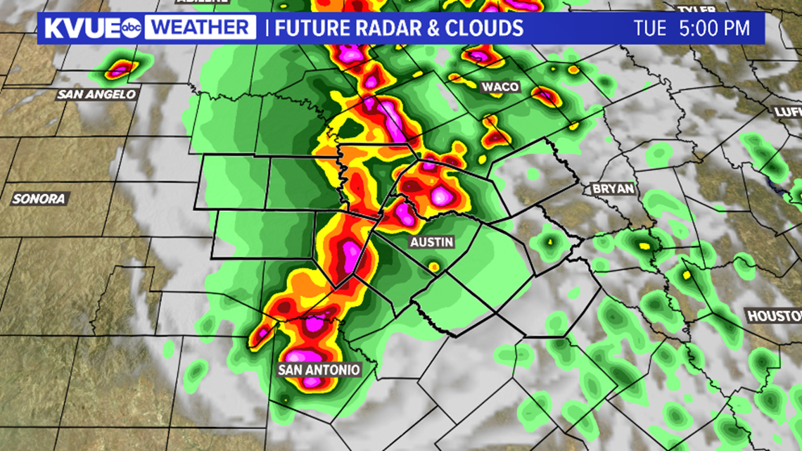
We're still on track to see the most widespread rain and storms on Tuesday and Wednesday. The exact timing will come into focus in the coming days, but this will include the risk not just for severe storms, but also for flooding.
A Flash Flood Watch has already been issued just to our north, and there's a good chance that this could be expanded southward over the next day or so.

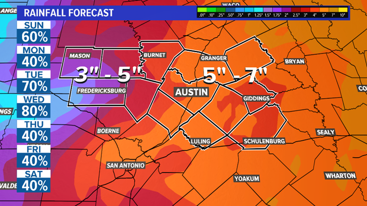
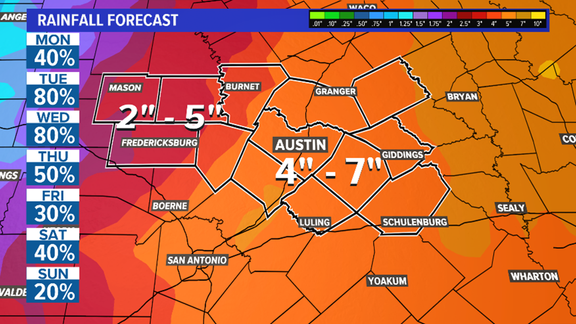
We're expecting a fairly widespread 2 to 5 inches of rainfall over the next 7 days, with most of that coming on Tuesday and Wednesday. Isolated amounts as high as 7 inches will be possible, especially along and east of Interstate 35.
Although a bit drier, we will keep at least scattered rain and storms in the forecast through next weekend.

Be sure to download KVUE's app for radar, updates and to upload pictures and video: kvue.com/app. Also be sure to follow KVUE on Facebook, YouTube, Twitter and Instagram.
The KVUE Storm Team will continue to monitor this developing forecast.
In the meantime, the extended forecast can be found below:

