
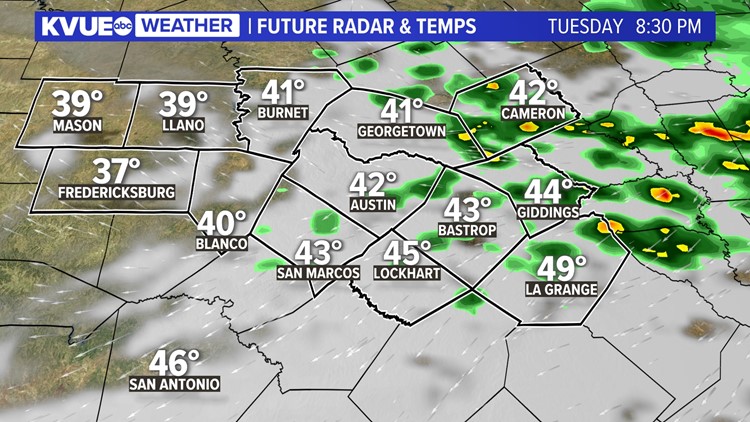
AUSTIN, Texas — We had a chilly and gloomy Tuesday across Central Texas as an upper-level disturbance brought light rain and sleet showers. Thankfully, temperatures through Tuesday have all been above freezing, which has prevented any issues with icing as any sleet pellets have melted on contact with the ground.
This will continue to be the case through the late evening as light rain showers with perhaps some sleet mixed in come to an end from west to east by about 10 p.m. or so. We will hang on to cloud cover on Tuesday night, but no additional precipitation is expected as temperatures drop to the 30s by Wednesday morning.

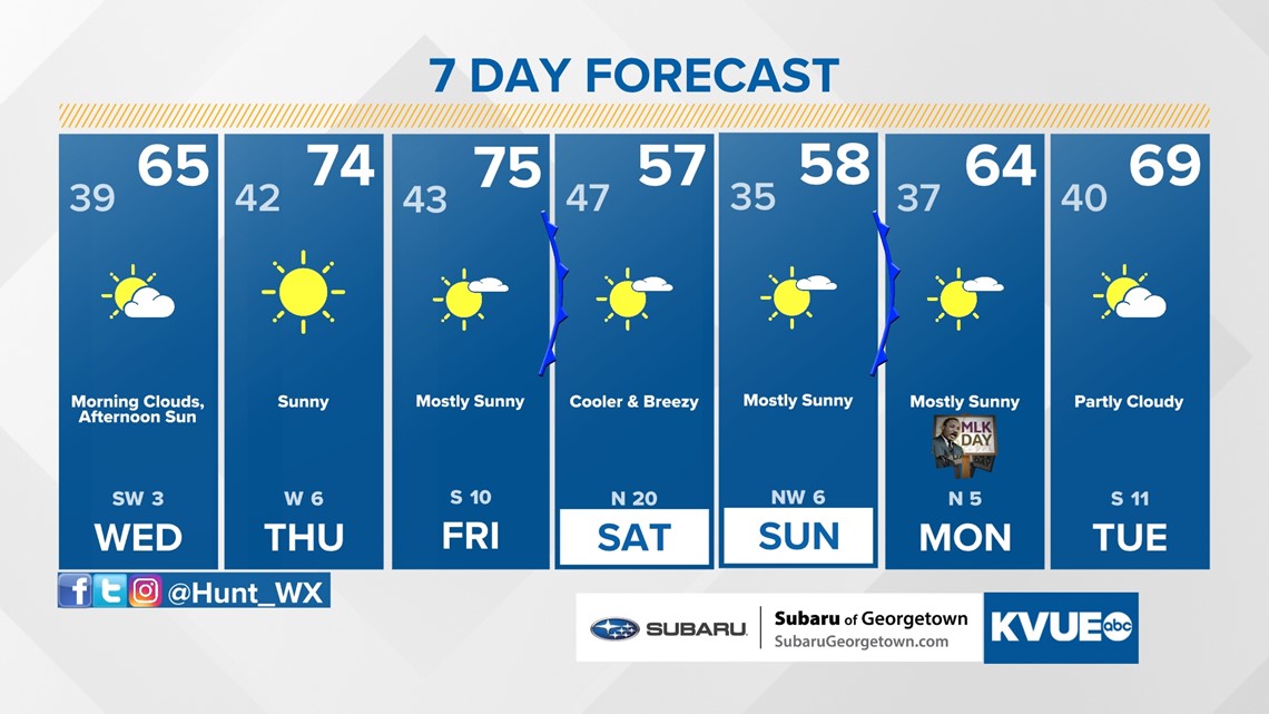
A cold and cloudy morning will give way to a warmer and much sunnier afternoon. Highs on Wednesday will reach the mid and upper 60s, and we're suddenly back in the 70s for afternoon highs on Thursday and Friday.

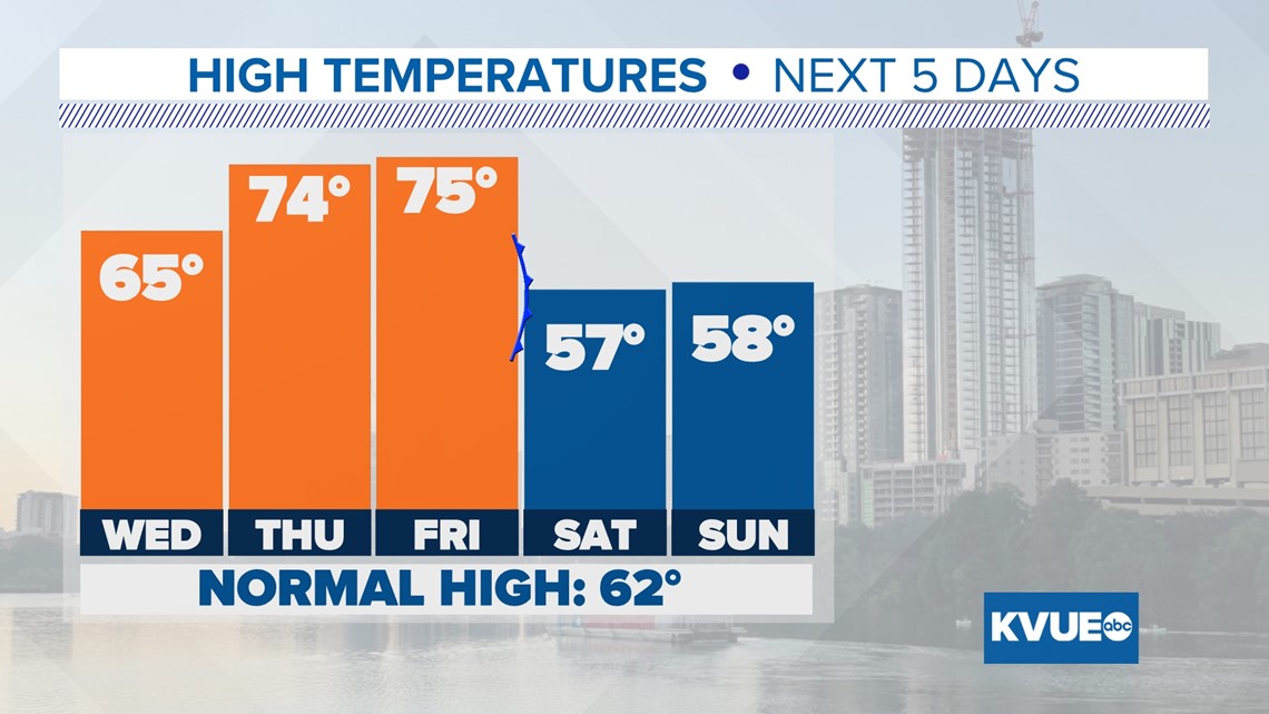
Our next cold front will push through on Friday night, and it will be another dry one with almost no rain chance for Central Texas. The latest data is also coming in slightly colder with this front, so we're now expecting afternoon highs to drop to the 50s for Saturday and Sunday.
Dry and quiet weather likely continues to start early next week, with highs in the 60s for Monday and Tuesday.
The KVUE Weather Team will continue to monitor this developing forecast.
In the meantime, here is a look at your extended forecast:

PEOPLE ARE ALSO READING:
