
AUSTIN, Texas — *A Heat Advisory will be in effect for Bastrop, Caldwell, Fayette, Hays, Lee, Milam, Travis and Williamson counties from 1 p.m. until 7 p.m. Wednesday.*
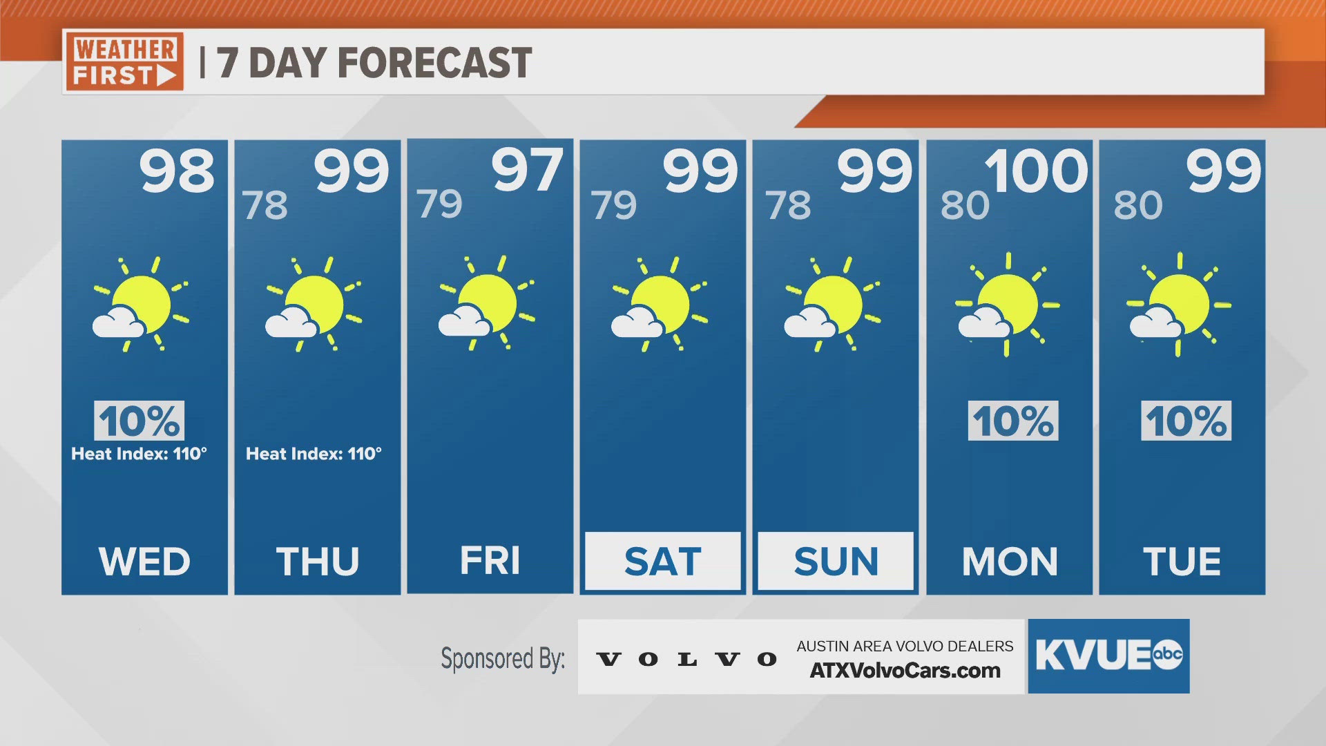
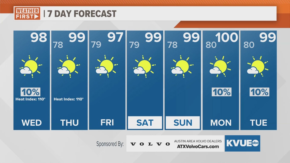
The middle of the week will be characterized by more high heat across Central Texas. As the heat dome builds further into the south-central U.S. Wednesday and Thursday, we can expect temperatures in the upper 90s on both afternoons. We have yet to hit 100 degrees in Austin so far in 2024.
Rain chances stay on the slime side Wednesday. A few spotty showers are expected to occur around the area in the afternoon, but most will remain dry.
The tropics are getting slightly more active and as of Wednesday morning, there is another area of interest off the West African coast, with a 30% chance of development over the next seven days. We are also watching another area of interest near Aruba, which only has a 20% chance for development as it is expected to shift into the southern Gulf over the next week.
Otherwise, locally, we do not have major changes to the forecast. Remember to stay cool and hydrated!
WEDNESDAY MORNING:
Partly cloudy. Patchy fog is possible. South wind at 5 to 10 mph.
LOW: 80
WEDNESDAY:
Mostly sunny. Hot. Heat index from 105-110 degrees. 10% chance for a shower. Southeast wind at 5 to 10 mph.
HIGH: 98
WEDNESDAY NIGHT:
Partly cloudy. Warm and humid. South wind at 5 to 10 mph.
LOW: 78
SEVEN-DAY FORECAST:

Check out the live radar for what you can expect the rest of the day and into the workweek.