AUSTIN, Texas — This week, Central Texas has been plagued with extreme heat and, for several evenings, thunderstorms.
In the summer, heat and thunderstorms are obviously quite common. But a rare phenomenon called a "heat burst" can occur given the right conditions.
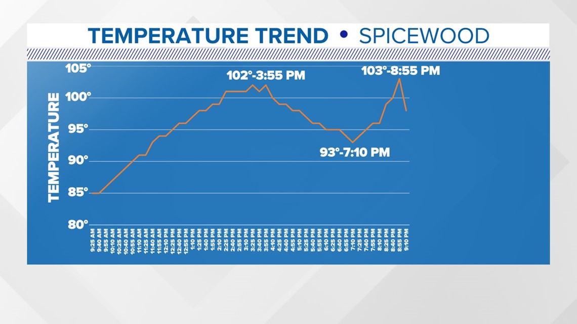
Take a look at the temperature trends from Spicewood on Monday night:


You can see temperatures peaking at 102 degrees for the afternoon, then nodding off after sunset. Then, seemingly random, temperatures shoot back up to 103 degrees near 9 p.m.
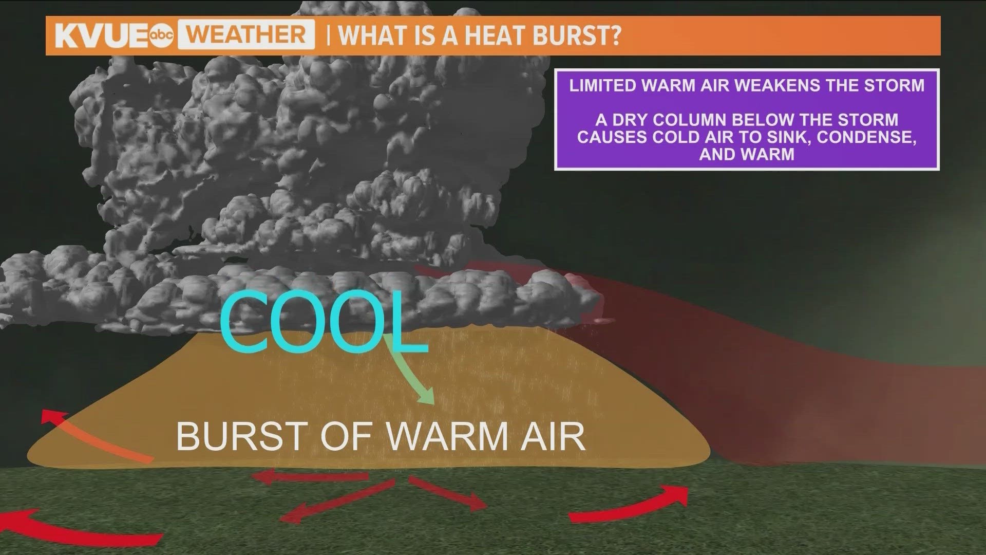
This is because on Monday night, there were a few severe thunderstorms out in the Hill Country. Hot air from the day is what fuels these storms. Then, as they drop heavy rain overhead, it cools the surface and the column of air below them.
When there is limited warm air left, the storm weakens. But this time, it is left with a dry, almost vacant space below.
The cool air at the top of the space (column of air) is dense and drops toward the surface. The fast plummet causes the air to condense, which is a warming process, sending a big plume of hot air to the surface, where it hits the ground and spreads out in all directions. This creates a push of hot wind.
You might compare the feeling of a heat burst to opening an oven to check on dinner and feeling a big rush of hot air.
With the Excessive Heat Warning extended into Wednesday and storms in the forecast, this could be another weather phenomenon to look out for this week.

