
AUSTIN, Texas — While we had somewhat of a reprieve from the serious heat with Wednesday morning's rainfall along and east of Interstate 35, there were still areas in the Hill Country that were shut out from rainfall or cloud cover. Those were our warm spots on Wednesday afternoon.
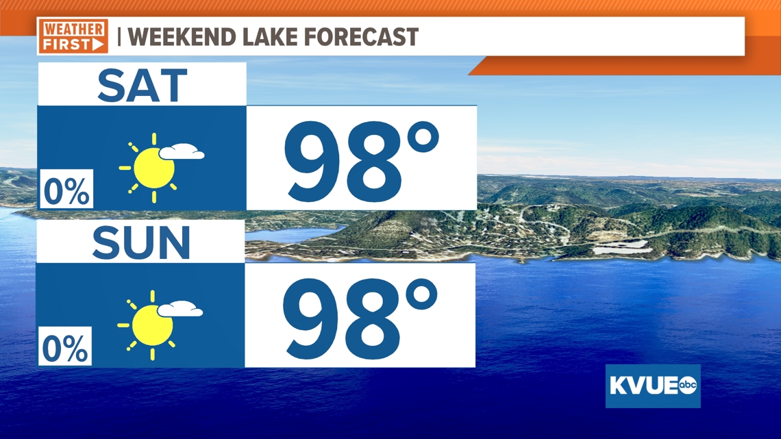
As we head into the weekend, we expect to feel slightly more tolerable afternoon forecast highs, due in large part to the lower humidity in Central Texas.
Heat exhaustion or heat stroke can set in within a couple of hours during dangerous heat like this, so be sure to stay hydrated; take breaks in the shade or inside; check on your older friends and neighbors; and double check the backseat for your kids if you are headed out to run errands.
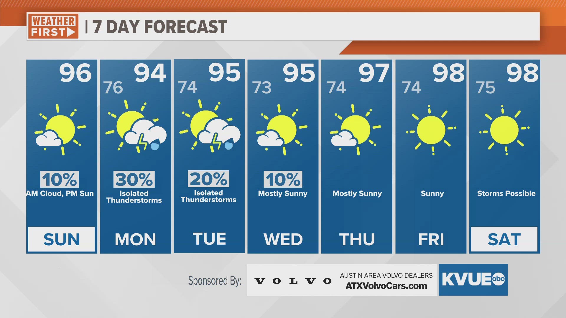
Tuesday was the start of highs of the upper 90s for at least the next five days. We will have to wait for a "cold front" next week to see any reprieve in heat.

Some models keep heat index values lower for Thursday due to the drier air, but the National Weather Service is calling for another round of "feels-like" temperatures in the triple digits.
Even if a Heat Advisory is not issued midweek, it is likely another heat alert will be issued heading into the weekend.
Preliminary forecast models do hint at a dip in temperatures by early next week and maybe a bit of rain too. But for the short-term period, make sure you are taking care of yourself in this heat.

