AUSTIN, Texas — The weather across Central Texas has been exceptional so far this week.
While no major weather changes are expected, the KVUE Storm Team will be on the watch for increasing wildfire danger as we head into the end of the workweek.
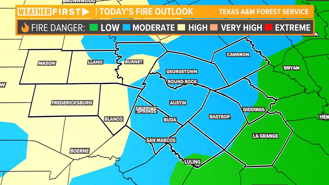
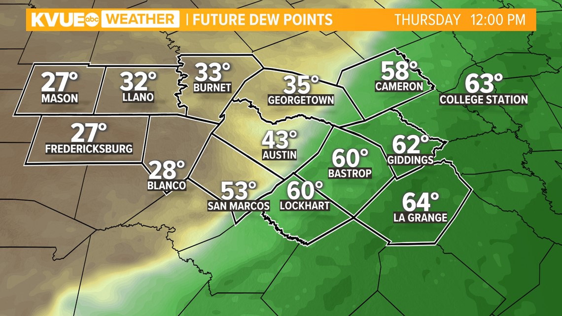
We're tracking a cold front moving through the area on Thursday. While this front will be dry, it will bring drier and windier conditions to Central Texas, elevating our fire weather conditions. Our main area of concern will be areas west of Interstate 35.

Ahead of the front, gusts of 30 to 35 mph will start as early as Wednesday evening. Windy conditions continue ahead of the front, which won't arrive until the back half of Thursday.

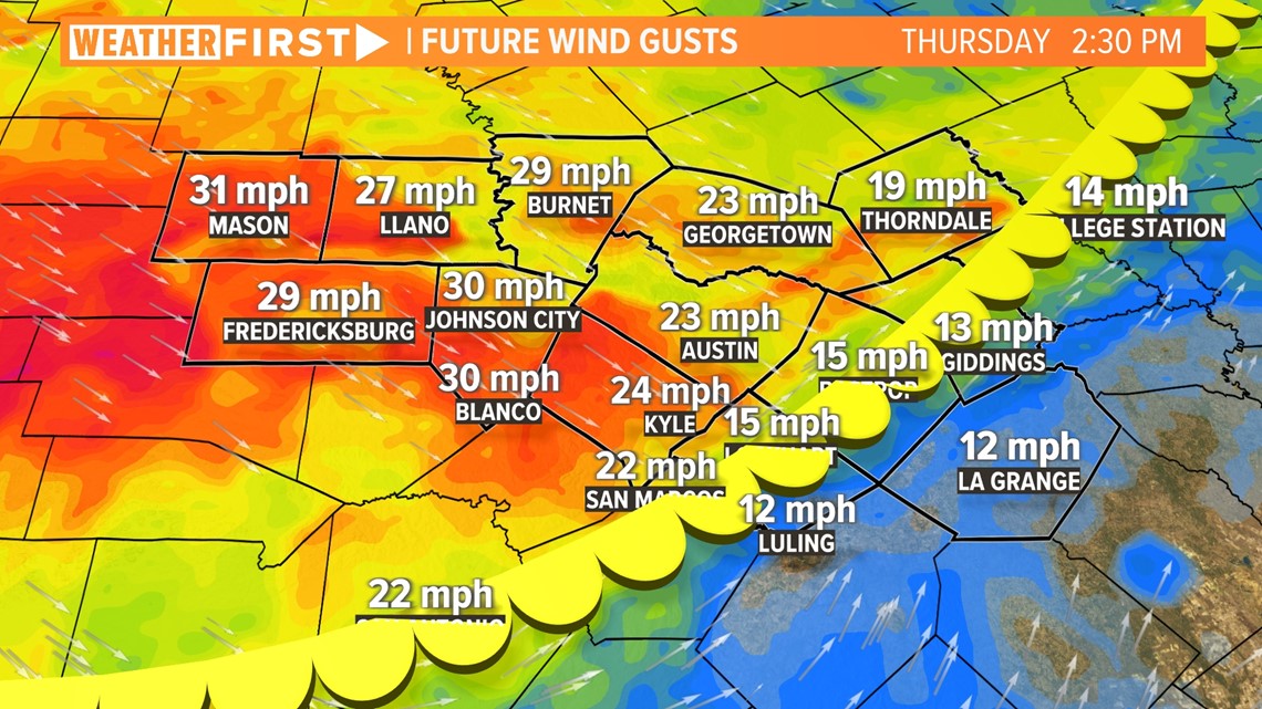
The cold front will also lower humidity levels through Thursday, which is another ingredient that exacerbates fire weather conditions. On Thursday morning, Hill Country regions will still feel those high winds.


Throughout the afternoon, wind flow will become more widespread throughout the region. Gusts of 20 to 30 mph can be expected through the afternoon Thursday.
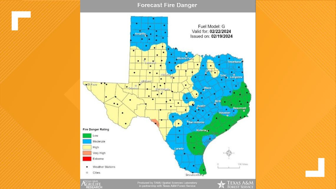
The breezy, dry conditions will be a bigger deal in the Hill Country because areas along and west of I-35 are still dealing with a wide range of drought conditions.

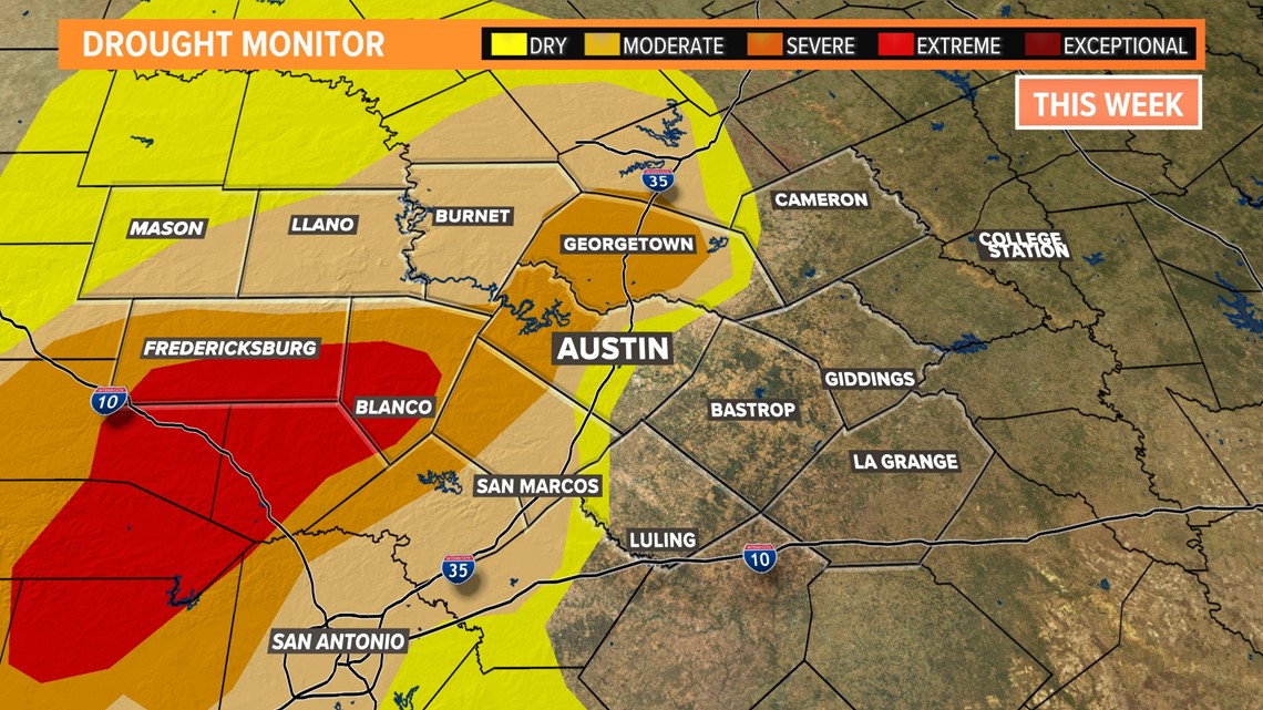
Portions of Williamson, Travis, Hays, Blanco and Gillespie counties are still under "severe" to "extreme" drought, and vegetation is very dry. There are currently no burn bans in place for these counties, but it's possible one could be issued later this week.
While temperatures take a dip Friday, winds will remain gusty and humidity levels will stay low. Those factors could keep certain regions in the "high" category for fire weather danger.
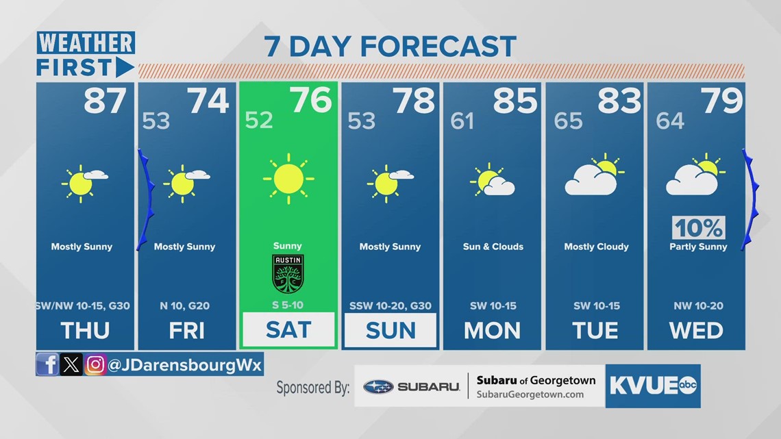
We will provide updates as we move through rest of the week. In the meantime, here's a look at your extended forecast: