AUSTIN, Texas — The next several days will continue to feature spring-like weather across Central Texas.
After highs on Thursday raked in a cool 86 and 87 from Austin Bergstrom International north to Camp Mabry, it left a lot of us wondering, is this a preview of the upcoming Spring and Summer months?
RELATED: Today's Allergy Report
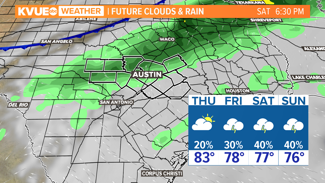
A reprieve is on the way. Temperatures will return to the 70s by Friday and the weekend as an approaching cold front brings more clouds and elevated rain chances.
The weekend forecast remains a bit fluid but, for now, the highest rain chances appear to be Saturday and Sunday, with a 40% chance of showers and storms.


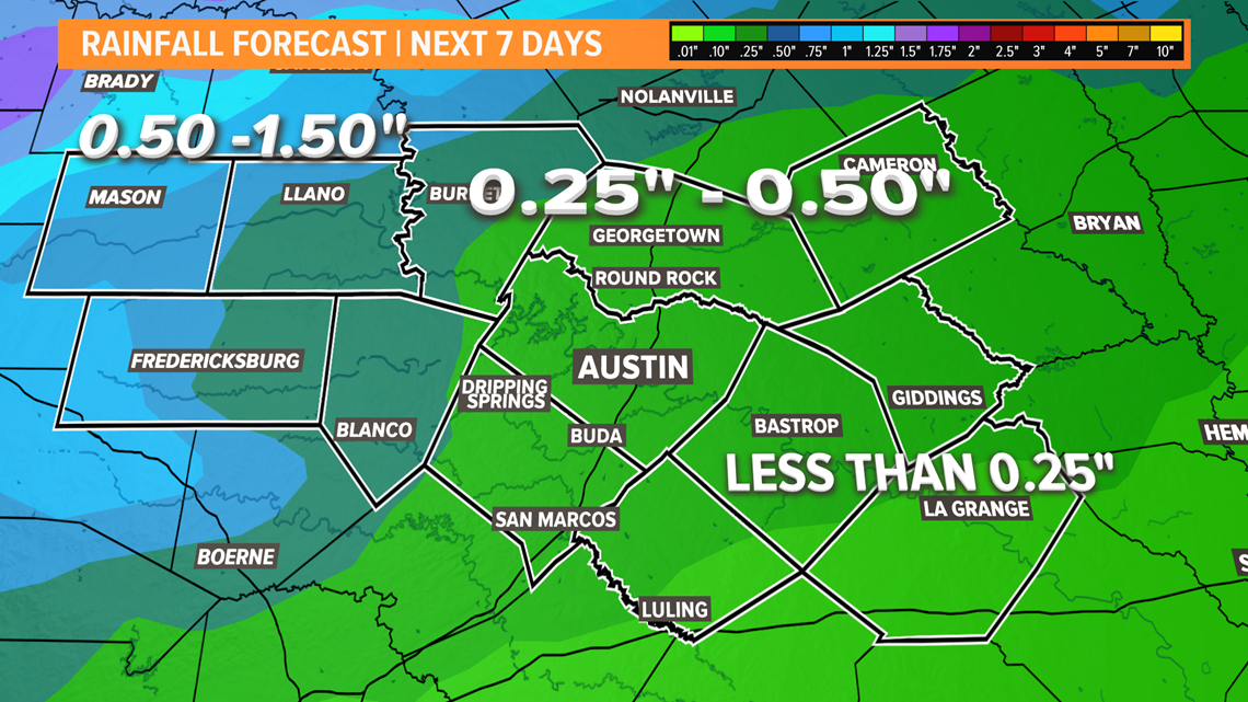
The highest rainfall totals over the next seven days will likely fall over the Hill Country, where some could see upwards of an inch.
Lesser amounts are expected for locations east of the Interstate 35 corridor.


The longer-term outlook for Central Texas
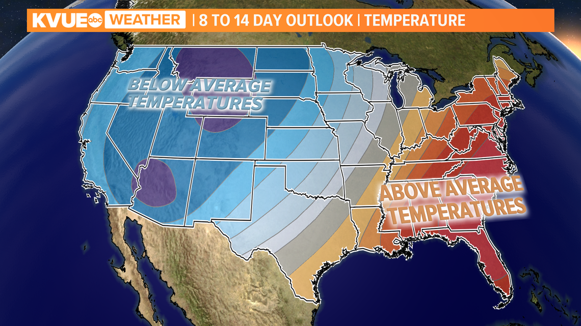
The eight- to 14-day outlook from the Climate Prediction Center suggests near or above-average temperatures in the March 18 to 24 time frame.
The average afternoon high for Austin-Bergstrom International Airport for March 18 is 74 degrees.


In the meantime, here's the extended forecast from the KVUE Storm Team:
KVUE will continue to monitor this developing forecast.
PEOPLE ARE ALSO READING:


